Campbell Scientific CSAT3 CSAT3 3-D Sonic Anemometer - Page 55
A.2 Online Magnetic Declination Calculator
 |
View all Campbell Scientific CSAT3 manuals
Add to My Manuals
Save this manual to your list of manuals |
Page 55 highlights
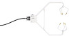
Appendix A. CSAT3 Orientation A.2 Online Magnetic Declination Calculator The magnetic declination calculator web calculator published by NOAA's Geophysical Data Center is available at the following url: www.ngdc.noaa.gov/geomagmodels/Declination.jsp. After the web page loads, enter the site zip code, or longitude and latitude, then click on the "Compute Declination" button (FIGURE A-4). FIGURE A-4. USGS web calculator The declination for Logan, UT is 12.4 degrees (3 June 2010). As shown in FIGURE A-4, the declination for Utah is positive (east of north), so true north for this site is 360 - 12.4, or 347.6 degrees. The annual change is -7 minutes/year or 7 minutes west per year. A-3
-
 1
1 -
2
-
3
-
4
-
5
-
6
-
7
-
8
-
9
-
10
-
11
-
12
-
13
-
14
-
15
-
16
-
17
-
18
-
19
-
20
-
21
-
22
-
23
-
24
-
25
-
26
-
27
-
28
-
29
-
30
-
31
-
32
-
33
-
34
-
35
-
36
-
37
-
38
-
39
-
40
-
41
-
42
-
43
-
44
-
45
-
46
-
47
-
48
-
49
-
 50
50 -
 51
51 -
 52
52 -
 53
53 -
 54
54 -
 55
55 -
 56
56 -
 57
57 -
 58
58 -
 59
59 -
 60
60 -
61
-
62
-
63
-
64
-
65
-
66
-
67
-
68
-
69
-
70
-
71
-
72
 |
 |

Appendix A.
CSAT3 Orientation
A.2 Online Magnetic Declination Calculator
The magnetic declination calculator web calculator published by NOAA’s
Geophysical Data Center is available at the following url:
www.ngdc.noaa.gov/geomagmodels/Declination.jsp
. After the web page loads,
enter the site zip code, or longitude and latitude, then click on the “Compute
Declination” button (FIGURE A-4).
FIGURE A-4.
USGS web calculator
The declination for Logan, UT is 12.4 degrees (3 June 2010). As shown in
FIGURE A-4, the declination for Utah is positive (east of north), so true north
for this site is 360 – 12.4, or 347.6 degrees. The annual change is -7
minutes/year or 7 minutes west per year.
A-3