Garmin fenix 2 Owner's Manual - Page 8
Geocaches, Activities - owners manual
 |
View all Garmin fenix 2 manuals
Add to My Manuals
Save this manual to your list of manuals |
Page 8 highlights
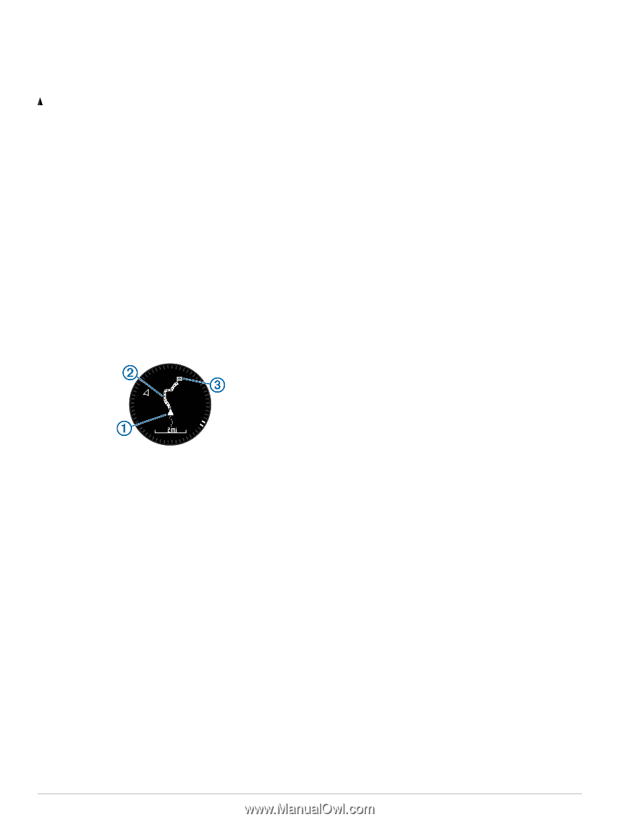
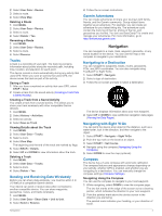
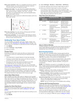
3 Orient yourself so that the bearing pointer aligns with the painted mark on the device. 4 Travel in that direction until you reach your destination. Map represents your location on the map. As you travel, the icon moves and leaves a track log (trail). Waypoint names and symbols appear on the map. When you are navigating to a destination, your route is marked with a line on the map. • Map navigation (Panning and Zooming the Map) • Map settings (Map Settings) Panning and Zooming the Map 1 While navigating, select UP to view the map. 2 Hold MENU. 3 Select Pan/Zoom. 4 Select an option: • To toggle between panning up and down, panning left and right, or zooming, select START. • To pan or zoom the map, select UP and DOWN. • To quit, select BACK. Navigating To Your Starting Point You can navigate back to the starting point of your track or activity along the path you traveled. This feature is available only for activities that use GPS. During an activity, select STOP > TracBack. Your current location , track to follow , and end point À Á Â appear on the map. Altimeter and Barometer The device contains an internal altimeter and barometer. The device collects altimeter and barometer data continuously, even in low-power mode. The altimeter displays your approximate elevation based on pressure changes. The barometer displays environmental pressure data based on the fixed elevation where the altimeter was most recently calibrated (Altimeter Settings). Marking and Starting Navigation to a Man Overboard Location You can save a man overboard (MOB) location, and automatically start navigation back to it. TIP: You can customize the hold function of the DOWN key to access the MOB function quickly (Customizing the Hot Key). 1 Hold MENU. 2 Select Tools > MOB. Geocaches A geocache is like a hidden treasure. Geocaching is when you hunt for hidden treasures using GPS coordinates posted online by those hiding the geocache. Downloading Geocaches 1 Connect the device to your computer using a USB cable. 2 Go to www.garmin.com/ geocaching. 3 If necessary, create an account. 4 Sign in. 5 Follow the on-screen instructions to find and download geocaches to your device. Navigating to a Geocache Before you can navigate to a geocache, you must download a geocache to your device. Go to www.garmin.com/ geocaching for more information. Navigating to a geocache is like navigating to any other location (Navigating to a Destination). Logging the Attempt After you have attempted to find a geocache, you can log your results. 1 Hold MENU. 2 Select User Data > Geocache > Log Attempt. 3 Select Found, Did Not Find, or Unattempted. 4 Select an option: • To begin navigation to a geocache nearest you, select Find Next. • To end the logging, select Done. chirp™ A chirp is a small Garmin accessory that is programmed and left in a geocache. You can use your device to find a chirp in a geocache. For more information about the chirp, see the chirp Owner's Manual at www.garmin.com. Finding a Geocache with a chirp Device 1 Hold MENU. 2 Select Settings > Sensors > chirp. 3 Select START > Navigate > Geocache. 4 Wait while the device locates satellites. 5 Select a geocache, and select chirp to show chirp details while you are navigating. 6 Select Go, and navigate to the geocache (Navigating to a Destination). When you are within 10 m (33 ft. ) of the geocache that contains a chirp device, a message appears. Activities Your device can be used for a variety of outdoor, athletic, and fitness activities. When you start an activity, the device displays and records sensor data about your activity. You can save activities and share them with the Garmin Connect™ community. The device functions differently depending on your activity. For example, data pages, recorded data, and menu options may appear differently based on your activity. Skiing Going Downhill Skiing or Snowboarding Before you go skiing or snowboarding, you should charge the device completely (Charging the Device). 1 Select START > Ski-Board. 2 Wait while the device locates satellites. 3 Select START to start the timer. History is recorded only while the timer is running. 4 Start your activity. 4 Geocaches
-
 1
1 -
2
-
 3
3 -
 4
4 -
 5
5 -
 6
6 -
 7
7 -
 8
8 -
 9
9 -
 10
10 -
 11
11 -
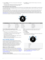 12
12 -
 13
13 -
14
-
15
-
16
-
17
-
18
-
19
-
20
-
21
-
22
-
23
-
24
-
25
-
26
 |
 |