Garmin GPS 12XL Owner's Manual (Software Version 2.00-3.62) - Page 10
Primary s - map
 |
UPC - 753759007034
View all Garmin GPS 12XL manuals
Add to My Manuals
Save this manual to your list of manuals |
Page 10 highlights
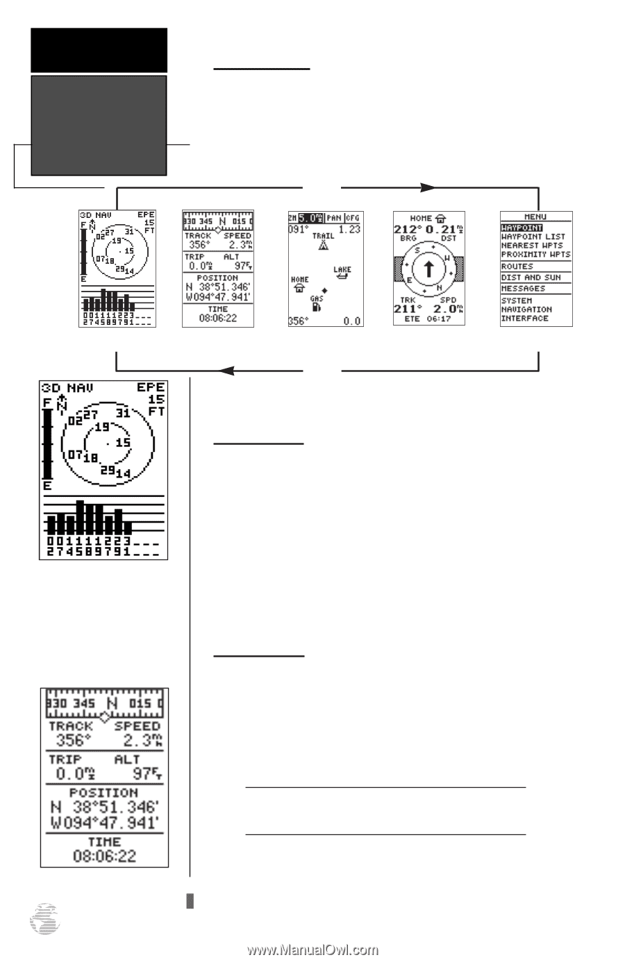
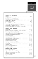
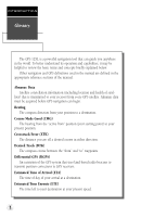
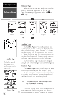
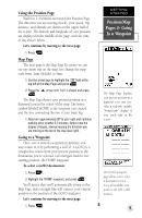
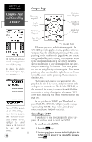
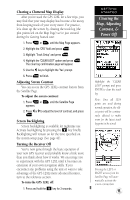
INTRODUCTION Primary Pages Primary Pages Before we start the tour, let's briefly look at the five primary information pages used for the GPS 12XL. Switch between pages by pressing either the Q or J keys. J Satellite Position Map Compass Menu Q Satellite Page The Satellite Page will allow you to monitor satellite signal reception and strength. Position Page 6 Satellite Page The Satellite Page shows satellite positions and signal strength. Satellite positions are displayed using two circles and a center point. The outer circle shows satellites on level with the horizon; the inner circle is 45º above the horizon; and the center point represents satellites directly overhead. Knowing satellite positions will show you the direction of any blocked signals. The bottom of the page contains a row of signal strength bars corresponding to each satellite being used. Position Page The Position Page shows you where you are, what direction you're heading and how fast you're going. The top of the page contains a compass tape which is a graphic representation of your heading. Your track and speed are indicated immediately below. ! The graphic compass tape reflects your heading only while you are moving. The rest of the page shows your current position in three dimensions: latitude, longitude, and altitude. A trip odometer and 12/24-hour clock are also provided.
-
 1
1 -
2
-
3
-
4
-
 5
5 -
 6
6 -
 7
7 -
 8
8 -
 9
9 -
 10
10 -
 11
11 -
 12
12 -
 13
13 -
 14
14 -
 15
15 -
16
-
17
-
18
-
19
-
20
-
21
-
22
-
23
-
24
-
25
-
26
-
27
-
28
-
29
-
30
-
31
-
32
-
33
-
34
-
35
-
36
-
37
-
38
-
39
-
40
-
41
-
42
-
43
-
44
-
45
-
46
-
47
-
48
-
49
-
50
-
51
-
52
-
53
-
54
-
55
-
56
-
57
-
58
-
59
-
60
-
61
-
62
-
63
-
64
 |
 |