Garmin GPS 12XL Owner's Manual (Software Version 2.00-3.62) - Page 24
Waypoint, Definition &, Reference, Waypoints
 |
UPC - 753759007034
View all Garmin GPS 12XL manuals
Add to My Manuals
Save this manual to your list of manuals |
Page 24 highlights
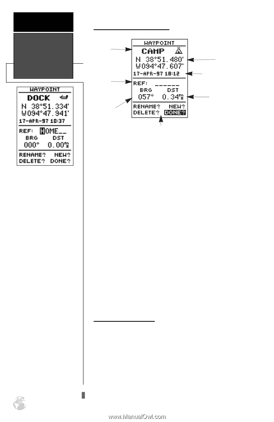
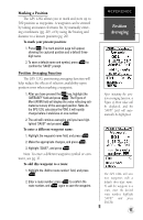
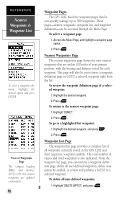
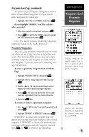
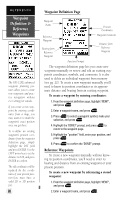
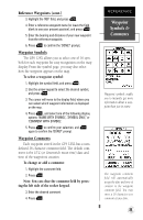
REFERENCE Waypoint Definition & Reference Waypoints The GPS 12XL's advanced waypoint planning features allow you to create new waypoints and practice navigation without ever setting foot outside. If you create a new waypoint by entering coordinates from a map, you may want to re-mark the waypoint's exact position once you get there. To re-define an existing waypoint's position coordinates from the waypoint definition page, simply highlight the DST field and press ENTER. Use the LEFT arrow key to set the distance to 0.00, and press ENTER to confirm. The old coordinates will be replaced by the coordinates of your present position (you must have a valid 2D or 3D position fix). 20 Waypoint Definition Page Waypoint Name Reference Waypoint Bearing from Reference Waypoint Position Coordinates Waypoint Comment Distance from Reference Waypoint Function Prompts The waypoint definition page lets you create new waypoints manually or review and edit an existing waypoint's coordinates, symbols, and comments. It is also used to delete an individual waypoint from memory (see pg. 22). To create a new waypoint manually, you'll need to know its position coordinates or its approximate distance and bearing from an existing waypoint. To create a waypoint by entering coordinates: 1. From the waypoint definition page, highlight 'NEW?', and press E. 2. Enter a waypoint name, and press E. 3. Press E to select a waypoint symbol, make your selection, and press E. 4. Highlight the 'DONE?' prompt, and press E to return to the waypoint page. 5. Highlight the "position" field, enter your position, and press E. 6. Press E to confirm the 'DONE?' prompt. Reference Waypoints To create a new waypoint manually without knowing its position coordinates, you'll need to enter its bearing and distance from an existing waypoint or your present position. To create a new waypoint by referencing a stored waypoint: 1. From the waypoint definition page, highlight 'NEW?', and press E. 2. Enter a waypoint name, and press E.
-
 1
1 -
2
-
3
-
4
-
5
-
6
-
7
-
8
-
9
-
10
-
11
-
12
-
13
-
14
-
15
-
16
-
17
-
18
-
 19
19 -
 20
20 -
 21
21 -
 22
22 -
 23
23 -
 24
24 -
 25
25 -
 26
26 -
 27
27 -
 28
28 -
 29
29 -
30
-
31
-
32
-
33
-
34
-
35
-
36
-
37
-
38
-
39
-
40
-
41
-
42
-
43
-
44
-
45
-
46
-
47
-
48
-
49
-
50
-
51
-
52
-
53
-
54
-
55
-
56
-
57
-
58
-
59
-
60
-
61
-
62
-
63
-
64
 |
 |