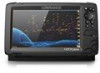
Lowrance HOOK Reveal 9 TripleShot HOOK Reveal Series Operator Manual - Page 28
North up, Course up, Look ahead, C-MAP charts, C-MAP specific chart options, Chart detail
 |
View all Lowrance HOOK Reveal 9 TripleShot manuals
Add to My Manuals
Save this manual to your list of manuals |
Page 28 highlights
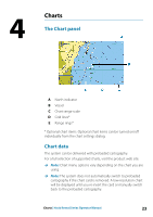
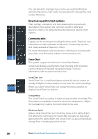
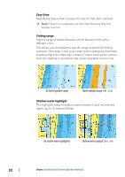
North up Displays the chart with north upward. Course up The chart direction is depending on if navigating or not: • when navigating: the desired course line is oriented up • if not navigating: the direction the vessel is actually traveling (COG) is oriented up Look ahead Moves the vessel icon on the panel to maximize your view ahead of the vessel. C-MAP charts All possible menu options for C-MAP charts are described below. The features and menu options available can vary depending on the charts you use. This section shows menus from a C-MAP chart. Ú Note: A menu option is greyed out if the feature is not available on the chart displayed. C-MAP specific chart options Chart detail • Full - displays all available information for the chart in use. • Medium - displays minimum information sufficient for navigation. • Low - displays basic level of information that cannot be removed, and includes information that is required in all geographic areas. It is not intended to be sufficient for safe navigation. Genesis Layer The Genesis Layer displays high-resolution contours contributed by Genesis users that have passed a quality check. This option toggles the Genesis layer on/off on the chart image. Available only if the C-MAP chart contains Genesis Layer data. 28 Charts | Hook Reveal Series Operator Manual
-
 1
1 -
2
-
3
-
4
-
5
-
6
-
7
-
8
-
9
-
10
-
11
-
12
-
13
-
14
-
15
-
16
-
17
-
18
-
19
-
20
-
21
-
22
-
 23
23 -
 24
24 -
 25
25 -
 26
26 -
 27
27 -
 28
28 -
 29
29 -
 30
30 -
 31
31 -
 32
32 -
 33
33 -
34
-
35
-
36
-
37
-
38
-
39
-
40
-
41
-
42
-
43
-
44
-
45
-
46
-
47
-
48
-
49
-
50
-
51
-
52
-
53
-
54
-
55
-
56
-
57
-
58
-
59
-
60
-
61
-
62
-
63
-
64
-
65
-
66
-
67
-
68
-
69
-
70
-
71
-
72
-
73
-
74
-
75
-
76
-
77
-
78
-
79
-
80
-
81
-
82
-
83
-
84
-
85
-
86
 |
 |
