Magellan RoadMate 760 Manual - English - Page 115
GPS STATUS Screen Structure - second
 |
UPC - 763357111163
View all Magellan RoadMate 760 manuals
Add to My Manuals
Save this manual to your list of manuals |
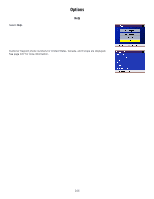
Page 115 highlights
Appendix B 17 ILL_DEFINED_2D_MATRIX 2X2 matrix can not be inverted in 2D fix 20 NO_SAT_TIME no satellite time 23 NOT_ENOUGH_SATS no enough satellite for 2D or 3D fix 24 CANNOT_SELECT_FIX_TYPE 30 VELOCITY_2D_ONLY 2 satellite fix only for velocity, no position fix 31 BAD_VELOCITY_PDOP 50 too big pdop for velocity 32 TOO_MANY_SATS_FOR_2D_VEL there are 4 or more satellites, but 2D fix provided 51 WRONG_NUMSAT number of satellite for fix > 12 or less 2 56 LOOP_3D_NOT_CONVERGING 3D initial fix is not convergent 57 MILLISECOND_ERROR millisecond jump happened 58 LOOP_2D_NOT_CONVERGING 2Dinitial fix is not convergent 59 BAD_RANGE_CHITEST; range post-fix residuals chi-test failed 60 BAD_DOPPLER_CHITEST doppler post-fix residuals chi-test failed 61 OSC_DRIFT_ERR too much clock drift 60HZ for XO, 7.5HZ for TCXO 62 BAD_DOPPLER_ERR too big Doppler errors 4m/s 63 BIG_RANGE_RESID 110m/40m depend on virtual ttagl/ DGPS factors 64 BIG_DOPPLER_RESID 0.7m/s 65 HUGE_RANGE_RESID 10km normal for postfit residuals for range 66 HUGE_DOPPLER_RESID 100m/s normal for postfit residuals for doppler Usually, Bad code is 20 and 23. If fix is good, it would be 0. GPS STATUS Screen Structure - second page Heading XXX (degree) Speeding XX.X (meter per second) Current Lat: DDD.DDDDD W/E (current latitude, degree) Current Long: DDD.DDDDD N/S (current longitude, degree) Current altitude XXXX (altitude in mean sea level meter) TTFF XXXXs (Time-To-First-Fix in second) #Satellite (U/T) XX/XX (the number of satellite used and tracked) PDOP XX.X (Position Dilution Of Precision) VDOP XX.X (Vertical Dilution of Precision) TDOP XX.X (Time Dilution of Precision) HDOP XX.X (Horizontal Dilution of Precision) FOMS P/V/H (Figures Of Merits for position, velocity and heading in map matching) UTC TIME MM/DD/YY HH:MM:SS(UTC time without local zone) 110
-
 1
1 -
2
-
3
-
4
-
5
-
6
-
7
-
8
-
9
-
10
-
11
-
12
-
13
-
14
-
15
-
16
-
17
-
18
-
19
-
20
-
21
-
22
-
23
-
24
-
25
-
26
-
27
-
28
-
29
-
30
-
31
-
32
-
33
-
34
-
35
-
36
-
37
-
38
-
39
-
40
-
41
-
42
-
43
-
44
-
45
-
46
-
47
-
48
-
49
-
50
-
51
-
52
-
53
-
54
-
55
-
56
-
57
-
58
-
59
-
60
-
61
-
62
-
63
-
64
-
65
-
66
-
67
-
68
-
69
-
70
-
71
-
72
-
73
-
74
-
75
-
76
-
77
-
78
-
79
-
80
-
81
-
82
-
83
-
84
-
85
-
86
-
87
-
88
-
89
-
90
-
91
-
92
-
93
-
94
-
95
-
96
-
97
-
98
-
99
-
100
-
101
-
102
-
103
-
104
-
105
-
106
-
107
-
108
-
109
-
 110
110 -
 111
111 -
 112
112 -
 113
113 -
 114
114 -
 115
115 -
 116
116 -
 117
117 -
 118
118 -
 119
119 -
 120
120 -
121
-
122
-
123
-
124
-
125
 |
 |
