Magellan eXplorist 500 Manual - English - Page 13
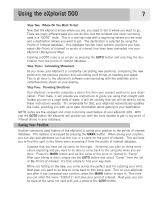
Using the eXplorist 500, Going to a Destination - software
 |
UPC - 763357109405
View all Magellan eXplorist 500 manuals
Add to My Manuals
Save this manual to your list of manuals |
Page 13 highlights
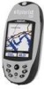
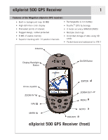
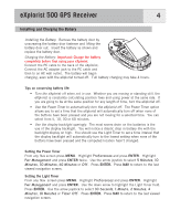
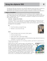
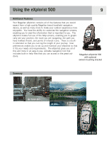
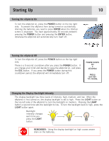
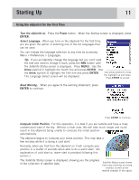
Using the eXplorist 500 6 The eXplorist 500 uses information from the GPS satellites orbiting the earth to provide you with detailed information about your exact location. This is the foundation that your eXplorist will use to provide you with the necessary information to arrive at your destination. Going to a Destination The most common use of your eXplorist will be to provide you with the navigation tools you'll need to arrive at your chosen destination. The simplest route, and the one used most often, is a GOTO route. This is a route that is computed as a straight line from where you are to where you want to go. Step One: Compute Your Position The basic operation of your eXplorist is to use the GPS satellites to compute your present position. This is done internally in the software of your eXplorist. The only thing that you need to do is to give your eXplorist a clear view of the sky so that it can receive the signals from the satellites. Do: • Point the antenna up toward the sky. • Maintain a clear view of the sky. Don't: • Cover the antenna with your hand or other objects. • Point the antenna down. • Stand under trees or other heavy foliage. • Stand where the satellite signals are being blocked by large obstructions (such as buildings, in a narrow canyon, etc.) If you find that the eXplorist is not computing a position, just move to a place that has a better view of the sky. Anytime that you want to view the status of the satellites and their signal strength, switch to the Satellite Status screen. Here, you will graphically see the satellites and their relative signal strength. You need at least three satellites with good signal strength (indicated by green bars) to compute your position. A computed position with only three satellites is termed a 2D position fix. When you are getting a 2D position fix, your elevation is not being computed. To add elevation to your position fix, you need at least four satellites with good signal strength. Positions that use four or more satellites are called 3D position fixes.
-
 1
1 -
2
-
3
-
4
-
5
-
6
-
7
-
 8
8 -
 9
9 -
 10
10 -
 11
11 -
 12
12 -
 13
13 -
 14
14 -
 15
15 -
 16
16 -
 17
17 -
 18
18 -
19
-
20
-
21
-
22
-
23
-
24
-
25
-
26
-
27
-
28
-
29
-
30
-
31
-
32
-
33
-
34
-
35
-
36
-
37
-
38
-
39
-
40
-
41
-
42
-
43
-
44
-
45
-
46
-
47
-
48
-
49
-
50
-
51
-
52
-
53
-
54
-
55
-
56
-
57
-
58
-
59
-
60
-
61
-
62
-
63
-
64
-
65
-
66
-
67
-
68
-
69
-
70
-
71
-
72
-
73
-
74
-
75
-
76
-
77
-
78
-
79
-
80
-
81
-
82
-
83
-
84
-
85
-
86
-
87
-
88
-
89
-
90
-
91
-
92
-
93
-
94
-
95
-
96
-
97
-
98
-
99
-
100
-
101
-
102
-
103
-
104
-
105
-
106
-
107
-
108
-
109
-
110
-
111
-
112
-
113
-
114
-
115
-
116
-
117
-
118
-
119
 |
 |