Garmin GPSMAP 2206 Owner's Manual - Page 74
Prefs Sub Tab, Map Outlines, Symbol Set, International, Light Sectors, Spot Soundings, Warn Depth
 |
UPC - 753759053024
View all Garmin GPSMAP 2206 manuals
Add to My Manuals
Save this manual to your list of manuals |
Page 74 highlights
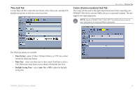
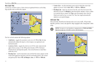
Main Menu > Map Tab Prefs Sub Tab Use the Prefs sub tab to select map preferences. • Map Outlines-turns coverage boxes on or off for BlueChart/MapSource data. • Symbol Set-controls the navaid symbol set: • NOAA-all maps are drawn using a symbol set similar to NOAA/NIMA. • International-all maps are drawn using a symbol set similar to the IALA symbol set. • Light Sectors-controls the drawing line sectors on the map. Select Off, Auto, or On. • Spot Soundings-turns on the depth spot sounding data. Select On, Warn Depth, or Off. • Warn Depth-shows the spot sounding below the set value in red. This field is available only when Warn Depth is selected in the Spot Soundings field. • Orientation-sets the orientation of the map display: • North Up-fixes the top of the map display to a north heading. • Track Up-fixes the top of the map display to the current track heading. Set to All Ranges for constant Track Up. The numeric value is the map range at which the unit switches to North Up when zooming out. • Course Up-fixes the map so the direction of navigation is always up and turns the course line vertical on the screen. • Defaults-restores map settings to factory defaults for all tabs. Press the Defaults soft key to restore original settings. 66 GPSMAP 2206/2210 Owner's Manual
-
 1
1 -
2
-
3
-
4
-
5
-
6
-
7
-
8
-
9
-
10
-
11
-
12
-
13
-
14
-
15
-
16
-
17
-
18
-
19
-
20
-
21
-
22
-
23
-
24
-
25
-
26
-
27
-
28
-
29
-
30
-
31
-
32
-
33
-
34
-
35
-
36
-
37
-
38
-
39
-
40
-
41
-
42
-
43
-
44
-
45
-
46
-
47
-
48
-
49
-
50
-
51
-
52
-
53
-
54
-
55
-
56
-
57
-
58
-
59
-
60
-
61
-
62
-
63
-
64
-
65
-
66
-
67
-
68
-
 69
69 -
 70
70 -
 71
71 -
 72
72 -
 73
73 -
 74
74 -
 75
75 -
 76
76 -
 77
77 -
 78
78 -
 79
79 -
80
-
81
-
82
-
83
-
84
-
85
-
86
-
87
-
88
-
89
-
90
-
91
-
92
-
93
-
94
-
95
-
96
-
97
-
98
-
99
-
100
-
101
-
102
-
103
-
104
-
105
-
106
 |
 |
