Magellan MobileMapper CX Getting Started Guide - Page 25
GPS Status Menu Bar, Connecting the Internal GPS Receiver to your Application - software
 |
UPC - 009905860047
View all Magellan MobileMapper CX manuals
Add to My Manuals
Save this manual to your list of manuals |
Page 25 highlights
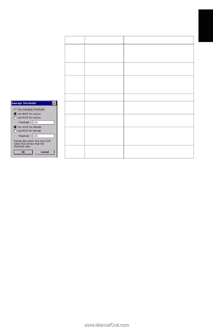
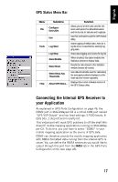
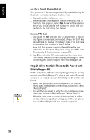
English GPS Status Menu Bar Menu File Tools Help Sub-Menu Configuration>Units Exit Log>Start Log>Stop Stats>Enable Stats>Reset Stats>Setup Avg Thresholds About GPS Status... Function Allows you to set the units used for distance and speed, for altitude/elevation and the format for latitude and longitude. Use this command to quit the GPS Status utility. Starts logging of NMEA data. Asks for a log file to be created before starting logging data. Stops data logging and closes the log file. When checked, this option enables the Statistics window to display data. Resets the data shown in the Statistics window (zeroes all results). Sets data thresholds used for calculating the averaged positions displayed on the Stats tab (see screen opposite). Displays the current software version of the GPS Status utility. Connecting the Internal GPS Receiver to your Application As explained in GPS Ports Configuration on page 46, the COM2 port in MobileMapper CX is a virtual COM port named "GPS VSP Output" and has fixed settings: 57600 bauds, 8 data bits, 1 stop bit and no parity bit. This virtual port will input GPS positions to off-the-shelf Windows CE mobile mapping applications running on MobileMapper CX. To do this, you just have to select "COM2" in your mobile mapping application as the source of GPS data. COM2 can therefore provide the mobile mapping application with NMEA-formatted data coming from the internal GPS receiver. You can define the NMEA sentences you would like to output through this port from the NMEA tab in the GPS Ports Configuration utility (see page 46). 17
-
 1
1 -
2
-
3
-
4
-
5
-
6
-
7
-
8
-
9
-
10
-
11
-
12
-
13
-
14
-
15
-
16
-
17
-
18
-
19
-
 20
20 -
 21
21 -
 22
22 -
 23
23 -
 24
24 -
 25
25 -
 26
26 -
 27
27 -
 28
28 -
 29
29 -
 30
30 -
31
-
32
-
33
-
34
-
35
-
36
-
37
-
38
-
39
-
40
-
41
-
42
-
43
-
44
-
45
-
46
-
47
-
48
-
49
-
50
-
51
-
52
-
53
-
54
-
55
-
56
-
57
-
58
-
59
-
60
-
61
-
62
-
63
-
64
-
65
-
66
-
67
-
68
-
69
-
70
-
71
-
72
-
73
-
74
-
75
-
76
-
77
-
78
-
79
-
80
-
81
-
82
-
83
-
84
-
85
-
86
 |
 |