Garmin G1000 Pilot's Training Guide (Instructor's Reference -04) - Page 9
Ground Lesson 1 - ifr training
 |
View all Garmin G1000 manuals
Add to My Manuals
Save this manual to your list of manuals |
Page 9 highlights
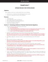
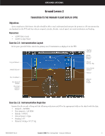
GROUND LESSONS Ground Lesson 1 INTRODUCTION AND G1000 SYSTEM OVERVIEW Objectives Upon completion of this lesson, the pilot should be able to do the following: • Describe the basic components of the G1000 Integrated Avionics System • Describe the communication between G1000 components Resources • G1000 Pilot's Guide • Aircraft Flight Manual (AFM) and supplements • Pilot's Operating Handbook (POH) and supplements • Aeronautical Information Manual (AIM) • Federal Aviation Regulations (FAR) Exercise 1.1: Terminology and Review of Pertinent Federal Aviation Regulations 1. Define the following navigation abbreviations and acronyms: • TRK = Aircraft ground track • DTK = Desired aircraft ground track; GPS-derived course across the ground; used as the GPS course line • VNAV = Vertical Navigation; used to alert the pilot to meet programmed descent profiles • CTS = Course To Steer; GPS-derived guidance to intercept a given course 2. Explain the use of and limitations of a TSO-C129a GPS during instrument approaches per the AIM. This class of GPS is to be used for LNAV non-precision approaches and as a substitute for ADF and DME so long as the Navaid and/or fix is located, as part of the database, in terminal and approach phases of flight. 3. When filling a flight plan, what suffix is used for a current Global Positioning System (GPS) database? /G 4. When can GPS be used in lieu of DME and ADF? When the Navaid and/or fix is located as part of the Jeppesen database; this includes flying DME arc procedures and as a Locator Outer Marker (LOM) in the case of the ADF. 5. Describe the differences between a fly-by and a fly-over GPS waypoint and draw their respective symbols. Fly-by waypoints allow for turn anticipation, whereas fly-over waypoints must be crossed, most often due to terrain clearance issues. Both symbols can be found on approach plates. 6. What does RAIM stand for? Describe its purpose. Receiver Autonomous Integrity Monitoring: provides the integrity check capability to ensure the safe use of GPS for IFR flight operations (see AIM for drawing verification). 7. A pilot is on the RNAV(GPS) 17 approach into KIXD (New Century Aircenter, Olathe, KS) and the system displays the "RAIM UNAVAIL" alert inside the Final Approach Fix. The weather is reported as 500 feet overcast with 2 statute miles of visibility. What action(s) should the pilot take and why? Immediately abandon the approach and notify the tower both that the aircraft has a RAIM warning on the approach and that non-GPS missed approach instructions are needed 190-00368-04 Rev. A Garmin G1000 Pilot's Training Guide - Instructor's Reference 3
-
 1
1 -
2
-
3
-
 4
4 -
 5
5 -
 6
6 -
 7
7 -
 8
8 -
 9
9 -
 10
10 -
 11
11 -
 12
12 -
 13
13 -
 14
14 -
15
-
16
-
17
-
18
-
19
-
20
-
21
-
22
-
23
-
24
-
25
-
26
-
27
-
28
-
29
-
30
-
31
-
32
-
33
-
34
-
35
-
36
-
37
-
38
-
39
-
40
-
41
-
42
-
43
-
44
-
45
-
46
-
47
-
48
-
49
-
50
-
51
-
52
-
53
-
54
 |
 |