Magellan RoadMate 6000T Manual - English - Page 109
Magellan RoadMate POI Manager - 18 08
 |
UPC - 763357115055
View all Magellan RoadMate 6000T manuals
Add to My Manuals
Save this manual to your list of manuals |
Page 109 highlights
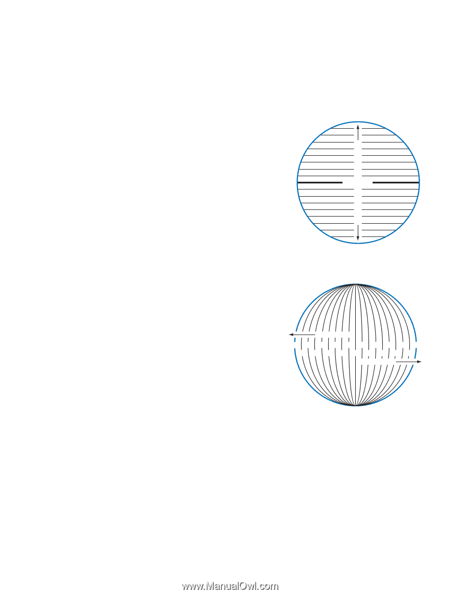
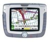
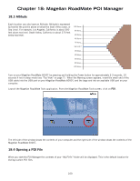
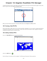
Chapter 18: Magellan RoadMate POI Manager The Magellan RoadMate POI Manager enables you to transfer custom points of interest files from your computer to your Magellan RoadMate 6000T. Before we add any custom POI's to the Magellan RoadMate 6000T, you should understand how the POI Manager plots POIs. 18.1 Latitude Latitude can be expressed by dividing Earth into horizontal segments totalling 180 degrees. Starting at the Equator, or zero degrees Latitude, lines (or Parallels) are drawn in 10-degree increments 90 degrees to the north and 90 degrees to the south. If your location is below the Equator, you are at a South Latitude. 18.2 Longitude 0° 10° 20° 30° 40° 50° 60° 70° 80° North Latitude 90° (North Pole) Equator 80° 70° 60° 50° 40° 30° 20° 10° 0° South Latitude 90° (South Pole) Conversely, longitude lines can be expressed by dividing Earth into vertical segments totalling 360 degrees. Starting at the Prime Meridian (which is The Royal Observatory in Greenwich, England), or zero degrees Longitude, lines are drawn in 10-degree increments 180 degrees to the West and 180 degrees to the East. If your location is on the western hemisphere, you are at a West Longitude. Additionally, to narrow down your location further, each 10-degree segment is divided into 60 smaller segments called minutes and, still further, each minute is divided into 60 segments called seconds. To express this in coordinates, the city of Los Angeles is located at 34° (degrees) 03' (minutes) and 08 (seconds) North of the Equator, and 118° (degrees) 14' (minutes) and 42 (seconds) West of the Prime Meridian. West Longitude 90° 70° 50° 30° 10° 10° 30° 50° 70° 90° 80° 60° 40° 20° 0° 20° 40° 60° 80° East Longitude 99
-
 1
1 -
2
-
3
-
4
-
5
-
6
-
7
-
8
-
9
-
10
-
11
-
12
-
13
-
14
-
15
-
16
-
17
-
18
-
19
-
20
-
21
-
22
-
23
-
24
-
25
-
26
-
27
-
28
-
29
-
30
-
31
-
32
-
33
-
34
-
35
-
36
-
37
-
38
-
39
-
40
-
41
-
42
-
43
-
44
-
45
-
46
-
47
-
48
-
49
-
50
-
51
-
52
-
53
-
54
-
55
-
56
-
57
-
58
-
59
-
60
-
61
-
62
-
63
-
64
-
65
-
66
-
67
-
68
-
69
-
70
-
71
-
72
-
73
-
74
-
75
-
76
-
77
-
78
-
79
-
80
-
81
-
82
-
83
-
84
-
85
-
86
-
87
-
88
-
89
-
90
-
91
-
92
-
93
-
94
-
95
-
96
-
97
-
98
-
99
-
100
-
101
-
102
-
103
-
 104
104 -
 105
105 -
 106
106 -
 107
107 -
 108
108 -
 109
109 -
 110
110 -
 111
111 -
 112
112 -
 113
113 -
 114
114 -
115
-
116
-
117
-
118
-
119
-
120
-
121
 |
 |