Garmin GPS 12XL Owner's Manual (Software Version 4.0 and above) - Page 39
Map
 |
UPC - 753759007034
View all Garmin GPS 12XL manuals
Add to My Manuals
Save this manual to your list of manuals |
Page 39 highlights
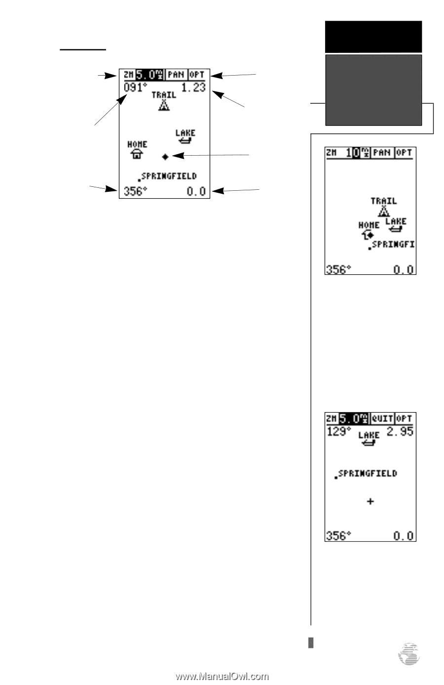
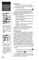
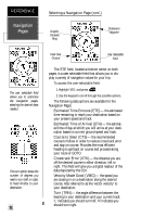
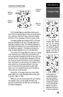
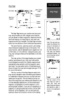
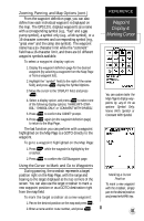
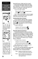
Map Page Zoom Scale Bearing to Waypoint Track Pan & Option Fields Distance to Waypoint Present Position Speed REFERENCE Map Page The Map Page shows your position and surroundings, and provides you with a target cursor that lets you pan ahead to nearby waypoints, determine the distance and bearing to a map position, and mark new waypoints while you navigate. The Map Page is broken down into two sections: control fields and map section. The zoom function, panning control, and configuration fields are located at the top of the screen. The zoom function uses 18 selectable zoom ranges from 0.2 to 500 miles, or 0.3 to 800 km. (Using the zoom, panning, and configure fields will be addressed in the next section.) The map portion of the page displays your present position as a diamond icon, with your track and/or route displayed as a solid line. Nearby waypoints are represented using symbols, with the waypoint name also listed. You may select which of these features are shown through the map options pages (see pgs. 37-39 for more information). The four corners of the Map Page are used to display various navigation data: the bearing and distance to a destination waypoint and your current track and speed over the ground. The two fields at the top corners of the map show your bearing and distance to one of three selectable destinations: an active destination waypoint, a highlighted on-screen waypoint, or the panning target crosshair. If you are not navigating to a waypoint or using the panning function, the top data fields will not be displayed. Your current track and speed are shown at the bottom corners of the display. Note: The map scale represents the distance from the top to the bottom of the Map Page. For example, when viewing the 10 mile scale, the distance represented between the top of the screen and bottom is 10 miles. The four corners of the Map Page are used to show your track and speed, along with distance and bearing to either a cursor or to a destination waypoint. 35
-
 1
1 -
2
-
3
-
4
-
5
-
6
-
7
-
8
-
9
-
10
-
11
-
12
-
13
-
14
-
15
-
16
-
17
-
18
-
19
-
20
-
21
-
22
-
23
-
24
-
25
-
26
-
27
-
28
-
29
-
30
-
31
-
32
-
33
-
 34
34 -
 35
35 -
 36
36 -
 37
37 -
 38
38 -
 39
39 -
 40
40 -
 41
41 -
 42
42 -
 43
43 -
 44
44 -
45
-
46
-
47
-
48
-
49
-
50
-
51
-
52
-
53
-
54
-
55
-
56
-
57
-
58
-
59
-
60
-
61
-
62
-
63
-
64
-
65
-
66
 |
 |