Garmin GPS 12XL Owner's Manual (Software Version 4.0 and above) - Page 42
Using the, Cursor & Map, Options
 |
UPC - 753759007034
View all Garmin GPS 12XL manuals
Add to My Manuals
Save this manual to your list of manuals |
Page 42 highlights
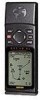
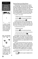
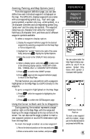
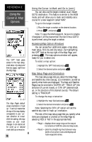
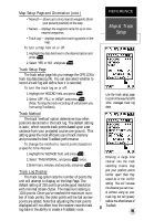
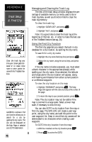
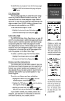
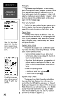
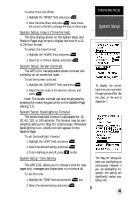
REFERENCE Using the Cursor & Map Options The 'OPT' field gives access to the map setup, track setup, city setup and find city pages, right from the Map Page. The Map Page's default screen orientation is 'track up'. 'Track Up' means that the top of the map display corresponds to your current direction of travel. With this setting, the map rotates as your track changes. It can also be set for north up or desired track (dtk) up orientation. 38 Using the Cursor to Mark and Go to (cont.) You can also use the target crosshair as an instant GOTO destination. This feature is similar to the MOB mode, and will allow you to mark and instantly set a course for a new waypoint called 'MAP'. To go to the target crosshair: 1. Place the target crosshair on the desired location. 2. Press , and press . Note: To save the MAP waypoint, be sure to rename it because it will be overwritten the next time a GOTO is performed using the target crosshair. Accessing Map Option Windows You can access four additional pages-map setup, track setup, find city and city setup-by highlighting the 'OPT' field at the top right of the Map Page, and pressing . The map options window will appear, ready for you to select one. To select a map option: 1. Highlight the 'OPT' field and press . 2. Select the desired option and press . Map Setup Page and Orientation The map setup page lets you select the Map Page and satellite sky view (see pg. 12) orientation, as well as specify what items are displayed. The Map and Satellite Pages may be oriented to 'NORTH UP,' 'TRACK UP' (the direction of current travel), or 'DTK UP' (desired track up, or the direction of the desired course). The default setting is 'TRACKUP'. To change the map orientation: 1. Highlight the 'map' field and press . 2. Select the desired orientation and press . Note: Selecting the 'DTK UP' option will set the satellite sky view to 'track up' orientation. The rest of the map setup page lets you specify what items are displayed or plotted on the Map Page by selecting 'YES' or 'NO' in the appropriate field. • 'Rings'- displays three range rings on the map at increments of 1/5th the selected map scale. • 'Route'- plots the straight-leg lines between waypoints of an active route and displays all route waypoint names.
-
 1
1 -
2
-
3
-
4
-
5
-
6
-
7
-
8
-
9
-
10
-
11
-
12
-
13
-
14
-
15
-
16
-
17
-
18
-
19
-
20
-
21
-
22
-
23
-
24
-
25
-
26
-
27
-
28
-
29
-
30
-
31
-
32
-
33
-
34
-
35
-
36
-
 37
37 -
 38
38 -
 39
39 -
 40
40 -
 41
41 -
 42
42 -
 43
43 -
 44
44 -
 45
45 -
 46
46 -
 47
47 -
48
-
49
-
50
-
51
-
52
-
53
-
54
-
55
-
56
-
57
-
58
-
59
-
60
-
61
-
62
-
63
-
64
-
65
-
66
 |
 |