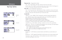
Garmin GPSMAP 178C Owners Manual - Page 40
The following data options are available for data fields on the main s, Highlight the field - transducer
 |
UPC - 753759043544
View all Garmin GPSMAP 178C manuals
Add to My Manuals
Save this manual to your list of manuals |
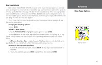
Page 40 highlights
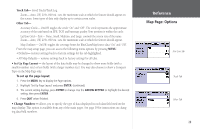
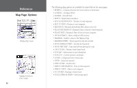
Reference Map Page: Options Changing Page Layout Highlight the field you wish to change 30 The following data options are available for data fields on the main pages: • BEARING - Compass direction from your position to destination • COMPASS - Compass ribbon • COURSE - Desired Track • DEPTH - Depth below transducer • DIST TO DESTINATION - Distance to final waypoint • DIST TO NEXT - Distance to next waypoint • ELEVATION - Elevation above/below MSL (Mean Sea Level) • ETA AT DESTINATION - Estimated Time of Arrival to final waypoint • ETA AT NEXT - Estimated Time of Arrival to next waypoint • GPS ACCURACY - Shows estimated GPS accuracy • HIGHWAY - Smaller version of the Highway Page • MAXIMUM SPEED - Fastest speed the unit has traveled • MOVE AVERAGE SPEED - Average moving speed • MOVE TRIP TIME - Time unit has been moving for a trip • OFF COURSE - Distance from desired track • POINTER - Arrow points to your destination • POSITION - Current position coordinates • SONAR - Compressed view of sonar data • SPEED - Speed over ground • TIME OF DAY - Current time • TIME TO DESTINATION - Time to final waypoint • TIME TO NEXT - Time to next waypoint • TO COURSE - Bearing to desired track • TOTAL AVERAGE SPEED - Total average speed
-
 1
1 -
2
-
3
-
4
-
5
-
6
-
7
-
8
-
9
-
10
-
11
-
12
-
13
-
14
-
15
-
16
-
17
-
18
-
19
-
20
-
21
-
22
-
23
-
24
-
25
-
26
-
27
-
28
-
29
-
30
-
31
-
32
-
33
-
34
-
 35
35 -
 36
36 -
 37
37 -
 38
38 -
 39
39 -
 40
40 -
 41
41 -
 42
42 -
 43
43 -
 44
44 -
 45
45 -
46
-
47
-
48
-
49
-
50
-
51
-
52
-
53
-
54
-
55
-
56
-
57
-
58
-
59
-
60
-
61
-
62
-
63
-
64
-
65
-
66
-
67
-
68
-
69
-
70
-
71
-
72
-
73
-
74
-
75
-
76
-
77
-
78
-
79
-
80
-
81
-
82
-
83
-
84
-
85
-
86
-
87
-
88
-
89
-
90
-
91
-
92
-
93
-
94
-
95
-
96
-
97
-
98
-
99
-
100
-
101
-
102
-
103
-
104
-
105
-
106
-
107
-
108
-
109
-
110
-
111
-
112
-
113
-
114
-
115
-
116
-
117
-
118
-
119
-
120
-
121
-
122
-
123
-
124
-
125
-
126
-
127
-
128
-
129
-
130
-
131
-
132
-
133
-
134
 |
 |
