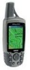
Garmin GPSMAP 60CS Owner's Manual
Garmin GPSMAP 60CS - Hiking GPS Receiver Manual
 |
UPC - 753759044060
View all Garmin GPSMAP 60CS manuals
Add to My Manuals
Save this manual to your list of manuals |
Garmin GPSMAP 60CS manual content summary:
- Garmin GPSMAP 60CS | Owner's Manual - Page 1
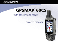
GPSMAP® 60CS with sensors and maps owner's manual - Garmin GPSMAP 60CS | Owner's Manual - Page 2
of such changes or improvements. Visit the Garmin web site (www.garmin.com) for current updates and supplemental information concerning the use and operation of this and other Garmin products. Garmin®, MapSource®, BlueChart®, TracBack® and GPSmap® are registered trademarks and AutoLocate™ is - Garmin GPSMAP 60CS | Owner's Manual - Page 3
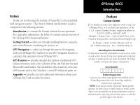
Preface Thank you for choosing the Garmin GPSmap 60CS color map handheld navigation system. This Owner's Manual and Reference Guide is comprised of the following sections: Introduction - contains the Garmin software license agreement, FCC and safety information, the Table of Contents and an overview - Garmin GPSMAP 60CS | Owner's Manual - Page 4
THE GPSmap 60CS, YOU AGREE TO BE BOUND BY THE TERMS AND CONDITIONS OF THE FOLLOWING SOFTWARE LICENSE AGREEMENT. PLEASE READ THIS AGREEMENT CAREFULLY. Garmin grants you a limited license to use the software embedded in this device (the "Software") in binary executable form in the normal operation of - Garmin GPSMAP 60CS | Owner's Manual - Page 5
to which the receiver is connected. • Consult the dealer or an experienced radio/TV technician for help. GPSmap 60CS Introduction FCC Compliance Information The GPSmap 60CS does not contain any user-serviceable parts. Repairs should only be made by an authorized Garmin service center. Unauthorized - Garmin GPSMAP 60CS | Owner's Manual - Page 6
Use the GPSmap™ 60CS at your own risk. To reduce the risk of unsafe operation, carefully review and understand all aspects of this Owner's Manual - and thoroughly practice operation using the information needed for safe navigation - and, as always, the user is responsible for their prudent use. iv - Garmin GPSMAP 60CS | Owner's Manual - Page 7
MAP DATA INFORMATION: One of the goals of Garmin is to GPS) is operated by the United States government, which is solely responsible for its accuracy and maintenance. The system is subject to changes which could affect the accuracy and performance of all GPS equipment. Although the Garmin GPSmap 60CS - Garmin GPSMAP 60CS | Owner's Manual - Page 8
use in vehicles, it is the sole responsibility of the owner/operator of a vehicle with the GPSmap 60CS installed to place and secure the device so that it will not interfere with the vehicle operating controls and safety devices, obstruct the driver's view of driving conditions, or cause damage or - Garmin GPSMAP 60CS | Owner's Manual - Page 9
Section 2: Getting Started 1-7 Battery Installation and Start Up 1 Key Functions 2 Unit Features 3 Initialization 4 The Satellite Page 4 Navigating with the GPSmap 60CS 5 The Main Page Sequence 6 The Main Page Features 7 Section 3: GPS Navigation 8-68 The Map Page 8 The Compass Page 14 - Garmin GPSMAP 60CS | Owner's Manual - Page 10
71 Sun and Moon Tables 72 Hunt and Fish Tables 73 .... GPS Enhanced Games 74 Non-Enhanced Game 77 Section 5: Appendix 78-96 Accessories 78 Specifcations 80 Data Field Definitions 82 .... Connecting the GPSmap 60CS to a Computer 87 Downloading MapSource Map Data 88 ..... UTC Offset Chart 89 - Garmin GPSMAP 60CS | Owner's Manual - Page 11
: 2009 Battery Compartment GPSmap 60CS Getting Started Battery Installation and Start Up Important Note When replacing batteries, use only new or fully charged batteries and damage to the battery compartment. Follow the manufacturer's instructions for proper care and disposal of used batteries. Do - Garmin GPSMAP 60CS | Owner's Manual - Page 12
GPSmap 60CS Getting Started Key Functions IN/OUT Zoom Keys • From the Map Page, press to zoom in or out. • From as a waypoint. QUIT Key • Press and release to cancel data entry or exit a page. 2 GPSmap 60CS IN FIND MARK QUIT OUT PAGE MENU ENTR POWER/BACKLIGHT Key • Press and Hold to turn unit On/ - Garmin GPSMAP 60CS | Owner's Manual - Page 13
CD-ROM provided with this unit. Otherwise, your PC may attempt to auto-install USB drivers incompatible with the unit. Refer to page 87 for detailed instructions. GPSmap 60CS Getting Started Unit Features GPS Antenna • Provides quick satellite acquisition. Battery Compartment Locking D-Ring • Turn - Garmin GPSMAP 60CS | Owner's Manual - Page 14
Map Page to determine your general location so the GPSmap 60CS can search for just those satellites above your position. To initialize your GPSmap 60CS: 1. Press and release the POWER key to turn on the unit. 2. Observe the "Power On" Page followed by the Satellite Page. 3. While the GPS receiver - Garmin GPSMAP 60CS | Owner's Manual - Page 15
your GPSmap 60CS, the solution could be as simple as moving slightly to avoid objects that are blocking or deflecting the satellite signals. 5. Press and Release the PAGE key until the Map Page is displayed. You are now ready to begin GPS aided navigation. Active Navigation is supported by - Garmin GPSMAP 60CS | Owner's Manual - Page 16
Started The Main Page Sequence Whenever you turn on the GPSmap 60CS, the Power On Page is followed by the Satellite Page Satellite Page Trip Computer Page Map Page Compass Page Altimeter Page Main Menu Satellite Page Options 6 Trip Computer Page Options Map Page Options There are no Menu - Garmin GPSMAP 60CS | Owner's Manual - Page 17
and when four or more satellites have been received (three dimensional fix). • Backlighting is Off displays whenever the alarm is set. • USB cable connection displays when the unit is a significant event in the operation of the unit occurs, an and closes the window. GPSmap 60CS Getting Started The Main - Garmin GPSMAP 60CS | Owner's Manual - Page 18
GPSmap 60CS GPS Navigation The Map Page "North Up" Mode with Map oriented with North at the top The Map Scale The Map Page Position Arrow The Map Page (full map) "Track Up" Mode North Orientation Arrow Data Fields Guidance Text Street Level Detailed Mapping The Map Page with Data Fields and - Garmin GPSMAP 60CS | Owner's Manual - Page 19
the display to provide a variety of travel and navigational information, see pages that follow. When navigating, Guidance Text is displayed at the top of the map. GPSmap 60CS GPS Navigation The Map Page Zoom In Zoom Out Map Features Map Scales Accuracy Circle Panning Arrow Guidance Text 9 - Garmin GPSMAP 60CS | Owner's Manual - Page 20
GPSmap 60CS GPS Navigation The Map Page The Map Page Options Menu A Quick Look at the Map Page Options Stop Navigation - Stops navigation and is disabled when there is no active navigation. Recalculate - Recalculates a route and is disabled when there is no - Garmin GPSMAP 60CS | Owner's Manual - Page 21
Map Page as is (full page map), or add two, three or four navigation data fields. 3. Highlight your choice and press ENTER. GPSmap 60CS GPS Navigation The Map Options are related to the display of data received from other devices interfaced to the GPSmap 60CS, for an explanation of what each option - Garmin GPSMAP 60CS | Owner's Manual - Page 22
GPSmap 60CS GPS Navigation The Map Page Guidance Text Options Menu GPS Status Message when not navigating To display Guidance Text: 1. With Map Page displayed, press the MENU key to display the Map Page Options Menu. 2. Highlight the Guidance Text Option and press ENTER to display the Guidance Text - Garmin GPSMAP 60CS | Owner's Manual - Page 23
Declutter On" and press ENTER to activate. Do the same to cancel the "Declutter" option. Restoring Default Settings This option allows you to return the map settings to factory settings. GPSmap 60CS GPS Navigation The Map Page "Measured Distance" The "Measure Distance" Option Enabled - Garmin GPSMAP 60CS | Owner's Manual - Page 24
Page The Compass Page is your guide to accurate and efficient navigation. GPS receiver to maintain your heading. When you stop (after a pre-set time), it again operates like a magnetic compass. The compass ring is especially helpful when using a paper map or chart in conjunction with your GPSmap 60CS - Garmin GPSMAP 60CS | Owner's Manual - Page 25
Compass Off, it stays off until you manually turn it On again. Sometimes, however, when you turn the Compass On, the GPSmap 60CS overrides the Compass and uses the GPS receiver to track your heading. The criteria for switching between the Compass and the GPS can be customized. (See below.) Turning - Garmin GPSMAP 60CS | Owner's Manual - Page 26
GPSmap 60CS GPS Navigation The Compass Page Hold the unit level and turn slowly. Calibration Progress Page Calibrating the Electronic Compass The Electronic Compass must be calibrated outdoors when you first use the GPSmap 60CS and after new batteries have been installed. The accuracy of the - Garmin GPSMAP 60CS | Owner's Manual - Page 27
traveling to your destination on a course line using the Course Pointer as a guide. Or... 6. Select "Project Waypoint" and press ENTER to display the the Map Page and begin navigation to the projected waypoint. The Compass Page displays a Bearing Pointer for guidance. GPSmap 60CS GPS Navigation - Garmin GPSMAP 60CS | Owner's Manual - Page 28
GPSmap 60CS GPS Navigation The Compass Page The Bearing Pointer always indicates the direction to your destination from your current location. 0.25 mi Scale The Course Pointer indicates - Garmin GPSMAP 60CS | Owner's Manual - Page 29
elds. To restore data fields to default settings: Select "Restore Defaults" and press ENTER to return the page to factory settings. GPSmap 60CS GPS Navigation The Compass Page Data Field Display Options Show 3 Data Fields Highlighted Data Field Show 4 Data Fields Course Pointer Option Data Field - Garmin GPSMAP 60CS | Owner's Manual - Page 30
GPSmap 60CS GPS Navigation The Altimeter Page Range Grid Measurement Scale Selectable Data Fields Elevation Profile Plot over Distance Elevation Status Field Rate of Ascent/Descent Altimeter Page Current Elevation Options Menu 20 The Altimeter Page provides the user with the current - Garmin GPSMAP 60CS | Owner's Manual - Page 31
the "Calibrate Altimeter" option. Use the "Reset" option to clear recorded data from the page and to begin recording new data. Plot Over Time/Distance These two measurement clear the "Track Log". GPSmap 60CS GPS Navigation The Altimeter Page Elevation over Distance Plot Pressure over Time Plot 21 - Garmin GPSMAP 60CS | Owner's Manual - Page 32
GPSmap 60CS GPS Navigation The Altimeter Page Zoom Ranges for Elevation over Distance Plot Zoom Ranges for Pressure over Time Plot 22 Zoom Ranges You can set the - Garmin GPSMAP 60CS | Owner's Manual - Page 33
to view. 2. Press ENTER to display the altitude point on the map. The point is marked by the Map Pointer with location coordinates, the compass bearing and distance from your current location. 3. Press QUIT to close. GPSmap 60CS GPS Navigation The Altimeter Page Red Crosshairs View Point for an - Garmin GPSMAP 60CS | Owner's Manual - Page 34
GPSmap 60CS GPS Navigation The Altimeter Page Resets or Deletes all items on the page Elevation over Distance Plot Unselects all checked items on the page Resets or Deletes only those items that are checked Delete Prompt Reset You can reset the elevation data and the maximum elevation data by - Garmin GPSMAP 60CS | Owner's Manual - Page 35
pressure, select "No" to use the default GPS elevation. 4. On the number keyboard, use the ROCKER key to enter the new elevation or pressure, then highlight "OK" and place it in the data field. GPSmap 60CS GPS Navigation The Altimeter Page Calibrate using Elevation Calibrate using Pressure Altimeter Data - Garmin GPSMAP 60CS | Owner's Manual - Page 36
GPSmap 60CS GPS Navigation The Trip Computer Page Select "Change Data Fields" or press the ROCKER the same manner as for the similar data fields on the Map Page. (See page 11 for details.) If you want to record new data for each trip, a "Reset" option is available. If you want to view significant trip - Garmin GPSMAP 60CS | Owner's Manual - Page 37
GPSmap 60CS GPS you do not want to save it as a new waypoint, press the QUIT button to cancel. Garmin website http://www.garmin.com/ximage to download the xImage transfer program. From there, the xImage help files provide instructions Naming a Waypoint for customizing waypoints and downloading - Garmin GPSMAP 60CS | Owner's Manual - Page 38
GPSmap 60CS GPS Navigation Using Waypoints Map Item selected as a Waypoint Information Page for a Map Point with Data 28 Waypoint Page for a Map Point without Data To create a waypoint using the map panning arrow: 1. With the Map Page displayed, move the panning arrow (map pointer) to the map - Garmin GPSMAP 60CS | Owner's Manual - Page 39
Find Feature Waypoints list and edited to change the map symbol, name, location coordinates, elevation or to delete waypoint symbol chart, and alpha/numeric keypad to enter new data. 3. Press the QUIT key to close and to delete. GPSmap 60CS GPS Navigation Using Waypoints Waypoint Symbols Chart Delete - Garmin GPSMAP 60CS | Owner's Manual - Page 40
GPSmap 60CS GPS Navigation Using Waypoints New Location Original Location Moving a Waypoint Project Waypoint Page 30 Projected Waypoint on the Map To Move a Waypoint on the Map Page: 1. Use the Find Feature to display the Information Page for the desired waypoint. (Refer to page 33.) 2. - Garmin GPSMAP 60CS | Owner's Manual - Page 41
GPSmap 60CS basemaps. If you have downloaded Garmin MapSource mapping data that contains additional map "Change Reference" (by moving the map Panning Arrow to a new location), "Nearest Containing" (a key Garmin website: http://www.garmin.com//cartography/mapSource/ bluechartCD.jsp GPSmap 60CS GPS - Garmin GPSMAP 60CS | Owner's Manual - Page 42
GPSmap 60CS GPS Navigation Using Find "Finding" icon displays while searching Pressing the FIND Interest." 3. Press the MENU key to select "Find By Name." 4. Use the ROCKER key and ENTER key to operate the keypad at the base of the display and begin to enter the name of the location, the list of - Garmin GPSMAP 60CS | Owner's Manual - Page 43
depth, if a waypoint. • Direction and distance from current location or the map pointer. At the bottom of the page are three on-screen buttons. - save as a waypoint. Map - display on the Map Page. Use - insert into a list of points on a route.. GPSmap 60CS GPS Navigation Using Find Selected as a - Garmin GPSMAP 60CS | Owner's Manual - Page 44
GPSmap 60CS GPS Navigation Using Find Waypoint Information Page Options include "Average Location" Find Map Database Item Information Page • Project Waypoint - Create a new waypoint by entering a bearing and distance from this point. (Refer to page 30 for detailed instructions.) • Find Near Here - - Garmin GPSMAP 60CS | Owner's Manual - Page 45
item on a New Route or add it to an existing route. (See Using Routes page 49 on for details.) GPSmap 60CS GPS Navigation Using Find Map Information Display the map that is the source of information about the map item. (Refer to page 88 of the Appendix for information about downloading detailed maps - Garmin GPSMAP 60CS | Owner's Manual - Page 46
GPSmap 60CS GPS Navigation Using Find Find Waypoint Options Find Waypoints List of a specific type. Change Reference: allows you to use the Panning Arrow to select a point on the map other than your current location. 4. Once found, a waypoint information page can be viewed by pressing the ENTER - Garmin GPSMAP 60CS | Owner's Manual - Page 47
from others on the waypoints list. For more information on creating a geocache point refer to Geocache Setup instruction on page 63 and www.garmin.com/products/ gpsmap60cs/. GPSmap 60CS GPS Navigation Using Find Options Menu To find a Geocache: 1. Press the FIND key to display the Find Menu. 2. Use - Garmin GPSMAP 60CS | Owner's Manual - Page 48
GPSmap 60CS GPS Navigation Using Find Cities Options Menu Select Maps Options City Page Options Find Cities List City Information Page Searching for a City The Find Cities feature allows you to search for any city listed in the mapping database (either in the basemap or from downloaded - Garmin GPSMAP 60CS | Owner's Manual - Page 49
Press ENTER to display the Information Page for the selected service. The Exit Services Information Page displays the name of the service, its direction from the exit, and a list of the services available. GPSmap 60CS GPS Navigation Using Find Find Exits List Options Menus Exit Information Page - Garmin GPSMAP 60CS | Owner's Manual - Page 50
GPSmap 60CS GPS Navigation Using Find Find Addresses Search Page Find Address Matches 40 Address Information Page Searching for an Address The Find Addresses feature allows you to search for an address if you have downloaded detailed mapping data. Enter the street number, street name and city and - Garmin GPSMAP 60CS | Owner's Manual - Page 51
downloaded detailed mapping data. Enter the two street names and city and the Find Feature matches that data with intersections in the map . 4. With highlighted, follow instructions in step 6 of the previous page. Repeat Information Page. GPSmap 60CS GPS Navigation Using Find Options - Garmin GPSMAP 60CS | Owner's Manual - Page 52
GPSmap 60CS GPS Navigation Using Find Find POI Topic List Search Method Select Category Searching for a Point of Interest You can use the Find Point of Interest feature to locate a nearby restaurant, lodging, landmark, public building, park, etc. However, you must have downloaded MapSource detailed - Garmin GPSMAP 60CS | Owner's Manual - Page 53
GPSmap 60CS GPS Navigation About the Main Menu The Main Menu The Main - A useful graphic perspective for navigating a route. • Setup - Controls the settings for many of the unit operating system features. • Proximity - Activates an alarm for a defined radius around a specified waypoint. • Calendar - Garmin GPSMAP 60CS | Owner's Manual - Page 54
GPSmap 60CS GPS Navigation Using Tracks Tracks Page with Saved Track Log Options Menu Track Log Setup Page 44 Using a Track Log The Tracks feature creates an electronic trail on the map page as you travel about and is will stop recording when full instead of overwriting the oldest data with new. - Garmin GPSMAP 60CS | Owner's Manual - Page 55
Track Page. The new saved track is a representation of the entire track log from beginning to end. 2. If you select "No," a map showing the entire track on the following page) GPSmap 60CS GPS Navigation Using Tracks Save Track Page Saved Track on Map Select Track Ending Point Select Track Beginning - Garmin GPSMAP 60CS | Owner's Manual - Page 56
GPSmap 60CS GPS Navigation Using Tracks Saved Track Page Area Calculation Option Saved Track on the Map the Map button and press ENTER to display the Map Page. 2. A map showing the entire track appears with "Begin" and "End" markers. Any User Waypoints save the new track to the Saved Tracks List. - Garmin GPSMAP 60CS | Owner's Manual - Page 57
only when you have DEM maps loaded on your GPSmap 60CS. A Track Elevation Profile can also be created from Digital Elevation Models (DEM) maps (MapSource U.S. Topo 24K) which include elevation data contained in the map. When these types of maps are available, a "Use Map Data" - "Use Track Data - Garmin GPSMAP 60CS | Owner's Manual - Page 58
GPSmap 60CS GPS Navigation Using Tracks TracBack Page Create User Waypoint Prompt 48 To Use the TracBack feature: 1. With the Saved Tracks Page for the track or the Track Log displayed, highlight the TracBack button and press ENTER to display the TracBack Page. 2. A map showing the entire track - Garmin GPSMAP 60CS | Owner's Manual - Page 59
route if desired. 6. Press QUIT to save it to the Saved Routes list. Or, highlight the "Navigate" button and press ENTER to navigate. GPSmap 60CS GPS Navigation Using Routes Indicates Active Route Options Menu List of Saved Routes Active Route Page when Off Road Route Setup Page Active Route - Garmin GPSMAP 60CS | Owner's Manual - Page 60
GPSmap 60CS GPS Navigation Using Routes Direct Line Navigation Go To (Distance) Navigation from Waypoint to Waypoint Auto Routing 50 Manual Routing Navigation using Existing Roadways Methods of navigating to a destination: • When you activate the "Go To" button on the Information Page for a User - Garmin GPSMAP 60CS | Owner's Manual - Page 61
GPSmap 60CS GPS Navigation Navigating a Route After you have created a route, you can on a Route 2. Highlight the "Navigate" button and press ENTER to begin navigation and display the route on the Map Page. 3. To view the list of turns on the route, press the PAGE key to display the Active Route - Garmin GPSMAP 60CS | Owner's Manual - Page 62
GPSmap 60CS GPS Navigation Using Routes Saved Routes to delete all routes?" Select "Yes" and press ENTER. Route Leg Transition Options Route on the map transitions to the next leg point when you are within a 1 mile radius of that point. list of options. Select "Auto,""Manual" or "Distance." 52 - Garmin GPSMAP 60CS | Owner's Manual - Page 63
create a vertical profile of the route: (Available only if Garmin MapSource U.S. Topo 24K map data is used. See page 88 for details.) Select "Profile and press ENTER to access the Route Waypoint Options Menu. GPSmap 60CS GPS Navigation Using Routes Route Detail Page Route Waypoint Options Menu - Garmin GPSMAP 60CS | Owner's Manual - Page 64
GPSmap 60CS GPS Navigation The Highway Page Highway Page with an Active Route Highway Page Options Menu Data Field Display Options 54 The Highway Page Whenever navigating a route, the Highway Page will guide you to the destination using data fields and a graphic highway. Up to four user selectable - Garmin GPSMAP 60CS | Owner's Manual - Page 65
Instructions for modifying features are explained in the sections that follow. System Setup The System Setup Page allows you to select from four modes of GPS operation . To view the software version, press MENU, select "Software Version" and press ENTER. GPSmap 60CS GPS Navigation The Setup Menu - Garmin GPSMAP 60CS | Owner's Manual - Page 66
log and MapSource data with a PC. GARMIN DGPS - The proprietary format used with a Garmin differential beacon receiver. It provides for tuning of the beacon receiver directly from the GPSmap 60CS. NMEA In/NMEA Out - Supports input and output of standard NMEA 0183 version 3.01 data. Text Out - Allows - Garmin GPSMAP 60CS | Owner's Manual - Page 67
bottom of the page. GPSmap 60CS GPS Navigation Interface Setup Data Format Page for GARMIN DGPS Data Format Page for RTCM In/NMEA Out Data Format Page for: NMEA In/NMEA Out Text Out RTCM In RTCM In/Text Out IMPORTANT NOTE: When the USB cable is connected to the GPS map 60CS, it is automatically - Garmin GPSMAP 60CS | Owner's Manual - Page 68
GPSmap 60CS GPS Navigation Tones Setup Tones Sound when highlighted Tones Setup Up or Down until the desired position is displayed and press ENTER. 3. To insert a new page highlight the page you wish to follow the new page in the order and press ENTER. Select "Insert", then choose a page from the - Garmin GPSMAP 60CS | Owner's Manual - Page 69
operation of your unit before deciding what features you want to customize. To customize the Map Page display: 1. To access the Map Setup Pages, press the MENU key with the Map key with the page displayed. GPSmap 60CS GPS Navigation Map Setup The "General Settings" Map Setup Page Many of the Setup - Garmin GPSMAP 60CS | Owner's Manual - Page 70
GPSmap 60CS GPS Navigation Map Setup The "General Settings" Map Setup Page The "Tracks Settings" Map Setup Page The "Points Settings" Map Setup Page 60 Map Setup - General Settings The first page of the Map Setup feature is the General Settings Page. Use this page: to select the map orientation, " - Garmin GPSMAP 60CS | Owner's Manual - Page 71
the Marine Settings Page. Use this page to control the display of marine chart items when using downloaded marine charts (i.e. MapSource BlueChart® marine mapping data). GPSmap 60CS GPS Navigation Map Setup The "Text Settings" Map Setup Page The "Map Information" Map Setup Page The "Marine Settings - Garmin GPSMAP 60CS | Owner's Manual - Page 72
GPSmap 60CS GPS Navigation Routing Setup Routing Setup Options Routing Setup Page Follow Road Options Routing Setup The Routing Setup Page allows you to customize the manner in - Garmin GPSMAP 60CS | Owner's Manual - Page 73
Garmin website for details and how to download geocache locations from the internet www.garmin.com. To use the Geocache Setup feature: 1. Access the Geocache which activate alarms for features specific to maritime navigation. To use to close. GPSmap 60CS GPS Navigation Geocache Setup Waypoint Symbols - Garmin GPSMAP 60CS | Owner's Manual - Page 74
GPSmap 60CS GPS Navigation Time Setup To 60CS. To use the Units Setup feature: 1. Access the Units Setup Page. 2. Use the ROCKER and ENTER keys to highlight the various units fields and select the desired units from the lists displayed. For more information about selecting Position Formats and Map - Garmin GPSMAP 60CS | Owner's Manual - Page 75
from True North, Magnetic North, Grid North, or User Grid North. 4. Select speed and time delay for electronic instructions on page 16. To calibrate the Altimeter: Select Altimeter and press ENTER to display the Altimeter Calibration Page and follow instructions on pages 25 and 66. GPSmap 60CS GPS - Garmin GPSMAP 60CS | Owner's Manual - Page 76
GPSmap 60CS GPS Navigation Altimeter Setup Important - If you select the "Save Always" option, be certain to switch back to the "Save When Power On" option before removing the batteries from the unit and when storing the unit for long periods with batteries in place. If not, you may need to reset - Garmin GPSMAP 60CS | Owner's Manual - Page 77
" or "Failed" message displays. Use the elevation determined by the GPS receiver Welcome Page Setup The Welcome Page Setup Page allows you to insert as desired by following steps 1 through 3 again. GPSmap 60CS GPS Navigation Altimeter Setup Calibration Complete Press ENTER Calibration Failed - Garmin GPSMAP 60CS | Owner's Manual - Page 78
GPSmap 60CS GPS Navigation Proximity Waypoints Use the ENTER key to Review or Remove an entry. Proximity using the Find Feature. 3. Select a waypoint from the Waypoints List or from any other group of map points and press ENTER to display the Information Page for that item. 4. With the "Use" - Garmin GPSMAP 60CS | Owner's Manual - Page 79
data for a specific date and location, press the MENU key and use the ROCKER key to make your choice. GPSmap 60CS GPS Features Calendar New Location Options Calendar: Week Format Options Menu Remove Points Options Calendar: Day Format Calendar: Month Format Marked waypoints are automatically - Garmin GPSMAP 60CS | Owner's Manual - Page 80
GPSmap 60CS GPS Features Alarm Clock Calculator Options Menus Alarm Clock The Alarm Clock Feature allows you to use your GPSmap 60CS silence the alarm. Calculator The Calculator Feature allows you to use your GPSmap 60CS as a calculator. You can select either a Standard or Scientific calculator - Garmin GPSMAP 60CS | Owner's Manual - Page 81
field and then press ENTER. To reset the stopwatch: With the stopwatch stopped, use the ROCKER key to highlight the "Reset" field and then press ENTER. then press ENTER. Enter the new value and press ENTER. When done, highlight "OK" and press ENTER. GPSmap 60CS GPS Features Stopwatch Lap Options Menu - Garmin GPSMAP 60CS | Owner's Manual - Page 82
GPSmap 60CS GPS Features Sun and Moon Tables Location Options Menu Sun and Moon The Sun and Moon Tables provide you . 3. To view the predictions for a different location, highlight the Location field and press ENTER to display the "New Location" options menu and choose from the options shown. 72 - Garmin GPSMAP 60CS | Owner's Manual - Page 83
fishing for a chosen date and location. GPSmap 60CS GPS Features Hunt and Fish Tables To display the "New Location" options menu. Choose "Use Map" to select a point on the map using the Map Location." Choose "Use Find Menu" to select a point from the Find Feature database. Follow instructions - Garmin GPSMAP 60CS | Owner's Manual - Page 84
Opened Symbol Symbol 74 Games The GPSmap 60CS provides games as an entertainment feature. Several of these games employ GPS. To select and play a game prompt for each game. Memory Race This is a GPS virtual game where the playing piece moves where you move. To win the Memory Race, remember which - Garmin GPSMAP 60CS | Owner's Manual - Page 85
of 2. Turn the cheat mode Off by pressing the ENTER key. Geko Smak Geko Smak is a GPS based game that features you as the player piece. In measured rhythm, Gekos will appear on the screen The pace quickens and values vary as difficulty levels increase. GPSmap 60CS GPS Features GPS Enhanced Games 75 - Garmin GPSMAP 60CS | Owner's Manual - Page 86
GPSmap 60CS GPS Features GPS Enhanced Games 76 Nibbons In this GPS game, you must walk around the field to make your game settings. Orient Map "Northwards" rotates your ship in the center of the map. The map is stationary and north is always up. Orient Map "Ship Up" rotates the virtual world - Garmin GPSMAP 60CS | Owner's Manual - Page 87
Beast Hunt Although not a true GPS game, Beast Hunt requires some navigation skills, in which you must find and the ROCKER key to point and ENTER to shoot. Hit the dragon and you win. GPSmap 60CS GPS Features Non-Enhanced Game Game Symbols Player Pit Warning Dragon Near Pit Dragon Aim Arrow 77 - Garmin GPSMAP 60CS | Owner's Manual - Page 88
to belt or waistband. USB Interface Cable - Provides connection to a PC for data transfer. (Not shown) Owner's Manual - Start up instructions and detailed operation reference. Quick Start Guide - Abbreviated overview of unit operation and reference. Note: Refer to the list of accessories on the unit - Garmin GPSMAP 60CS | Owner's Manual - Page 89
for removal if not required) Belt Clip (attaches to belt or waistband) USB Connector (under weather cover) Power/Data Cable Connector (Serial Port) (under weather cover) Back of GPSmap 60CS GPSmap 60CS Appendix Accessories Suction Mount Kit Auto Dash Mount Kit Marine Mount Kit Bicycle Mount Kit - Garmin GPSMAP 60CS | Owner's Manual - Page 90
5 degrees1, resolution; 1 degree Altimeter: Accuracy; +/- 10 feet1, resolution; 1 foot Keypad: Operating Range: Nine multifunction backlit keys 5 to 158oF (-15 to 70oC)2 PERFORMANCE Receiver: Acquisition Time: Update Rate: GPS Accuracy Position: Velocity: WAAS enabled, 12 parallel channel Warm - Garmin GPSMAP 60CS | Owner's Manual - Page 91
Receiver input.) 5. Alkaline batteries lose a significant amount of their capacity as the temperature decreases. Use Lithium batteries when operating the GPS map 60CS in below-freezing conditions. Extensive use of backlighting, electronic compass and audible tones reduces battery life. GPSmap 60CS - Garmin GPSMAP 60CS | Owner's Manual - Page 92
provides a brief description of each data field option. Some of these options are supported only by devices interfaced to your GPSmap 60CS. Accuracy GPS - The current accuracy of you GPS determined location. Ambient Pressure - The uncalibrated current pressure. Ascent-Average - The average vertical - Garmin GPSMAP 60CS | Owner's Manual - Page 93
(lat/lon) - Your current location as latitude/longitude coordinates. Location (selected) - Your current location described in the selected units of measure (other than lat/lon). GPSmap 60CS Appendix Data Field Definitions 83 - Garmin GPSMAP 60CS | Owner's Manual - Page 94
GPSmap 60CS Appendix Data Field Definitions 84 Odometer - The total distance you kilometers per hour or knots. Speed - Maximum - The maximum speed you have attained since the Trip Computer was reset. Speed - Moving Avg. - The average speed while your vehicle was moving. Speed - Overall Avg. - The - Garmin GPSMAP 60CS | Owner's Manual - Page 95
(since the Trip Computer was reset). Trip Time - Total - The total time the unit has been tracking since the Trip Computer was reset. Turn - The direction of, devices interfaced to the GPSmap 60CS is used to calculate your current speed over water. GPSmap 60CS Appendix Data Field Definitions 85 - Garmin GPSMAP 60CS | Owner's Manual - Page 96
GPSmap 60CS Appendix Data Field Definitions Water Temperature - The temperature of water at a measured depth using measurement devices interfaced to the GPSmap 60CS. Waypoint - Destination - The last point on a route, your destination. Waypoint - Next - The next point on your route. 86 - Garmin GPSMAP 60CS | Owner's Manual - Page 97
necessary for downloading of detailed map from Garmin MapSource Map Data CDs. You can also save routes, waypoints, and tracks from the GPSmap 60CS to MapSource. Refer to the MapSource User's Guide provided with your MapSource CDs. To connect to your computer using the USB connector: 1. Install the - Garmin GPSMAP 60CS | Owner's Manual - Page 98
Garmin MapSource CDROM, and the Universal Service Bus (USB) cable supplied with this unit. When downloading new maps, those already downloaded are overwritten. Include maps you want to retain by adding them to your new map download. Follow instructions for map transfer in the MapSource User's Manual - Garmin GPSMAP 60CS | Owner's Manual - Page 99
.5° to W052.5° -04.00 W052.5° to W037.5° -03.00 W037.5° to W022.5° -02.00 W022.5° to W007.5° -01.00 W007.5° to E007.5° -00.00 GPSmap 60CS Appendix UTC Offset Chart Longitudinal Zone E007.5° to E022.5° E022.5° to E037.5° E052.5° to E067.5° E067.5° to E082.5° E082.5° to E097.5° E097.5° to E112 - Garmin GPSMAP 60CS | Owner's Manual - Page 100
or chart are referenced to a specific map datum. Every chart has a map datum reference and the GPSmap 60CS can be set to match most of those commonly used. If you are navigating and comparing the GPS coordinates to a map, chart or other reference, the map datum in the GPS unit should be set to the - Garmin GPSMAP 60CS | Owner's Manual - Page 101
60CS is not relying on the LORAN signal for navigation and actually converts the TD coordinate to a useful LAT/LON coordinate before storing the waypoint to memory Handbook, available at the Garmin Web site, at www.garmin.com/support/userManual.html. GPSmap 60CS Appendix Loran TD Setup Location - Garmin GPSMAP 60CS | Owner's Manual - Page 102
GPSmap 60CS Appendix WAAS and DGPS 92 What is WAAS? The Wide Area Augmentation System (WAAS) is an F.A.A. funded project to improve the overall integrity of the GPS form of a beacon receiver compatible with the RTCM format sentences supported by your Garmin GPS. Refer to the section titled " - Garmin GPSMAP 60CS | Owner's Manual - Page 103
/or a second GPS receiver. The NMEA 0183 version 3.01 interface format is supported by the GPSmap 60CS and enables the unit to drive up to three NMEA devices. NMEA 0183 Version 3.01 Approved Sentences: GPGGA, GPGLL, GPGSA, GPGSV, GPRMB, GPRMC, GPRTE, GPVTG, GPWPL, GPBOD Garmin Proprietary Sentences - Garmin GPSMAP 60CS | Owner's Manual - Page 104
GPSmap 60CS Appendix Index A Accessories 78 Accuracy Circle Map 60 Differential GPS (DGPS) 92 Display Mode 60 Display Setup 56 E Elevation 11, 20, 26 Elevation Profile 21,47,53 Exit Services 39 Exits 39 Exits, Nearest 39 F Fields, Data 11, 54 Find Address 40 Find Cities 38 Find Exits 39 Find Geocache - Garmin GPSMAP 60CS | Owner's Manual - Page 105
53 Profile 53 Navigating 53 Reversing 51 Routing Setup 62 GPSmap 60CS Appendix Index S Satellite Page 4 Saving the Tracklog 45 Selecting a Page 2 Setup Menu 55 Show Data Fields 10 Show Map Only 10 Sight 'N Go 17 Software Version (Operating) 55 Specifications 80 Stop Navigation 10, 14, 57 Stopwatch - Garmin GPSMAP 60CS | Owner's Manual - Page 106
GPSmap 60CS Appendix Index Track Up 8, 60 Trip Computer Page 26 Trip Odometer 26 Trip Time 26 U Unit Features 3 Unit i.d. 55 Units of Measure 64 Units Setup 64 User Waypoint Symbol 27 UTC Offset 64, 89 V View Elevation Plot 21 View Pressure Plot 21 View Waypoints on Route 53, 59 W WAAS and DGPS 92 - Garmin GPSMAP 60CS | Owner's Manual - Page 107
to repair or replace the unit or software or offer a full refund of the purchase price at its sole discretion. SUCH REMEDY SHALL BE YOUR SOLE AND EXCLUSIVE REMEDY FOR ANY BREACH OF WARRANTY. To obtain warranty service, call your local Garmin authorized dealer. Or call Garmin Customer Service at - Garmin GPSMAP 60CS | Owner's Manual - Page 108
the latest free software updates (excluding map data) throughout the life of your Garmin products, visit the Garmin web site at www.garmin.com © Copyright 2004 Garmin Ltd. or its subsidiaries Garmin International, Inc. 1200 East 151st Street, Olathe, Kansas 66062, U.S.A. Garmin (Europe) Ltd. Unit
-
 1
1 -
 2
2 -
 3
3 -
 4
4 -
 5
5 -
 6
6 -
 7
7 -
8
-
9
-
10
-
11
-
12
-
13
-
14
-
15
-
16
-
17
-
18
-
19
-
20
-
21
-
22
-
23
-
24
-
25
-
26
-
27
-
28
-
29
-
30
-
31
-
32
-
33
-
34
-
35
-
36
-
37
-
38
-
39
-
40
-
41
-
42
-
43
-
44
-
45
-
46
-
47
-
48
-
49
-
50
-
51
-
52
-
53
-
54
-
55
-
56
-
57
-
58
-
59
-
60
-
61
-
62
-
63
-
64
-
65
-
66
-
67
-
68
-
69
-
70
-
71
-
72
-
73
-
74
-
75
-
76
-
77
-
78
-
79
-
80
-
81
-
82
-
83
-
84
-
85
-
86
-
87
-
88
-
89
-
90
-
91
-
92
-
93
-
94
-
95
-
96
-
97
-
98
-
99
-
100
-
101
-
102
-
103
-
104
-
105
-
106
-
107
-
108
 |
 |
with sensors and maps
owner’s manual
GPSMAP
®
60CS