Garmin GPSMAP 60CS Owner's Manual - Page 92
Data Field Definitions
 |
UPC - 753759044060
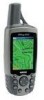
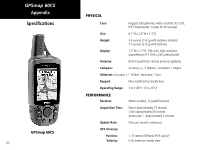
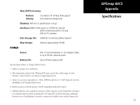
View all Garmin GPSMAP 60CS manuals
Add to My Manuals
Save this manual to your list of manuals |
Page 92 highlights
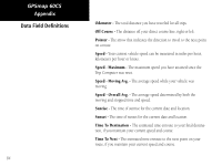
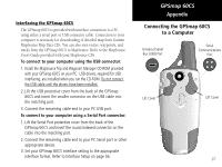
GPSmap 60CS Appendix Data Field Definitions 82 The following list provides a brief description of each data field option. Some of these options are supported only by devices interfaced to your GPSmap 60CS. Accuracy GPS - The current accuracy of you GPS determined location. Ambient Pressure - The uncalibrated current pressure. Ascent-Average - The average vertical distance of ascents. Ascent-Maximum - The maximum ascent rate in feet/meters per minute. Ascent-Total - The total distance ascended. Barometer - The calibrated current pressure. Bearing - The compass direction from your current position to a destination point. Course - The desired path of travel from your starting point to your destination point. Depth - The depth of water from sonar NMEA input. Descent-Average - The average vertical distance of descent. Descent-Maximum - The maximum descent rate in feet/meters per minute. Descent-Total - The total distance descended.
-
 1
1 -
2
-
3
-
4
-
5
-
6
-
7
-
8
-
9
-
10
-
11
-
12
-
13
-
14
-
15
-
16
-
17
-
18
-
19
-
20
-
21
-
22
-
23
-
24
-
25
-
26
-
27
-
28
-
29
-
30
-
31
-
32
-
33
-
34
-
35
-
36
-
37
-
38
-
39
-
40
-
41
-
42
-
43
-
44
-
45
-
46
-
47
-
48
-
49
-
50
-
51
-
52
-
53
-
54
-
55
-
56
-
57
-
58
-
59
-
60
-
61
-
62
-
63
-
64
-
65
-
66
-
67
-
68
-
69
-
70
-
71
-
72
-
73
-
74
-
75
-
76
-
77
-
78
-
79
-
80
-
81
-
82
-
83
-
84
-
85
-
86
-
 87
87 -
 88
88 -
 89
89 -
 90
90 -
 91
91 -
 92
92 -
 93
93 -
 94
94 -
 95
95 -
 96
96 -
 97
97 -
98
-
99
-
100
-
101
-
102
-
103
-
104
-
105
-
106
-
107
-
108
 |
 |