Garmin GPSMAP 60CS Owner's Manual - Page 70
Map Setup - General Settings, Map Setup - Tracks Settings, Map Setup - Points Settings
 |
UPC - 753759044060
View all Garmin GPSMAP 60CS manuals
Add to My Manuals
Save this manual to your list of manuals |
Page 70 highlights
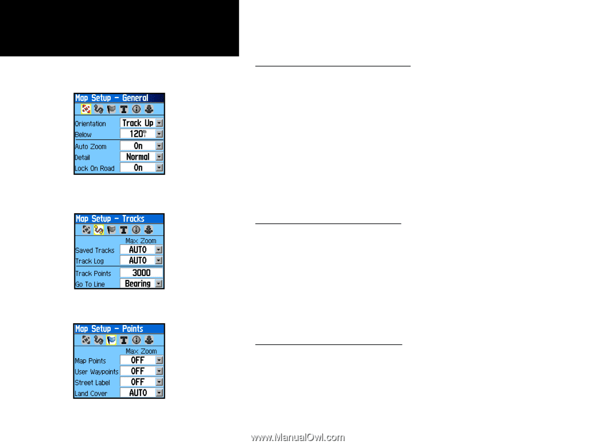
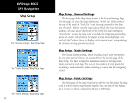
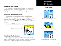
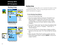
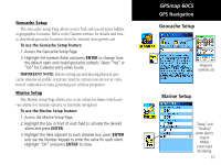
GPSmap 60CS GPS Navigation Map Setup The "General Settings" Map Setup Page The "Tracks Settings" Map Setup Page The "Points Settings" Map Setup Page 60 Map Setup - General Settings The first page of the Map Setup feature is the General Settings Page. Use this page: to select the map orientation, "North Up" (with north at the top of the map) or "Track Up" (with the map oriented in the direction of travel). "Below" sets the map scale at which the Track Up feature displays, all scales above that revert to the North Up map orientation. "Auto Zoom", zooms the map scale to include the beginning and ending points of a route. Detail selects the degree of map detail displayed. You can lock the Position Arrow to display on the nearest road, compensating for variances in map position accuracy. Map Setup - Tracks Settings The Tracks feature settings, which records a log of your movements for any given period of time, are accessed from the second page of the Map Setup. You have settings for maximum zoom for viewing saved tracks and active track logs. You can set the number of track points for recording a track and select either a bearing or course line for navigating a track. Map Setup - Points Settings The third page of the map setup feature allows you determine the map scale at which various map features display. You can turn off the display, set it to Auto or select a value from 20 feet to 500 miles.
-
 1
1 -
2
-
3
-
4
-
5
-
6
-
7
-
8
-
9
-
10
-
11
-
12
-
13
-
14
-
15
-
16
-
17
-
18
-
19
-
20
-
21
-
22
-
23
-
24
-
25
-
26
-
27
-
28
-
29
-
30
-
31
-
32
-
33
-
34
-
35
-
36
-
37
-
38
-
39
-
40
-
41
-
42
-
43
-
44
-
45
-
46
-
47
-
48
-
49
-
50
-
51
-
52
-
53
-
54
-
55
-
56
-
57
-
58
-
59
-
60
-
61
-
62
-
63
-
64
-
 65
65 -
 66
66 -
 67
67 -
 68
68 -
 69
69 -
 70
70 -
 71
71 -
 72
72 -
 73
73 -
 74
74 -
 75
75 -
76
-
77
-
78
-
79
-
80
-
81
-
82
-
83
-
84
-
85
-
86
-
87
-
88
-
89
-
90
-
91
-
92
-
93
-
94
-
95
-
96
-
97
-
98
-
99
-
100
-
101
-
102
-
103
-
104
-
105
-
106
-
107
-
108
 |
 |