Garmin GPSMap 498 Owner's Manual - Page 33
AIS, AIS Vessels, Heading Line
 |
UPC - 753759052171
View all Garmin GPSMap 498 manuals
Add to My Manuals
Save this manual to your list of manuals |
Page 33 highlights
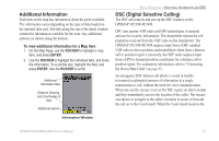
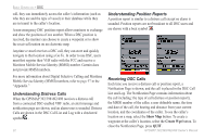
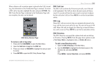
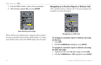
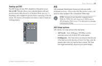
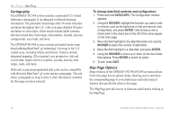
Setting up DSC The DSC Setup tab turns DSC chartplotter information screen On and Off. This also allows you to simulate distress calls and position reports while the unit is in Simulator Mode (see page 3). Simulating calls is helpful for practice before connecting to the real system. The distress call simulator also helps to check if alarms are working properly. BASIC OPERATION > AIS AIS AIS (Automatic Identification System) provides area traffic situational awareness. AIS provides ship IDs, position, course, and speed for ships equipped with a transponder within range. NOTE: You must set your charplotter communitcation to NMEA In / NMEA Out with a baud rate of 38400 to receive AIS information. Refer to page 69 for information on changing communication settings. DSC Setup AIS Setup options AIS contains two setup options in the main menu. • AIS Vessels-Auto, All Ranges, 30ft-800mi: sets the maximum zoom scale at which AIS vessels appear. • Heading Line-Off, Time: draws an extension from the end of the boat icon in the direction of travel. For Time, enter the numeric time value you want the line to extend. The Time line length automatically adjusts as your speed changes. GPSMAP 392/398/492/498 Owner's Manual 25
-
 1
1 -
2
-
3
-
4
-
5
-
6
-
7
-
8
-
9
-
10
-
11
-
12
-
13
-
14
-
15
-
16
-
17
-
18
-
19
-
20
-
21
-
22
-
23
-
24
-
25
-
26
-
27
-
 28
28 -
 29
29 -
 30
30 -
 31
31 -
 32
32 -
 33
33 -
 34
34 -
 35
35 -
 36
36 -
 37
37 -
 38
38 -
39
-
40
-
41
-
42
-
43
-
44
-
45
-
46
-
47
-
48
-
49
-
50
-
51
-
52
-
53
-
54
-
55
-
56
-
57
-
58
-
59
-
60
-
61
-
62
-
63
-
64
-
65
-
66
-
67
-
68
-
69
-
70
-
71
-
72
-
73
-
74
-
75
-
76
-
77
-
78
-
79
-
80
-
81
-
82
-
83
-
84
-
85
-
86
-
87
-
88
-
89
-
90
-
91
-
92
-
93
-
94
-
95
-
96
-
97
-
98
-
99
-
100
-
101
-
102
-
103
-
104
-
105
-
106
-
107
-
108
-
109
-
110
-
111
-
112
-
113
-
114
-
115
-
116
-
117
-
118
-
119
-
120
-
121
-
122
 |
 |