Garmin GPSMap 498 Owner's Manual - Page 88
Automatic Scroll Speed Limit, Auto Color Gain - 76s
 |
UPC - 753759052171
View all Garmin GPSMap 498 manuals
Add to My Manuals
Save this manual to your list of manuals |
Page 88 highlights
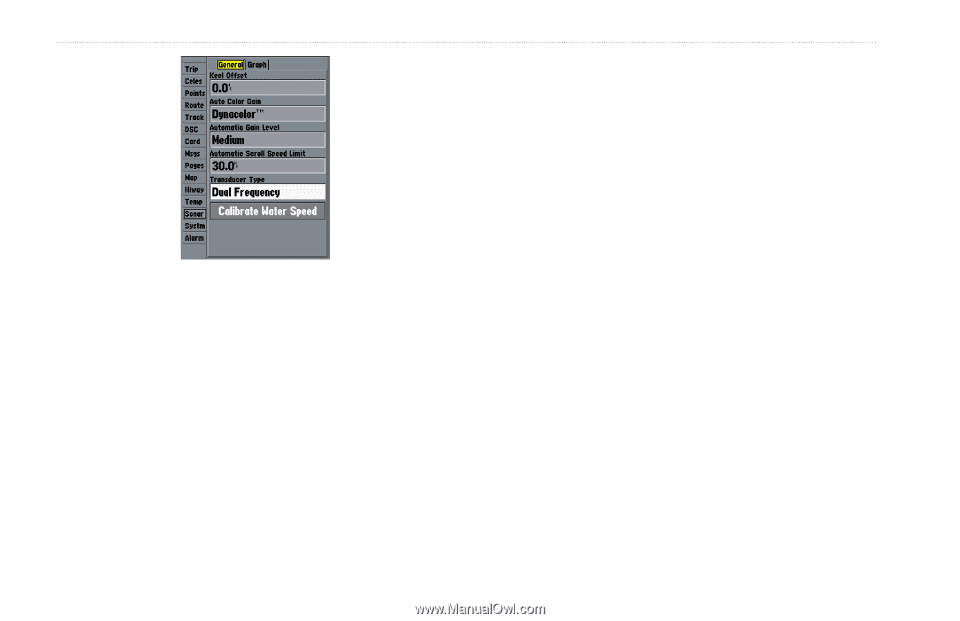
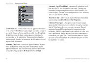
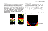
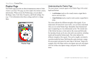
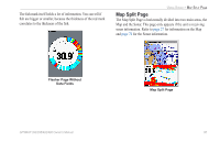
USING SONAR > UNDERSTANDING SONAR Auto Color Gain-controls what colors are applied to the objects on the screen. Color DCG is based on depth and makes it easier to spot subtle changes in bottom conditions or fish sizes. DynaColor (default) represents the latest in sonar data presentation and is recommended for all applications. The presentation is based on bottom strength. It makes the bottom and the fish easier to see and requires fewer adjustments. Automatic Gain Level-controls the aggressiveness of the Auto Gain. The higher the setting, the greater the number of targets appear on the screen. The lower the setting, the less clutter on the screen. The settings are Low, Medium (default), and High. Automatic Scroll Speed Limit-automatically adjusts the Scroll rate (see page 76) with the speed of your vessel. Entering your maximum cruising speed produces a 100% scroll rate when you reach that speed. One half of that speed produces a 50% scroll rate, and so on. The default is 30.0 kt. Transducer Type-allows you to specify what type of transducer you are using, either Dual Beam or Dual Frequency.. Calibrate Water Speed-this appears only if you are using a speed-capable transducer/sensor. Calibration is required to ensure that the Water Speed shown on your unit is accurate. The unit automatically uses GPS ground speed for comparison on the calibration. If a GPS ground speed is not available, use either your boat's speedometer reading (not always accurate) or a stopwatch to determine your speed over a certain distance (distance / time = speed). It is recommended that the calibration take place in water having little or no current. 80 GPSMAP 392/398/492/498 Owner's Manual
-
 1
1 -
2
-
3
-
4
-
5
-
6
-
7
-
8
-
9
-
10
-
11
-
12
-
13
-
14
-
15
-
16
-
17
-
18
-
19
-
20
-
21
-
22
-
23
-
24
-
25
-
26
-
27
-
28
-
29
-
30
-
31
-
32
-
33
-
34
-
35
-
36
-
37
-
38
-
39
-
40
-
41
-
42
-
43
-
44
-
45
-
46
-
47
-
48
-
49
-
50
-
51
-
52
-
53
-
54
-
55
-
56
-
57
-
58
-
59
-
60
-
61
-
62
-
63
-
64
-
65
-
66
-
67
-
68
-
69
-
70
-
71
-
72
-
73
-
74
-
75
-
76
-
77
-
78
-
79
-
80
-
81
-
82
-
 83
83 -
 84
84 -
 85
85 -
 86
86 -
 87
87 -
 88
88 -
 89
89 -
 90
90 -
 91
91 -
 92
92 -
 93
93 -
94
-
95
-
96
-
97
-
98
-
99
-
100
-
101
-
102
-
103
-
104
-
105
-
106
-
107
-
108
-
109
-
110
-
111
-
112
-
113
-
114
-
115
-
116
-
117
-
118
-
119
-
120
-
121
-
122
 |
 |