Garmin GPSMap 498 Owner's Manual - Page 39
Measure Distance, Show/Hide Detail, Setup, Hide/Show Detail, To show and select the Map options
 |
UPC - 753759052171
View all Garmin GPSMap 498 manuals
Add to My Manuals
Save this manual to your list of manuals |
Page 39 highlights
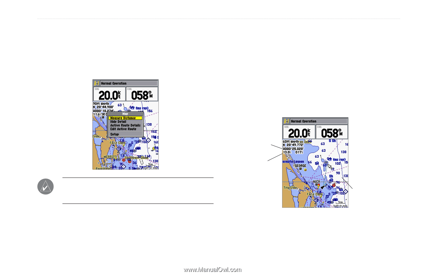
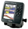
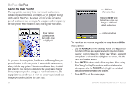
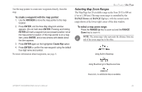
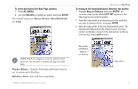
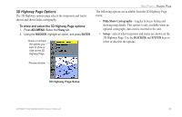
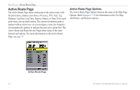
To show and select the Map Page options: 1. Press ADJ/MENU. 2. Use the ROCKER to highlight an option, and press ENTER. The available options are Measure Distance, Show/Hide Detail, and Setup. MAIN PAGES > MAP PAGE To measure the bearing/distance between two points: 1. Highlight Measure Distance, and press ENTER. An on-screen map pointer labeled ENT REF appears on the Map Page at your present location. 2. Move the map pointer to a reference point (the point that you want to measure from), and press ENTER. 3. Move the map pointer to the end measurement point. The bearing and distance from the reference point and map pointer coordinates is shown in the data window at the top of the screen. Press QUIT to finish. NOTE: Map Pointer, Highway, Location, and Sonar field options are only available on medium and large sized data fields. Measure Distance-measures the bearing and distance between any two points on the Map Page. Hide/Show Detail-hides and shows map details. GPSMAP 392/398/492/498 Owner's Manual Map pointer coordinates Distance and bearing Map pointer 31
-
 1
1 -
2
-
3
-
4
-
5
-
6
-
7
-
8
-
9
-
10
-
11
-
12
-
13
-
14
-
15
-
16
-
17
-
18
-
19
-
20
-
21
-
22
-
23
-
24
-
25
-
26
-
27
-
28
-
29
-
30
-
31
-
32
-
33
-
 34
34 -
 35
35 -
 36
36 -
 37
37 -
 38
38 -
 39
39 -
 40
40 -
 41
41 -
 42
42 -
 43
43 -
 44
44 -
45
-
46
-
47
-
48
-
49
-
50
-
51
-
52
-
53
-
54
-
55
-
56
-
57
-
58
-
59
-
60
-
61
-
62
-
63
-
64
-
65
-
66
-
67
-
68
-
69
-
70
-
71
-
72
-
73
-
74
-
75
-
76
-
77
-
78
-
79
-
80
-
81
-
82
-
83
-
84
-
85
-
86
-
87
-
88
-
89
-
90
-
91
-
92
-
93
-
94
-
95
-
96
-
97
-
98
-
99
-
100
-
101
-
102
-
103
-
104
-
105
-
106
-
107
-
108
-
109
-
110
-
111
-
112
-
113
-
114
-
115
-
116
-
117
-
118
-
119
-
120
-
121
-
122
 |
 |