2007 BMW 6 Series Owner's Manual - Page 148
2007 BMW 6 Series Manual
Page 148 highlights
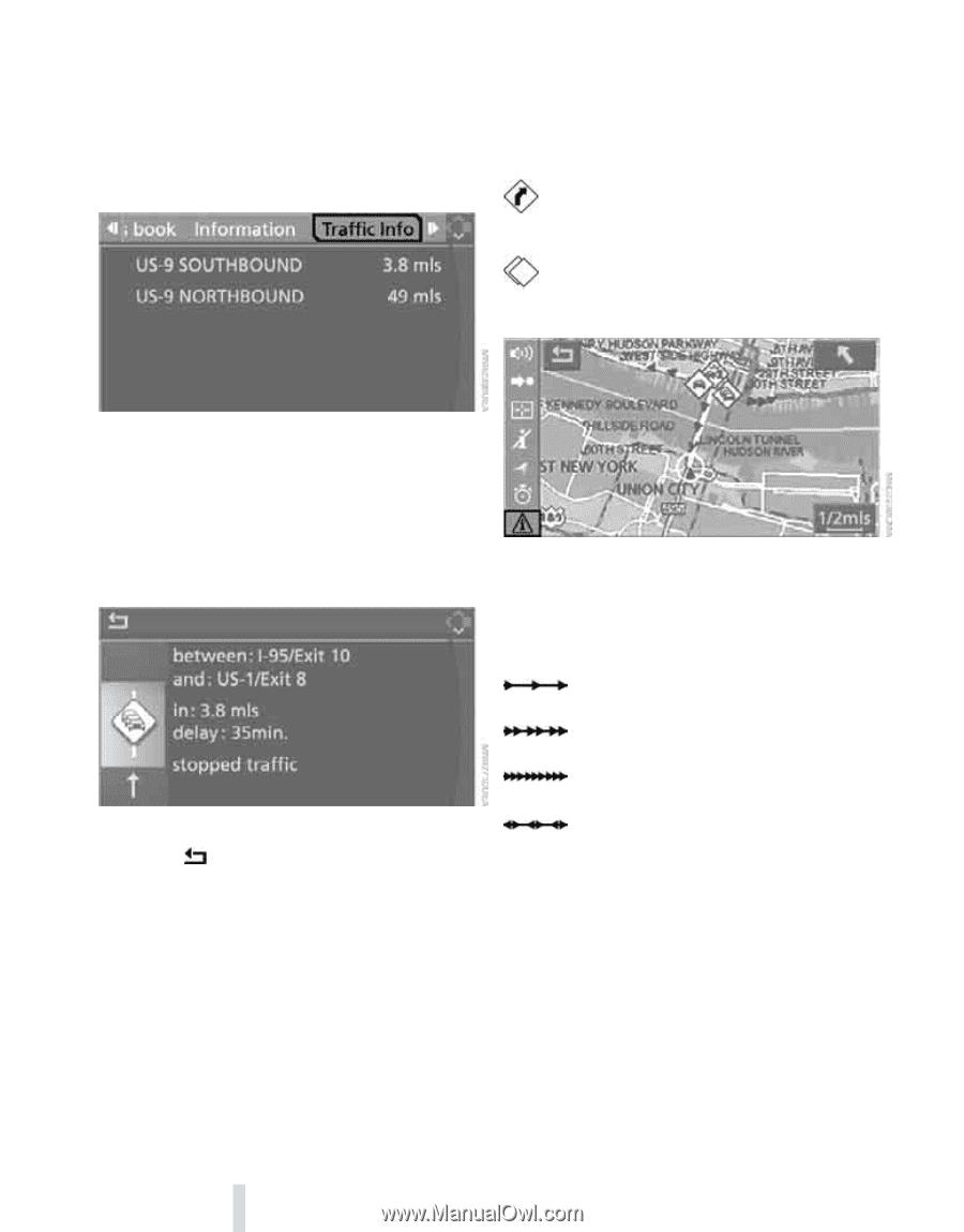
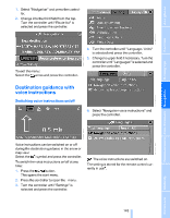
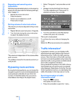
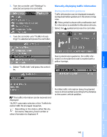
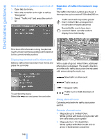
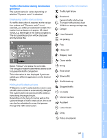
Destination guidance With destination guidance switched off 1. Open the start menu. 2. Move the controller to the right to call up "Navigation". 3. Select "Traffic Info" and press the controller. Depiction of traffic information in map view The traffic information symbols are shown in the map view up to a scale of 100 miles/200 km. Traffic event with map scales greater than 5 miles/10 km, arrow points in the direction of travel concerned Several traffic events have been received. Select a smaller scale to display these individually. First the traffic information along the planned route is shown sorted according to the distance to the current vehicle position. Displaying detailed traffic information Select a traffic information item from the list and press the controller. With a scale of up to 5 miles/10 km, additional information is displayed. The length, direction and effect of a traffic obstruction are indicated with arrows along the route, e.g. Slow traffic or other event Traffic back up Stopped traffic To exit from the menu: Select the arrow and press the controller. Traffic event in both directions of travel Along planned route Colored symbol with the traffic obstruction symbol. Outside planned route > Map scale up to 5 miles/10 km: White symbol with black or gray border with the traffic obstruction symbol > Map scale from 10 miles/20 km: White symbol with black border and an arrow in the direction concerned 146 Online Edition for Part no. 01 41 0 013 312 - © 02/07 BMW AG
-
 1
1 -
2
-
3
-
4
-
5
-
6
-
7
-
8
-
9
-
10
-
11
-
12
-
13
-
14
-
15
-
16
-
17
-
18
-
19
-
20
-
21
-
22
-
23
-
24
-
25
-
26
-
27
-
28
-
29
-
30
-
31
-
32
-
33
-
34
-
35
-
36
-
37
-
38
-
39
-
40
-
41
-
42
-
43
-
44
-
45
-
46
-
47
-
48
-
49
-
50
-
51
-
52
-
53
-
54
-
55
-
56
-
57
-
58
-
59
-
60
-
61
-
62
-
63
-
64
-
65
-
66
-
67
-
68
-
69
-
70
-
71
-
72
-
73
-
74
-
75
-
76
-
77
-
78
-
79
-
80
-
81
-
82
-
83
-
84
-
85
-
86
-
87
-
88
-
89
-
90
-
91
-
92
-
93
-
94
-
95
-
96
-
97
-
98
-
99
-
100
-
101
-
102
-
103
-
104
-
105
-
106
-
107
-
108
-
109
-
110
-
111
-
112
-
113
-
114
-
115
-
116
-
117
-
118
-
119
-
120
-
121
-
122
-
123
-
124
-
125
-
126
-
127
-
128
-
129
-
130
-
131
-
132
-
133
-
134
-
135
-
136
-
137
-
138
-
139
-
140
-
141
-
142
-
 143
143 -
 144
144 -
 145
145 -
 146
146 -
 147
147 -
 148
148 -
 149
149 -
 150
150 -
 151
151 -
 152
152 -
 153
153 -
154
-
155
-
156
-
157
-
158
-
159
-
160
-
161
-
162
-
163
-
164
-
165
-
166
-
167
-
168
-
169
-
170
-
171
-
172
-
173
-
174
-
175
-
176
-
177
-
178
-
179
-
180
-
181
-
182
-
183
-
184
-
185
-
186
-
187
-
188
-
189
-
190
-
191
-
192
-
193
-
194
-
195
-
196
-
197
-
198
-
199
-
200
-
201
-
202
-
203
-
204
-
205
-
206
-
207
-
208
-
209
-
210
-
211
-
212
-
213
-
214
-
215
-
216
-
217
-
218
-
219
-
220
-
221
-
222
-
223
-
224
-
225
-
226
-
227
-
228
-
229
-
230
-
231
-
232
-
233
-
234
-
235
-
236
-
237
-
238
-
239
-
240
-
241
-
242
-
243
-
244
-
245
-
246
-
247
-
248
-
249
-
250
-
251
-
252
-
253
-
254
 |
 |