Alpine INE-Z928HD Navigation User's Manual (english) - Page 18
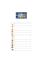
Symbol, Description
 |
View all Alpine INE-Z928HD manuals
Add to My Manuals
Save this manual to your list of manuals |
Page 18 highlights
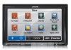
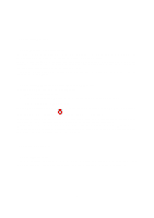
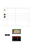
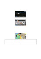
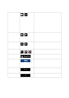
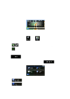
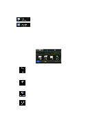
2.2.3.7 Elements of the active route Your software shows the route in the following way: Symbol Name Description Current GPS position and Start point Your current position displayed on the map. If roads are near, it is aligned to the nearest road. Normally if GPS position is available, the route starts from the current position. If there is no valid GPS position, your software uses the last known position as the start point. Waypoint (intermediate destination) An intermediate destination of the route before reaching the final destination. Destination (end point) The final destination of the route. Route color Streets and roads that are excluded from the navigation Streets and roads that are affected by traffic events The route always stands out with its color on the map, both in daytime and in night color mode. You can choose whether you want to use or avoid certain road types (page 74). However, when your software cannot avoid such roads, the route will include them and it will show them in a color that is different from the route color. Road segments may be affected by traffic events received. These streets and roads are displayed in an alternate color, and small symbols displayed along the route show the type of the traffic event. 2.2.3.8 Traffic events Road segments affected by traffic events are displayed with an alternate color on the map, and small symbols above the road show the nature of the event: Tap to open the list of traffic event categories: 18
-
 1
1 -
2
-
3
-
4
-
5
-
6
-
7
-
8
-
9
-
10
-
11
-
12
-
 13
13 -
 14
14 -
 15
15 -
 16
16 -
 17
17 -
 18
18 -
 19
19 -
 20
20 -
 21
21 -
 22
22 -
 23
23 -
24
-
25
-
26
-
27
-
28
-
29
-
30
-
31
-
32
-
33
-
34
-
35
-
36
-
37
-
38
-
39
-
40
-
41
-
42
-
43
-
44
-
45
-
46
-
47
-
48
-
49
-
50
-
51
-
52
-
53
-
54
-
55
-
56
-
57
-
58
-
59
-
60
-
61
-
62
-
63
-
64
-
65
-
66
-
67
-
68
-
69
-
70
-
71
-
72
-
73
-
74
-
75
-
76
-
77
-
78
-
79
-
80
-
81
-
82
-
83
-
84
-
85
 |
 |