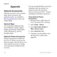
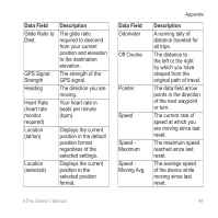
Garmin eTrex 10 Owner's Manual - Page 48
Data Field, Description, ETA at Next - altitude
 |
View all Garmin eTrex 10 manuals
Add to My Manuals
Save this manual to your list of manuals |
Page 48 highlights
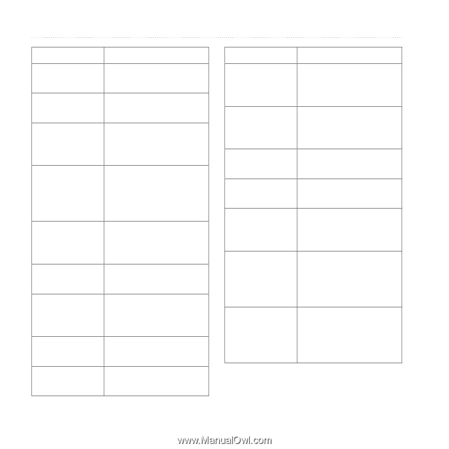
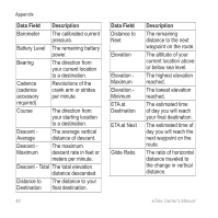
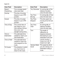
Appendix Data Field Description Barometer The calibrated current pressure. Battery Level The remaining battery power. Bearing The direction from your current location to a destination. Cadence (cadence accessory required) Revolutions of the crank arm or strides per minute. Course The direction from your starting location to a destination. Descent Average The average vertical distance of descent. Descent Maximum The maximum descent rate in feet or meters per minute. Descent - Total The total elevation distance descended. Distance to The distance to your Destination final destination. 48 Data Field Distance to Next Elevation Elevation Maximum Elevation Minimum ETA at Destination ETA at Next Glide Ratio Description The remaining distance to the next waypoint on the route. The altitude of your current location above or below sea level. The highest elevation reached. The lowest elevation reached. The estimated time of day you will reach your final destination. The estimated time of day you will reach the next waypoint on the route. The ratio of horizontal distance traveled to the change in vertical distance. eTrex Owner's Manual
-
 1
1 -
2
-
3
-
4
-
5
-
6
-
7
-
8
-
9
-
10
-
11
-
12
-
13
-
14
-
15
-
16
-
17
-
18
-
19
-
20
-
21
-
22
-
23
-
24
-
25
-
26
-
27
-
28
-
29
-
30
-
31
-
32
-
33
-
34
-
35
-
36
-
37
-
38
-
39
-
40
-
41
-
42
-
 43
43 -
 44
44 -
 45
45 -
 46
46 -
 47
47 -
 48
48 -
 49
49 -
 50
50 -
 51
51 -
 52
52 -
 53
53 -
54
-
55
-
56
-
57
-
58
-
59
-
60
 |
 |