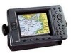
Garmin GPSMAP 2206 GPSMAP 2206/2210 Owner's Manual - Page 104
GPSMAP 2206/2210 Owner's Manual, Maritime Mobile Service Identity.
 |
UPC - 753759053024
View all Garmin GPSMAP 2206 manuals
Add to My Manuals
Save this manual to your list of manuals |
Page 104 highlights
INDEX H hardness of the bottom 73 hard structure 73 heading 60 highlight 8 Highway Page 41 options 41 I installation i invert route 25 L labels 67 language 59 leg distance 29 leg time 29 limited warranty 93 log, temperature 81 log and graph scale 81 log duration 70 LORAN TD 86-87 setting up 87 using 86 M magnetic north 60 Main Menu 43-71 Card tab 54 Celestial tab 47 GPS tab 43 Highway tab 71 Messages tab 55 Network tab 64 overview 43 Pages tab 64 Points tab 49 96 Routes tab 50 Sonar tab 71 System tab 58 Temp tab 70 Tide tab 44 Tracks tab 50 Trip tab 48 main pages Compass Page 40 configuring 31 Highway Page 41 Map Page 34-37 Map Split Page 39 manage user card 55 manual conventions i MapSource 54, 83 map data 10 map datums 60 map outlines 66 Map Page 34-37 distance and bearing 37 options 37 ranges 35 map pointer 10 moving 10 map ranges 35 Map Split Page 39 Map tab 65-69 AIS sub tab 68 detail sub tab 67 nav sub tab 68 prefs sub tab 66 source sub tab 69 Maritime Mobile Service Identity. See MMSI merge from card 55 messages 90 Messages tab 55 MMSI number 85 MOB 23 moon phase 47 moon rise/set 47 N narrow beam 72 NAV/MOB Key 2, 19, 22, 54 navigating a saved route 24 navigation terms 90 Nav alarms 57 Network tab 64 NMEA 62 NMEA interface 62 NMEA output setup 62 north reference 60 O off course alarm 57 on-screen buttons 9 options selecting 9 orientation 66 P Pages tab 64 PAGE key 2 pointer mode 35 position format 60 position mode 35 position report 52, 85 POWER key 2 pressure 60 product registration v, 93 proximity alarms 19 proximity waypoints 19 clearing 19 proximity waypoint list 18 Q QUICK NAV route 25 QUIT key 2 R re-evaluate route 25 receiver status 6 replace from card 55 review waypoint page 15 ROCKER key 2 routes 23-29 copying 25 creating 23 deleting 26 editing 26 navigating 24 planning 29 quick nav 25 Routes tab 50 S saved tracks 51 scale, log and graph 81 scroll bar 8 serial number electronic 59 Setup tab 58 set position 6 shallow water alarm 58 GPSMAP 2206/2210 Owner's Manual
-
 1
1 -
2
-
3
-
4
-
5
-
6
-
7
-
8
-
9
-
10
-
11
-
12
-
13
-
14
-
15
-
16
-
17
-
18
-
19
-
20
-
21
-
22
-
23
-
24
-
25
-
26
-
27
-
28
-
29
-
30
-
31
-
32
-
33
-
34
-
35
-
36
-
37
-
38
-
39
-
40
-
41
-
42
-
43
-
44
-
45
-
46
-
47
-
48
-
49
-
50
-
51
-
52
-
53
-
54
-
55
-
56
-
57
-
58
-
59
-
60
-
61
-
62
-
63
-
64
-
65
-
66
-
67
-
68
-
69
-
70
-
71
-
72
-
73
-
74
-
75
-
76
-
77
-
78
-
79
-
80
-
81
-
82
-
83
-
84
-
85
-
86
-
87
-
88
-
89
-
90
-
91
-
92
-
93
-
94
-
95
-
96
-
97
-
98
-
 99
99 -
 100
100 -
 101
101 -
 102
102 -
 103
103 -
 104
104 -
 105
105 -
 106
106
 |
 |