Garmin GPSMAP 67 Owners Manual - Page 54
Appendix, Data Fields, hr. Min. Temperature
 |
View all Garmin GPSMAP 67 manuals
Add to My Manuals
Save this manual to your list of manuals |
Page 54 highlights
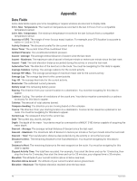
Appendix Data Fields Some data fields require you to be navigating or require wireless accessories to display data. 24 hr. Max. Temperature: The maximum temperature recorded in the last 24 hours from a compatible temperature sensor. 24 hr. Min. Temperature: The minimum temperature recorded in the last 24 hours from a compatible temperature sensor. Accuracy of GPS: The margin of error for your exact location. For example, your GPS location is accurate to within +/- 3.65 m (12 ft.). Activity Distance: The distance traveled for the current track or activity. Alarm Timer: The current time of the countdown timer. Ambient Pressure: The uncalibrated ambient pressure. Ascent - Average: The average vertical distance of ascent since the last reset. Ascent - Maximum: The maximum rate of ascent in feet per minute or meters per minute since the last reset. Ascent - Total: The total elevation distance ascended during the activity or since the last reset. Automotive Turn: The direction of the next turn in the route. You must be navigating for this data to appear. Average Cadence: Cycling. The average cadence for the current activity. Average HR %Max.: The average percentage of maximum heart rate for the current activity. Average Lap: The average lap time for the current activity. Avg. HR: The average heart rate for the current activity. Barometer: The calibrated current pressure. Battery Level: The remaining battery power. Bearing: The direction from your current location to a destination. You must be navigating for this data to appear. Cadence: Cycling. The number of revolutions of the crank arm. Your device must be connected to a cadence accessory for this data to appear. Calories: The amount of total calories burned. Compass Heading: The direction you are moving based on the compass. Course: The direction from your starting location to a destination. Course can be viewed as a planned or set route. You must be navigating for this data to appear. Current Lap: The stopwatch time for the current lap. Date: The current day, month, and year. Depth: The depth of the water. Your device must be connected to a NMEA® 0183 device capable of acquiring the water depth. Descent - Average: The average vertical distance of descent since the last reset. Descent - Maximum: The maximum rate of descent in meters per minute or feet per minute since the last reset. Descent - Total: The total elevation distance descended during the activity or since the last reset. Distance to Dest.: The remaining distance to the final destination. You must be navigating for this data to appear. Distance to Next: The remaining distance to the next waypoint on the route. You must be navigating for this data to appear. Elapsed Activity Time: The total time recorded. For example, if you start the timer and run for 10 minutes, then stop the timer for 5 minutes, then start the timer and run for 20 minutes, your elapsed time is 35 minutes. Elevation: The altitude of your current location above or below sea level. Elevation Above Ground: The altitude of your current location above ground level. Elevation - Maximum: The highest elevation reached since the last reset. 48 Appendix
-
 1
1 -
2
-
3
-
4
-
5
-
6
-
7
-
8
-
9
-
10
-
11
-
12
-
13
-
14
-
15
-
16
-
17
-
18
-
19
-
20
-
21
-
22
-
23
-
24
-
25
-
26
-
27
-
28
-
29
-
30
-
31
-
32
-
33
-
34
-
35
-
36
-
37
-
38
-
39
-
40
-
41
-
42
-
43
-
44
-
45
-
46
-
47
-
48
-
 49
49 -
 50
50 -
 51
51 -
 52
52 -
 53
53 -
 54
54 -
 55
55 -
 56
56 -
 57
57 -
 58
58 -
 59
59 -
60
 |
 |
