Nextar Q4-04 User Guide - Page 21
Zooming In and Out - gps navigation
 |
UPC - 714129880886
View all Nextar Q4-04 manuals
Add to My Manuals
Save this manual to your list of manuals |
Page 21 highlights
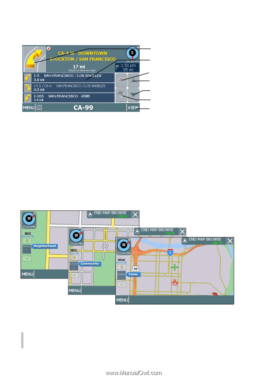
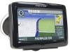
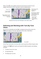
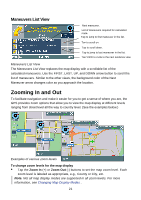
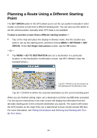
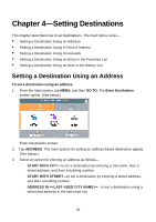
Maneuvers List View Next maneuver. List of maneuvers required for calculated route. Tap to jump to first maneuver in the list. Tap to scroll up. Tap to scroll down. Tap to jump to last maneuver in the list. Tap VIEW to cycle to the next guidance view. Maneuvers List View The Maneuvers List View replaces the map display with a scrollable list of the calculated maneuvers. Use the FIRST, LAST, UP, and DOWN arrow button to scroll the list of maneuvers. Similar to the other views, the background color of the Next Maneuver arrow changes color as you approach the location. Zooming In and Out To facilitate navigation and make it easier for you to get a sense of where you are, the GPS provides zoom options that allow you to view the map display at different levels ranging from street level all the way to country level. (See the examples below.) Examples of various zoom levels To change zoom levels for the map display • Tap the Zoom In (+) or Zoom Out (-) buttons to set the map zoom level. Each zoom level is labeled as appropriate, e.g., County or City, etc. Note. Not all map display modes are supported in all zoom levels. For more information, see Changing Map Display Modes . 21
-
 1
1 -
2
-
3
-
4
-
5
-
6
-
7
-
8
-
9
-
10
-
11
-
12
-
13
-
14
-
15
-
 16
16 -
 17
17 -
 18
18 -
 19
19 -
 20
20 -
 21
21 -
 22
22 -
 23
23 -
 24
24 -
 25
25 -
 26
26 -
27
-
28
-
29
-
30
-
31
-
32
-
33
-
34
-
35
-
36
-
37
-
38
-
39
-
40
-
41
-
42
-
43
-
44
-
45
-
46
-
47
-
48
-
49
-
50
-
51
-
52
-
53
-
54
 |
 |