Garmin GPSMAP 172C Owner's Manual - Page 30
Map Cursor, and Zooming - cover
 |
UPC - 753759043537
View all Garmin GPSMAP 172C manuals
Add to My Manuals
Save this manual to your list of manuals |
Page 30 highlights
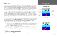
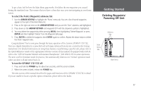
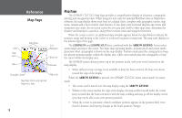
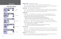
Reference Map Page: Cursor and Zooming Creating New Map Waypoint Using Built-In Basemap Using BlueChart/MapSource Data Overzoom, no additional data 20 To eliminate the cursor and re-center your position on-screen: 1. Press the QUIT key. The cursor may also be used to create new waypoints directly from the map. To create a waypoint with the cursor: 1. Use the ARROW KEYPAD to move the cursor to the desired map position. 2. Press the ENTER/MARK key and the 'New Map Waypoint' window appears. If the cursor is on a map item, you get a new window with details about the item when ENTER/MARK is pressed. Press ENTER again on the highlighted 'Create Wpt' option. 3. Press ENTER to confirm the new waypoint using the default three-digit name and symbol. Selecting Map Scales The map display has 28 available range scales from 20 ft. to 800 mi. (5 m to 1200 km). The map scale is controlled by the IN and OUT keys, with the current scale displayed at the bottom right of the data window. To select a map scale: 1. Press the OUT key to zoom out and the IN key to zoom in. F The scale value represents the distance from one end of the scale bar to the other. The GPSMAP 172/172C's system has a built-in worldwide database to 20 mi, with more detailed coverage available through the use of the optional BlueChart or MapSource data. The GPSMAP 172/172C displays cartography as long as there is chart information available for the range you've selected. Map coverage conforms to the following conditions: • When the selected zoom range is covered by either the internal database, BlueChart, or MapSource data, cartography is displayed. • When the selected zoom range is covered by both the internal database and BlueChart/ MapSource data, cartography is displayed using the data with the best resolution. • When the selected zoom range exceeds the resolution of the data in use, overzoom cartography is displayed and an 'overzoom' warning appears below the scale field.
-
 1
1 -
2
-
3
-
4
-
5
-
6
-
7
-
8
-
9
-
10
-
11
-
12
-
13
-
14
-
15
-
16
-
17
-
18
-
19
-
20
-
21
-
22
-
23
-
24
-
 25
25 -
 26
26 -
 27
27 -
 28
28 -
 29
29 -
 30
30 -
 31
31 -
 32
32 -
 33
33 -
 34
34 -
 35
35 -
36
-
37
-
38
-
39
-
40
-
41
-
42
-
43
-
44
-
45
-
46
-
47
-
48
-
49
-
50
-
51
-
52
-
53
-
54
-
55
-
56
-
57
-
58
-
59
-
60
-
61
-
62
-
63
-
64
-
65
-
66
-
67
-
68
-
69
-
70
-
71
-
72
-
73
-
74
-
75
-
76
-
77
-
78
-
79
-
80
-
81
-
82
-
83
-
84
-
85
-
86
-
87
-
88
-
89
-
90
-
91
-
92
-
93
-
94
-
95
-
96
-
97
-
98
-
99
-
100
-
101
-
102
-
103
-
104
-
105
-
106
-
107
-
108
-
109
-
110
 |
 |
