Garmin GPSMAP 4210 Owner's Manual - Page 20
Using Mariner’s Eye 3D, Style, Classic, Charts, Photos - radar
 |
View all Garmin GPSMAP 4210 manuals
Add to My Manuals
Save this manual to your list of manuals |
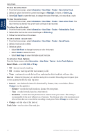
Page 20 highlights
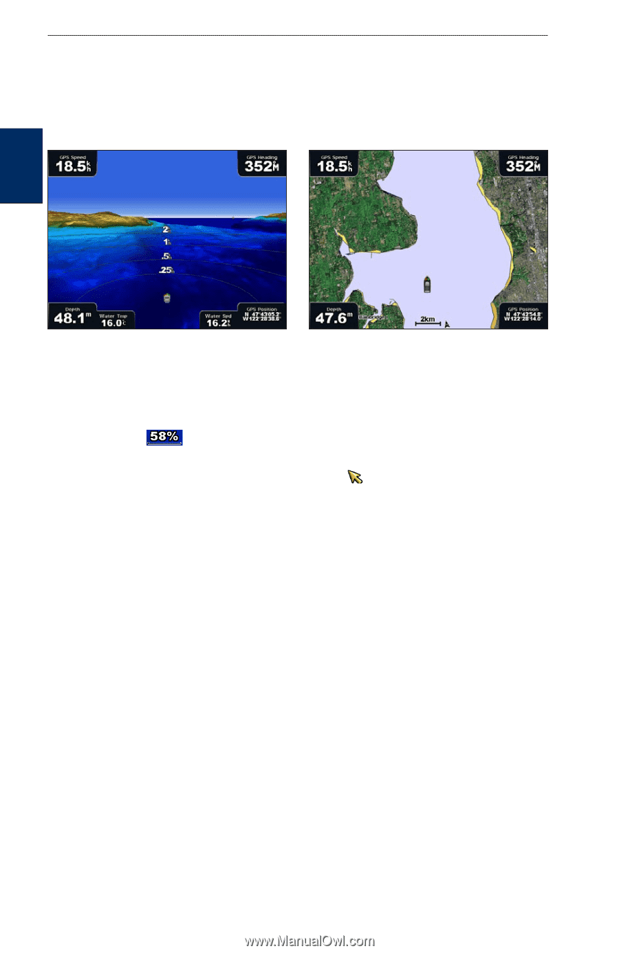
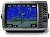
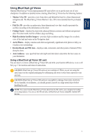
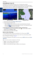
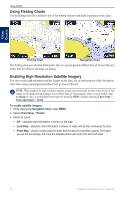
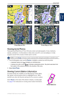
Using Charts Using Mariner's Eye 3D A BlueChart g2 Vision SD card offers Mariner's Eye 3D, which provides a detailed, three‑dimensional view from above and behind the boat (according to your course) and provides a visual navigation aid. This view is helpful when navigating tricky shoals, reefs, bridges, or channels, and when trying to identify entry and exit routes in unfamiliar harbors or anchorages. Using Charts Mariner's Eye 3D Navigation Chart 1. From the Home screen, touch Charts > Mariner's Eye 3D. 2. Use the range keys to adjust the view: • Select the Range (+) key to move the view closer to your boat and lower to the water. • Select the Range (-) key to move the view away from the boat. This is temporarily indicated by the scale ( ) at the bottom of the screen. To view details about navaids such as beacons, lights, and obstructions: 1. Use the Rocker to point to the navaid. When the cursor ( ) is over the navaid, an option is displayed, such as as Beacon or Light. 2. Select the option for the navaid to view details. Mariner's Eye 3D Settings To access additional settings or options from the Mariner's Eye 3D screen, press MENU. For settings and options related to Waypoints & Tracks, Other Vessels, Surface Radar, and Data Bars, see "Perspective 3D Settings" on page 12. To customize the appearance of the Mariner's Eye 3D screen, press MENU and then select Chart Appearance. Style-Select how chart data is displayed over 3D terrain. • Classic-use color schemes to indicate 3D terrain. • Charts-provide chart information in a 3D view. • Photos-provide satellite photo imagery in addition to chart information. 16 GPSMAP 4000 Series Owner's Manual
-
 1
1 -
2
-
3
-
4
-
5
-
6
-
7
-
8
-
9
-
10
-
11
-
12
-
13
-
14
-
 15
15 -
 16
16 -
 17
17 -
 18
18 -
 19
19 -
 20
20 -
 21
21 -
 22
22 -
 23
23 -
 24
24 -
 25
25 -
26
-
27
-
28
-
29
-
30
-
31
-
32
-
33
-
34
-
35
-
36
-
37
-
38
-
39
-
40
-
41
-
42
-
43
-
44
-
45
-
46
-
47
-
48
-
49
-
50
-
51
-
52
-
53
-
54
-
55
-
56
-
57
-
58
-
59
-
60
-
61
-
62
-
63
-
64
-
65
-
66
-
67
-
68
-
69
-
70
-
71
-
72
-
73
-
74
-
75
-
76
-
77
-
78
-
79
-
80
-
81
-
82
-
83
-
84
 |
 |