Garmin GPSMAP 4210 Owner's Manual - Page 80
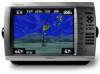
GPSMAP 4000 Series Owner's Manual, Perspective 3D
 |
View all Garmin GPSMAP 4210 manuals
Add to My Manuals
Save this manual to your list of manuals |
Page 80 highlights
Index P panning the navigation chart 8 Perspective 3D 12 photos 9, 19 POI data 20 position 36 position icon 8 Power key 1 precipitation information 58 preferred devices 37 pressure center 61 gradient 62 isobars 62 unit settings 36 product registration 73 R radar 5, 44 cross talk 48 fast time constant 48 overlay screen 47 surface 12 range 53 Range keys 1 range rings 13 rings 9, 49 roads 20 Rocker 1 roses 9 routes creating 27 deleting 28 deleting all 32 editing 28 route to 23 S safe depth 13, 36 safe height 36 satellite signals 3 save preset (XM) 41, 65 scroll speed 52 SD cards inserting and removing 3 sea conditions 61 search for a destination by name 24 service points 9 settings alarms 38 chart 9 combinations 22 communications 37 fish eye 3D 17 initializing 2 mariner's eye 3D 16 navigation chart 7 sonar 52 sonar (advanced) 52 76 system 35 XM audio 65 simulator mode 4 soft key i software license agreement 74 sonar 5, 50 A-scope 52 advanced settings 52 depth line 52 full screen 50 gain 53 range 52, 53 scroll speed 52 split frequency screen 51 split zoom screen 50 temp log 51 sonar cone 17 sonar data 17 specifications 66 split frequency screen 51 split zoom screen 50 spot depths 11 stop navigating 24 storm cell information 59 surface noise 52 Surface Radar 12 surface winds 62 symbols 11 system settings 4, 35 T targeting (radar) 46, 47 temperature 36 temp log 51 tides/currents 9 tide station 9, 29 time 37 time zone 37 tracks 13, 17 deleting all 32 transducer configuring 39 transfer data 31 transmit radar 44 tropical depression 59 tropical storm 59 true north 36 turn the unit off 2 U units of measure 36 user data 30 user mag var 36 V video 34 view system information 4 visibility 63 VRM/EBL adjusting 48 W water speed (calibrate) 39 temperature 63 wave height 62 waypoint 12, 25 create new 8, 25 delete 25, 26 edit existing 12, 26 man overboard 25 mark current location 25 move existing 26 waypoints & tracks 7 weather 5 fronts 61 where to? 5, 23 whiteline 52 wireless devices 37 X XM 58 audio 41, 65 weather 58 Z zoom 6, 53 GPSMAP 4000 Series Owner's Manual
-
 1
1 -
2
-
3
-
4
-
5
-
6
-
7
-
8
-
9
-
10
-
11
-
12
-
13
-
14
-
15
-
16
-
17
-
18
-
19
-
20
-
21
-
22
-
23
-
24
-
25
-
26
-
27
-
28
-
29
-
30
-
31
-
32
-
33
-
34
-
35
-
36
-
37
-
38
-
39
-
40
-
41
-
42
-
43
-
44
-
45
-
46
-
47
-
48
-
49
-
50
-
51
-
52
-
53
-
54
-
55
-
56
-
57
-
58
-
59
-
60
-
61
-
62
-
63
-
64
-
65
-
66
-
67
-
68
-
69
-
70
-
71
-
72
-
73
-
74
-
 75
75 -
 76
76 -
 77
77 -
 78
78 -
 79
79 -
 80
80 -
 81
81 -
 82
82 -
 83
83 -
 84
84
 |
 |