Garmin GPSMAP 4210 Owner's Manual - Page 23
Viewing Aerial Photos, Viewing Current Station Information, Review
 |
View all Garmin GPSMAP 4210 manuals
Add to My Manuals
Save this manual to your list of manuals |
Page 23 highlights
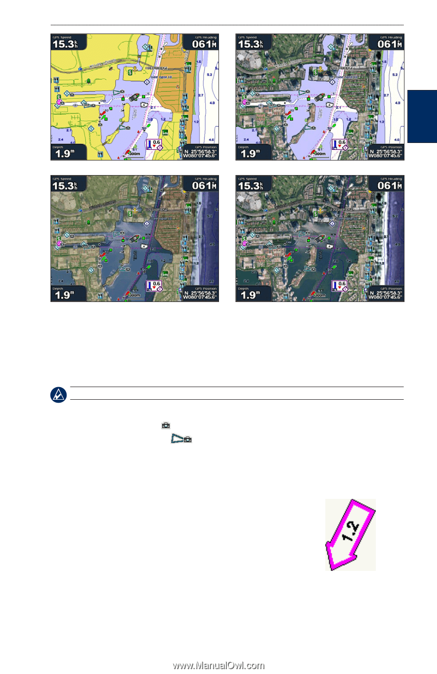
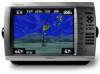
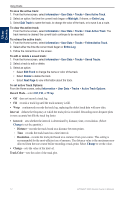
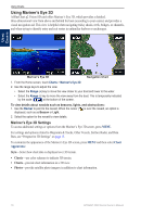
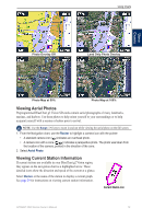
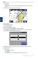
Using Charts Using Charts Photo Overlay Off Land Only Photo Overlay Photo Map at 50% Photo Map at 100% Viewing Aerial Photos Preprogrammed BlueChart g2 Vision SD cards contain aerial photographs of many landmarks, marinas, and harbors. Use these photos to help orient yourself to your surroundings or to help acquaint yourself with a marina or harbor prior to arrival. Note: Use the Range (-/+) keys to zoom in and out while viewing the aerial photo on the full screen. 1. From the Navigation chart, use the Rocker to highlight a camera icon with the pointer: • A standard camera icon ( ) indicates an overhead photo. • A camera icon with a cone ( ) indicates a perspective photo. The photo was taken from the location of the camera, pointed in the direction of the cone. 2. Select Aerial Photo. Viewing Current Station Information If current stations are available in your BlueChart g2 Vision region, they appear on the navigation chart as a highlighted arrow. These detailed icons show the direction and speed of the current at a glance. Select Review or the name of the station to display a current graph. See page 29 for instructions on viewing current station information. Current Station icon GPSMAP 4000 Series Owner's Manual 19
-
 1
1 -
2
-
3
-
4
-
5
-
6
-
7
-
8
-
9
-
10
-
11
-
12
-
13
-
14
-
15
-
16
-
17
-
 18
18 -
 19
19 -
 20
20 -
 21
21 -
 22
22 -
 23
23 -
 24
24 -
 25
25 -
 26
26 -
 27
27 -
 28
28 -
29
-
30
-
31
-
32
-
33
-
34
-
35
-
36
-
37
-
38
-
39
-
40
-
41
-
42
-
43
-
44
-
45
-
46
-
47
-
48
-
49
-
50
-
51
-
52
-
53
-
54
-
55
-
56
-
57
-
58
-
59
-
60
-
61
-
62
-
63
-
64
-
65
-
66
-
67
-
68
-
69
-
70
-
71
-
72
-
73
-
74
-
75
-
76
-
77
-
78
-
79
-
80
-
81
-
82
-
83
-
84
 |
 |