Garmin Geko 301 Owner's Manual - Page 20
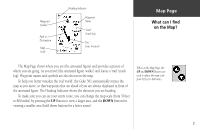
Map
 |
UPC - 753759042073
View all Garmin Geko 301 manuals
Add to My Manuals
Save this manual to your list of manuals |
Page 20 highlights
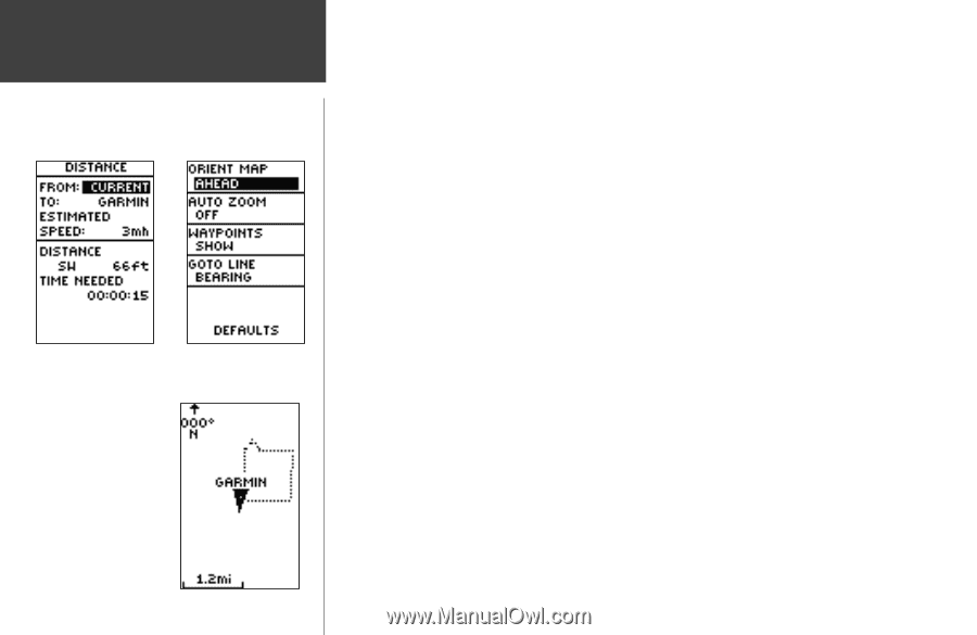
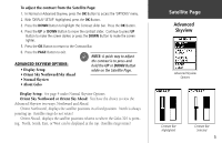
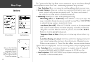
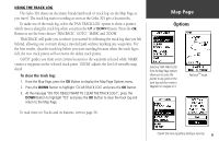
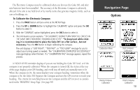
Map Page Options Measure Distance Map Setup Options When you select 'Orient Map Northward' the figure icon is replaced by a 'direction' triangle. The tip of the triangle tells you the general direction in which you are moving. 8 The Options on the Map Page allow you to customize the page in several ways although not all options are visible all the time. The following options are always available: • Clear Track Log: Allows you to clear the track log and immediately start a new one. • Measure Distance: Allows you to choose two waypoints (the default for one is your current position) and your current estimated speed. The distance and estimated time needed to reach that point is calculated automatically. • Map Setup: Allows you to adjust the map settings including: Orient Map (Ahead or Northward): When 'AHEAD' is selected, the top of the map is oriented in the direction you are currently moving. When 'NORTHWARD' is selected, the map is always oriented to the North. Auto Zoom (On or Off): When 'AUTO ZOOM' is turned on, the map automatically adjusts its scale to display your entire navigating route until you manually change the zoom level. When it's turned off, you must press the UP or DOWN Button to select the appropriate map scale. Waypoints (Show or Hide): Allows you to view the map with or without waypoints. Goto Line (Bearing or Course): Determines whether the display pointer shows your current bearing or the direction to the next waypoint. A Bearing Goto line follows you as you move. A Course Goto Line is fixed from your starting location. Options that do not display until you have a track log or are actively navigating include: • Pan Track Log: Allows you to move the pointer to any point along the track and then start a TRACBACK, a GOTO, MARK a waypoint, or ZOOM In or Out. • Stop Navigation: 'STOP NAVIGATION' stops any active navigation (navigation means there is a destination waypoint).
-
 1
1 -
2
-
3
-
4
-
5
-
6
-
7
-
8
-
9
-
10
-
11
-
12
-
13
-
14
-
 15
15 -
 16
16 -
 17
17 -
 18
18 -
 19
19 -
 20
20 -
 21
21 -
 22
22 -
 23
23 -
 24
24 -
 25
25 -
26
-
27
-
28
-
29
-
30
-
31
-
32
-
33
-
34
-
35
-
36
-
37
-
38
-
39
-
40
-
41
-
42
-
43
-
44
-
45
-
46
-
47
-
48
-
49
-
50
-
51
-
52
-
53
-
54
-
55
-
56
-
57
-
58
-
59
-
60
-
61
-
62
-
63
-
64
-
65
-
66
-
67
-
68
 |
 |