Garmin Geko 301 Owner's Manual - Page 30
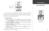
To select a data field
 |
UPC - 753759042073
View all Garmin Geko 301 manuals
Add to My Manuals
Save this manual to your list of manuals |
Page 30 highlights
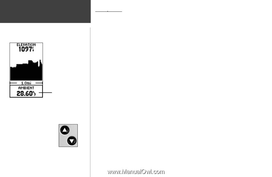
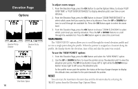
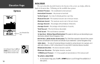
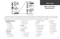
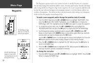
Elevation Page Options User-Selectable Data Field On the Elevation Page, the UP and DOWN Buttons are used to cycle through different elevation data. 18 DATA FIELDS The user-selectable data field found at the bottom of the screen can display different kinds of elevation data. Following are the available data options: Ambient Pressure - The uncalibrated current pressure. Normalized Pressure - The pressure at sea level. Vertical Speed - Your rate of altitude gain/loss over time. Maxium Descent - The maximum descent rate in feet per minute. Maximum Ascent - The maximum ascent rate in feet per minute. Average Descent - The average vertical distance of descents. Average Ascent - The average vertical distance of ascents. Total Descent - The total distance descended. Total Ascent - The total distance ascended. Vt Spd Dest -(Vertical Speed Destination) The speed at which you are descending to your destination altitude. (Active Navigation Only) Gld Rt Dest -(Glide Ration Destination) The Glide Ratio required to descend from current location and altitude to the location and altitude of your destination. (Active Navigation Only) Glide Ratio - The ratio of horizontal distance travelled to vertical descent. For example, a 6:1 glide ratio indicates a 1000' vertical descent for every 6000' horizontal distance travelled. Minimum Elevation - The lowest elevation reached. Maximum Elevation - The highest elevation reached. 12HRS(Hours) Pressure - A 12 hour graphical representation of the 'pressure plot' To select a data field: 1. On the Elevation Page, press the UP or DOWN Button to scroll through the available list of data options.
-
 1
1 -
2
-
3
-
4
-
5
-
6
-
7
-
8
-
9
-
10
-
11
-
12
-
13
-
14
-
15
-
16
-
17
-
18
-
19
-
20
-
21
-
22
-
23
-
24
-
 25
25 -
 26
26 -
 27
27 -
 28
28 -
 29
29 -
 30
30 -
 31
31 -
 32
32 -
 33
33 -
 34
34 -
 35
35 -
36
-
37
-
38
-
39
-
40
-
41
-
42
-
43
-
44
-
45
-
46
-
47
-
48
-
49
-
50
-
51
-
52
-
53
-
54
-
55
-
56
-
57
-
58
-
59
-
60
-
61
-
62
-
63
-
64
-
65
-
66
-
67
-
68
 |
 |