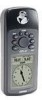
Garmin GPS 72 Owner's Manual - Page 37
Main Menu, Proximity Alarm - owners manual
 |
UPC - 689076719087
View all Garmin GPS 72 manuals
Add to My Manuals
Save this manual to your list of manuals |
Page 37 highlights
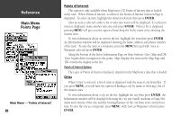
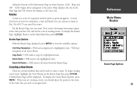
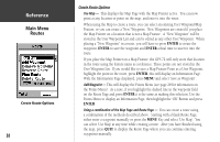
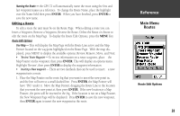
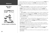
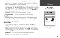
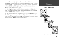
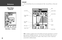
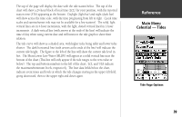
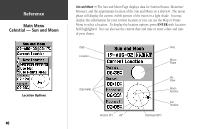
Plan Route - To plan a route, enter a Speed, Fuel Flow, Depart Time and Depart Date. Fuel Flow is measured in "units per hour". It may be necessary to consult your vehicle's Owner's Manual for performance specifications. The Active Route Page and Route Page display trip-planning information for each leg or the entire route. The information includes Course, ETA, Fuel to point, Leg Fuel, Leg Time, Sunrise & Sunset at point location, Time to Point and Leg Distance. To show a specific field, with the Active Route or Route Page displayed, press the ROCKER right or left to cycle through the fields. Delete Route - Will remove the selected route from the Routes Page. Start/Stop Navigation - Will begin or end navigation of the selected route Proximity Proximity waypoints can be used to alert you when you are approaching a predetermined area. When you place a waypoint in the Proximity List, you will enter a 'Radius' that will determine when a Proximity Alarm will be displayed. You can turn the Proximity Alarm On or Off for your convenience. Proximity Options To view the available options with the Proximity Page displayed press MENU. Add Waypoint - When 'Add Waypoint' is selected, the Points Menu is displayed (see page 24 for more information on the Points Menu). Select a point to insert into the Proximity List. With the 'Radius' field highlighted, press ENTER. Enter a radius for an alert to be displayed. You can also add a waypoint by highlighting the dashed entry line and pressing ENTER. Remove Point - Removes the highlighted waypoint from the Proximity List. Remove All - Removes all waypoints from the Proximity List. InRterofedruecntcioen Main Menu Proximity Alarm Proximity Alarm List 35
-
 1
1 -
2
-
3
-
4
-
5
-
6
-
7
-
8
-
9
-
10
-
11
-
12
-
13
-
14
-
15
-
16
-
17
-
18
-
19
-
20
-
21
-
22
-
23
-
24
-
25
-
26
-
27
-
28
-
29
-
30
-
31
-
 32
32 -
 33
33 -
 34
34 -
 35
35 -
 36
36 -
 37
37 -
 38
38 -
 39
39 -
 40
40 -
 41
41 -
 42
42 -
43
-
44
-
45
-
46
-
47
-
48
-
49
-
50
-
51
-
52
-
53
-
54
-
55
-
56
-
57
-
58
-
59
-
60
-
61
-
62
-
63
-
64
-
65
-
66
-
67
 |
 |
