Magellan 330X User Manual - Page 27
Magellan 330X - GPS Map Manual
 |
UPC - 763357102796
View all Magellan 330X manuals
Add to My Manuals
Save this manual to your list of manuals |
Page 27 highlights
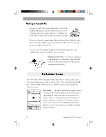
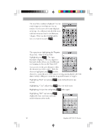
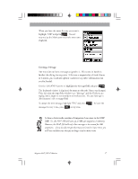
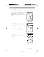
Basic Basic Operation Operation A waypoint is a point on a map that you can name and save in the MAP 330. They are primarily used for creating routes. Whether the route is a simple GOTO or a more complex multileg route, it needs stored waypoints to use as its starting and destination point. Saving a Waypoint with a Receiver-Generated Name From any screen, press and hold MARK for 2 seconds and the Mark screen is displayed. The "Save" button is highlighted and you can press ENTER to save the waypoint using the default name and icon. You can later go back and edit any of the waypoint information through the Database Menu or you can change the information now following the guidelines below. (See Waypoints in the Reference chapter.) Saving a Waypoint with a User-Input Icon and Name From any screen, press and hold MARK for 2 seconds. Use the UP/DOWN arrows and notice that the highlight moves from field to field and then back to "Save." Highlight the Icon field using the UP/DOWN arrows. Press ENTER . Magellan MAP 330 GPS Receiver 15
-
 1
1 -
2
-
3
-
4
-
5
-
6
-
7
-
8
-
9
-
10
-
11
-
12
-
13
-
14
-
15
-
16
-
17
-
18
-
19
-
20
-
21
-
 22
22 -
 23
23 -
 24
24 -
 25
25 -
 26
26 -
 27
27 -
 28
28 -
 29
29 -
 30
30 -
 31
31 -
 32
32 -
33
-
34
-
35
-
36
-
37
-
38
-
39
-
40
-
41
-
42
-
43
-
44
-
45
-
46
-
47
-
48
-
49
-
50
-
51
-
52
-
53
-
54
-
55
-
56
-
57
-
58
-
59
-
60
-
61
-
62
-
63
-
64
-
65
-
66
-
67
-
68
-
69
-
70
-
71
-
72
-
73
-
74
-
75
-
76
-
77
-
78
-
79
-
80
-
81
-
82
-
83
-
84
-
85
-
86
-
87
-
88
-
89
-
90
-
91
-
92
-
93
-
94
 |
 |