Magellan 330X User Manual - Page 65
Magellan 330X - GPS Map Manual
 |
UPC - 763357102796
View all Magellan 330X manuals
Add to My Manuals
Save this manual to your list of manuals |
Page 65 highlights
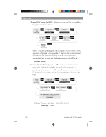
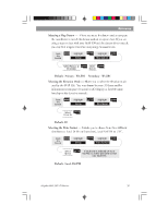
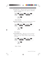
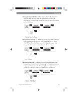
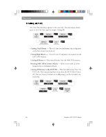
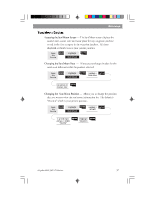
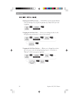
Reference Selecting a Map Datum - Allows you to set the datum used to compute the coordinates to match the datum used on a map or chart. If you are using a map or chart with your MAP 330 and the datums do not match, you may find irregularities when comparing the coordinates. From Any Screen MENU Highlight Setup ENTER Highlight Map Datum ENTER Select Primary or Secondary ENTER Select Datum ENTER Default: Primary - WGS84 Secondary - WGS84 Selecting the Elevation Mode - Allows you to select the elevation mode used by the MAP 330. You may choose between 3D (uses satellite information to compute elevation) or 2D (displays a fixed elevation based upon the elevation entered). From Any Screen MENU Highlight Setup ENTER Highlight Elev Mode ENTER Select 3D or 2D ENTER Default: 3D Selecting the Time Format - Enables you to choose from three different time formats: Local 24 Hr (military time), Local AM/PM or UTC. From Any Screen MENU Highlight Setup ENTER Highlight Time Format ENTER Select Format ENTER If Local time is selected (24 hr. or AM/PM) you will be prompted to enter your local time. Default: Local AM/PM Magellan MAP 330 GPS Receiver 53
-
 1
1 -
2
-
3
-
4
-
5
-
6
-
7
-
8
-
9
-
10
-
11
-
12
-
13
-
14
-
15
-
16
-
17
-
18
-
19
-
20
-
21
-
22
-
23
-
24
-
25
-
26
-
27
-
28
-
29
-
30
-
31
-
32
-
33
-
34
-
35
-
36
-
37
-
38
-
39
-
40
-
41
-
42
-
43
-
44
-
45
-
46
-
47
-
48
-
49
-
50
-
51
-
52
-
53
-
54
-
55
-
56
-
57
-
58
-
59
-
 60
60 -
 61
61 -
 62
62 -
 63
63 -
 64
64 -
 65
65 -
 66
66 -
 67
67 -
 68
68 -
 69
69 -
 70
70 -
71
-
72
-
73
-
74
-
75
-
76
-
77
-
78
-
79
-
80
-
81
-
82
-
83
-
84
-
85
-
86
-
87
-
88
-
89
-
90
-
91
-
92
-
93
-
94
 |
 |