Magellan 330X User Manual - Page 84
Magellan 330X - GPS Map Manual
 |
UPC - 763357102796
View all Magellan 330X manuals
Add to My Manuals
Save this manual to your list of manuals |
Page 84 highlights
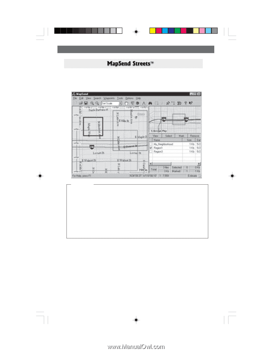
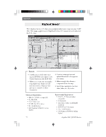
Appendix The MapSend Streets CD allows you to load detailed street maps into your MAP 330. The maps supplied on the MapSend Streets CD contain full street detail of the U.S. cities. Features • Enables you to load street maps (up to 8MB) for any region in the United States into the MAP 330. • Allows you to cut any rectangular map region you choose to load into the receiver. Maps are not pre-cut to counties or other boundaries. Minimum Requirements IBM PC AT-486 or compatible 32 MB RAM VGA Video Card 60 MB Hard Drive Space 8x CD-ROM drive MS Windows 95/98/NT 4.0 (or higher) • Creation, management and upload/download of waypoints and routes. • Allows straight line distance computation on the map. • Search for map objects (such as cities, lakes, etc.) by name. Recommended Requirements • IBM PC AT-Pentium/300 or compatible • 64 MB RAM • True Color Video with 800x600 resolution • 60 MB Hard Drive Space • 32x CD-ROM drive • MS Windows 95/98/NT 4.0 (or higher) Magellan MAP 330 GPS Receiver 72
-
 1
1 -
2
-
3
-
4
-
5
-
6
-
7
-
8
-
9
-
10
-
11
-
12
-
13
-
14
-
15
-
16
-
17
-
18
-
19
-
20
-
21
-
22
-
23
-
24
-
25
-
26
-
27
-
28
-
29
-
30
-
31
-
32
-
33
-
34
-
35
-
36
-
37
-
38
-
39
-
40
-
41
-
42
-
43
-
44
-
45
-
46
-
47
-
48
-
49
-
50
-
51
-
52
-
53
-
54
-
55
-
56
-
57
-
58
-
59
-
60
-
61
-
62
-
63
-
64
-
65
-
66
-
67
-
68
-
69
-
70
-
71
-
72
-
73
-
74
-
75
-
76
-
77
-
78
-
 79
79 -
 80
80 -
 81
81 -
 82
82 -
 83
83 -
 84
84 -
 85
85 -
 86
86 -
 87
87 -
 88
88 -
 89
89 -
90
-
91
-
92
-
93
-
94
 |
 |