Garmin GPSMAP 541s Owner's Manual - Page 15
Navigation Chart Menu, full Screen Map, WaYpoints & Tracks, Other Vessels, Stop Navigation
 |
UPC - 753759096045
View all Garmin GPSMAP 541s manuals
Add to My Manuals
Save this manual to your list of manuals |
Page 15 highlights
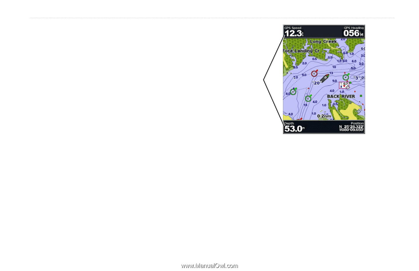
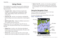
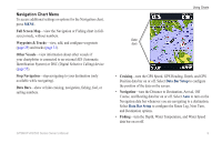
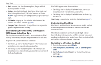
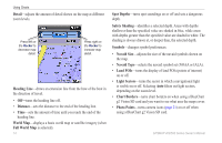
Navigation Chart Menu To access additional settings or options for the Navigation chart, press MENU. Full Screen Map-view the Navigation or Fishing chart in fullscreen mode, without numbers. Waypoints & Tracks-view, add, and configure waypoints (page 29) and tracks (page 31). Other Vessels-view information about other vessels if your chartplotter is connected to an external AIS (Automatic Identification System) or DSC (Digital Selective Calling) device (page 55). Stop Navigation-stop navigating to your destination (only available while navigating). Data Bars-show or hide cruising, navigation, fishing, fuel, or sailing numbers. GPSMAP 400/500 Series Owner's Manual Using Charts Data bars • Cruising-turn the GPS Speed, GPS Heading, Depth, and GPS Position data bar on or off. Select Data Bar Setup to configure the position of the data on the screen. • Navigation-turn the Distance to Destination, Arrival, Off Course, and Bearing data bar on or off. Select Auto to turn on the Navigation data bar whenever you are navigating to a destination. Select Data Bar Setup to configure the Route Leg, Next Turn, and Destination options. • Fishing-turn the Depth, Water Temperature, and Water Speed data bar on or off. 9
-
 1
1 -
2
-
3
-
4
-
5
-
6
-
7
-
8
-
9
-
 10
10 -
 11
11 -
 12
12 -
 13
13 -
 14
14 -
 15
15 -
 16
16 -
 17
17 -
 18
18 -
 19
19 -
 20
20 -
21
-
22
-
23
-
24
-
25
-
26
-
27
-
28
-
29
-
30
-
31
-
32
-
33
-
34
-
35
-
36
-
37
-
38
-
39
-
40
-
41
-
42
-
43
-
44
-
45
-
46
-
47
-
48
-
49
-
50
-
51
-
52
-
53
-
54
-
55
-
56
-
57
-
58
-
59
-
60
-
61
-
62
-
63
-
64
-
65
-
66
-
67
-
68
-
69
-
70
-
71
-
72
-
73
-
74
-
75
-
76
-
77
-
78
-
79
-
80
-
81
-
82
-
83
-
84
-
85
-
86
-
87
-
88
 |
 |