Garmin GPSMAP 541s Owner's Manual - Page 28
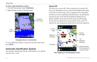
Automatic Identification System, About AIS
 |
UPC - 753759096045
View all Garmin GPSMAP 541s manuals
Add to My Manuals
Save this manual to your list of manuals |
Page 28 highlights
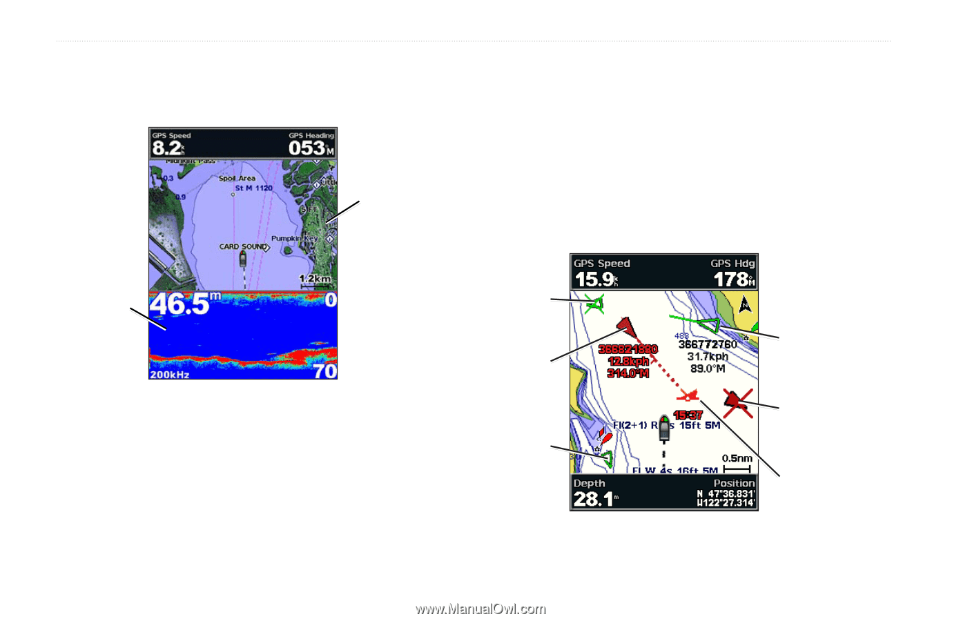
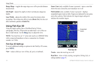
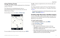
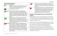
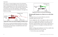
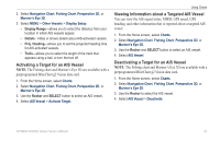
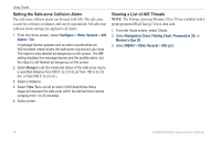
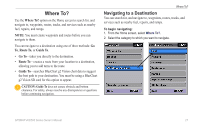
Using Charts To view a split chart/sonar screen: 1. From the Home screen, select Chart/Sonar. 2. Select the type of chart on the split screen. Navigation chart screen About AIS AIS alerts you to area traffic. When connected to an external AIS device, the chartplotter can show some AIS information about other vessels that are within range, that are equipped with a transponder, and that are actively transmitting AIS information. The information reported for each vessel includes the Maritime Mobile Service Identity (MMSI), the location, the GPS speed, the GPS heading, the time that has elapsed since the last position of the vessel was reported, the nearest approach, and the time to the nearest approach. Sonar screen Navigation/Sonar Combination To access additional settings or options for the chart/sonar screen, press MENU. Automatic Identification System The Automatic Identification System (AIS) enables you to identify and track other vessels. 22 Lost AIS target Dangerous AIS target AIS target Tracking AIS target Lost dangerous AIS target Closest point and time of approach to dangerous target AIS Targeting on the Navigation Chart GPSMAP 400/500 Series Owner's Manual
-
 1
1 -
2
-
3
-
4
-
5
-
6
-
7
-
8
-
9
-
10
-
11
-
12
-
13
-
14
-
15
-
16
-
17
-
18
-
19
-
20
-
21
-
22
-
 23
23 -
 24
24 -
 25
25 -
 26
26 -
 27
27 -
 28
28 -
 29
29 -
 30
30 -
 31
31 -
 32
32 -
 33
33 -
34
-
35
-
36
-
37
-
38
-
39
-
40
-
41
-
42
-
43
-
44
-
45
-
46
-
47
-
48
-
49
-
50
-
51
-
52
-
53
-
54
-
55
-
56
-
57
-
58
-
59
-
60
-
61
-
62
-
63
-
64
-
65
-
66
-
67
-
68
-
69
-
70
-
71
-
72
-
73
-
74
-
75
-
76
-
77
-
78
-
79
-
80
-
81
-
82
-
83
-
84
-
85
-
86
-
87
-
88
 |
 |