Garmin GPSMAP 541s Owner's Manual - Page 48
Changing the System Language, Configuring Navigation Preferences, HeaDing, Auto Magnetic - chartplotter / sounder
 |
UPC - 753759096045
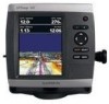
View all Garmin GPSMAP 541s manuals
Add to My Manuals
Save this manual to your list of manuals |
Page 48 highlights
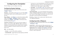
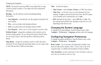
Configuring the Chartplotter Note: You must be receiving NMEA sonar depth data or using a Garmin sounder module to view depth and water temperature information. Heading-sets the reference used in calculating heading information. • Auto Magnetic-automatically sets the magnetic declination for your location. • True-sets true north as the heading reference. • Grid-sets grid north as the heading reference (000º). • User Magnetic-allows you to set the magnetic variation value. Position Format-change the coordinate style in which a given location reading appears. Do not change the position format unless you are using a map or chart that specifies a different position format. Map Datum-change the coordinate system in which the map is structured. Do not change the map datum unless you are using a map or chart that specifies a different map datum. Time-set the time options. • Time Format-select 12-hour, 24-hour, or UTC time format. • Time Zone-set the time zone you want displayed for time readings. If Auto is selected for the Time Zone, the DST option is not available and is automatically set to Auto. • DST (Daylight Saving Time)-select Off, On, or Auto. The auto setting automatically turns daylight saving time on or off, depending on the time of year. Changing the System Language To change the system language, from the Home screen, select Configure > Preferences > Language and then select the language. Configuring Navigation Preferences To change navigation preferences, from the Home screen, select Configure > Preferences > Navigation. Route Labels-for saved routes, this determines whether route turns are indicated by number (Turn 1, Turn 2, and so on) or by waypoint name, or whether the description of turns is hidden. Turn Transition-set how much time or how far before a turn in a route that you transition to the next leg. 42 GPSMAP 400/500 Series Owner's Manual
-
 1
1 -
2
-
3
-
4
-
5
-
6
-
7
-
8
-
9
-
10
-
11
-
12
-
13
-
14
-
15
-
16
-
17
-
18
-
19
-
20
-
21
-
22
-
23
-
24
-
25
-
26
-
27
-
28
-
29
-
30
-
31
-
32
-
33
-
34
-
35
-
36
-
37
-
38
-
39
-
40
-
41
-
42
-
 43
43 -
 44
44 -
 45
45 -
 46
46 -
 47
47 -
 48
48 -
 49
49 -
 50
50 -
 51
51 -
 52
52 -
 53
53 -
54
-
55
-
56
-
57
-
58
-
59
-
60
-
61
-
62
-
63
-
64
-
65
-
66
-
67
-
68
-
69
-
70
-
71
-
72
-
73
-
74
-
75
-
76
-
77
-
78
-
79
-
80
-
81
-
82
-
83
-
84
-
85
-
86
-
87
-
88
 |
 |