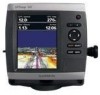
Garmin GPSMAP 541s Owner's Manual - Page 50
Configuring Communications Settings, Serial Port 1, Garmin data TransFer, Garmin Remote Sonar TransFer - chartplotter sounder
 |
UPC - 753759096045
View all Garmin GPSMAP 541s manuals
Add to My Manuals
Save this manual to your list of manuals |
Page 50 highlights
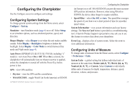
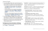
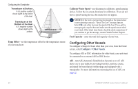
Configuring the Chartplotter 7. If you selected Near or Far in step 6, review the placement of the Auto Guidance line. Determine whether the line safely avoids known obstacles, and whether the turns enable efficient travel. • If the placement of the Auto Guidance line is satisfactory, select MENU > Navigation Options > Stop Navigation. Proceed to step 9. • If the Auto Guidance line is too close to known obstacles, from the Home screen, select Configure > Preferences > Navigation > Auto Guidance > Shoreline Distance > Farthest. • If the turns in the Auto Guidance line are too wide, from the Home screen, select Configure > Preferences > Navigation > Auto Guidance > Shoreline Distance > Nearest. 8. If you selected Nearest or Farthest, review the placement of the Auto Guidance line. Determine whether the line safely avoids known obstacles, and whether the turns enable efficient travel. 9. Repeat steps 1-8 at least once more, using a different destination each time, until you are familiar with the functionality of the Shoreline Distance setting. Configuring Communications Settings To change the communications settings from the Home screen, select Configure > Communications. Serial Port 1-configures the input/output format for serial port 1 to use when connecting your chartplotter to external NMEA devices, a computer, or other Garmin devices. Serial Port 2 (if supported)-configures the input/output format for serial port 2 to use when connecting your chartplotter to external NMEA devices, a computer, or other Garmin devices. • Garmin Data Transfer-supports the input or output of Garmin-proprietary data for communicating with Garmin software. • Garmin Remote Sonar Transfer (GPSMAP 430/440/530/540/535/545)-supports the input or output of Garmin-proprietary sonar data for communicating with Garmin software. • NMEA Standard-supports the input or output of standard NMEA 0183 data, DSC, and sonar NMEA input support for the DPT, MTW, and VHW sentences. • NMEA High Speed-supports the input or output of standard 0183 data for most AIS receivers. NMEA 0183 Setup-enable or disable NMEA 0183 output sentences for sounder, route, system, and Garmin NMEA settings. 44 GPSMAP 400/500 Series Owner's Manual
-
 1
1 -
2
-
3
-
4
-
5
-
6
-
7
-
8
-
9
-
10
-
11
-
12
-
13
-
14
-
15
-
16
-
17
-
18
-
19
-
20
-
21
-
22
-
23
-
24
-
25
-
26
-
27
-
28
-
29
-
30
-
31
-
32
-
33
-
34
-
35
-
36
-
37
-
38
-
39
-
40
-
41
-
42
-
43
-
44
-
 45
45 -
 46
46 -
 47
47 -
 48
48 -
 49
49 -
 50
50 -
 51
51 -
 52
52 -
 53
53 -
 54
54 -
 55
55 -
56
-
57
-
58
-
59
-
60
-
61
-
62
-
63
-
64
-
65
-
66
-
67
-
68
-
69
-
70
-
71
-
72
-
73
-
74
-
75
-
76
-
77
-
78
-
79
-
80
-
81
-
82
-
83
-
84
-
85
-
86
-
87
-
88
 |
 |