Garmin GPSMAP 541s Owner's Manual - Page 30
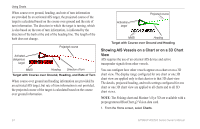
Showing AIS Vessels on a Chart or on a 3D Chart
 |
UPC - 753759096045
View all Garmin GPSMAP 541s manuals
Add to My Manuals
Save this manual to your list of manuals |
Page 30 highlights
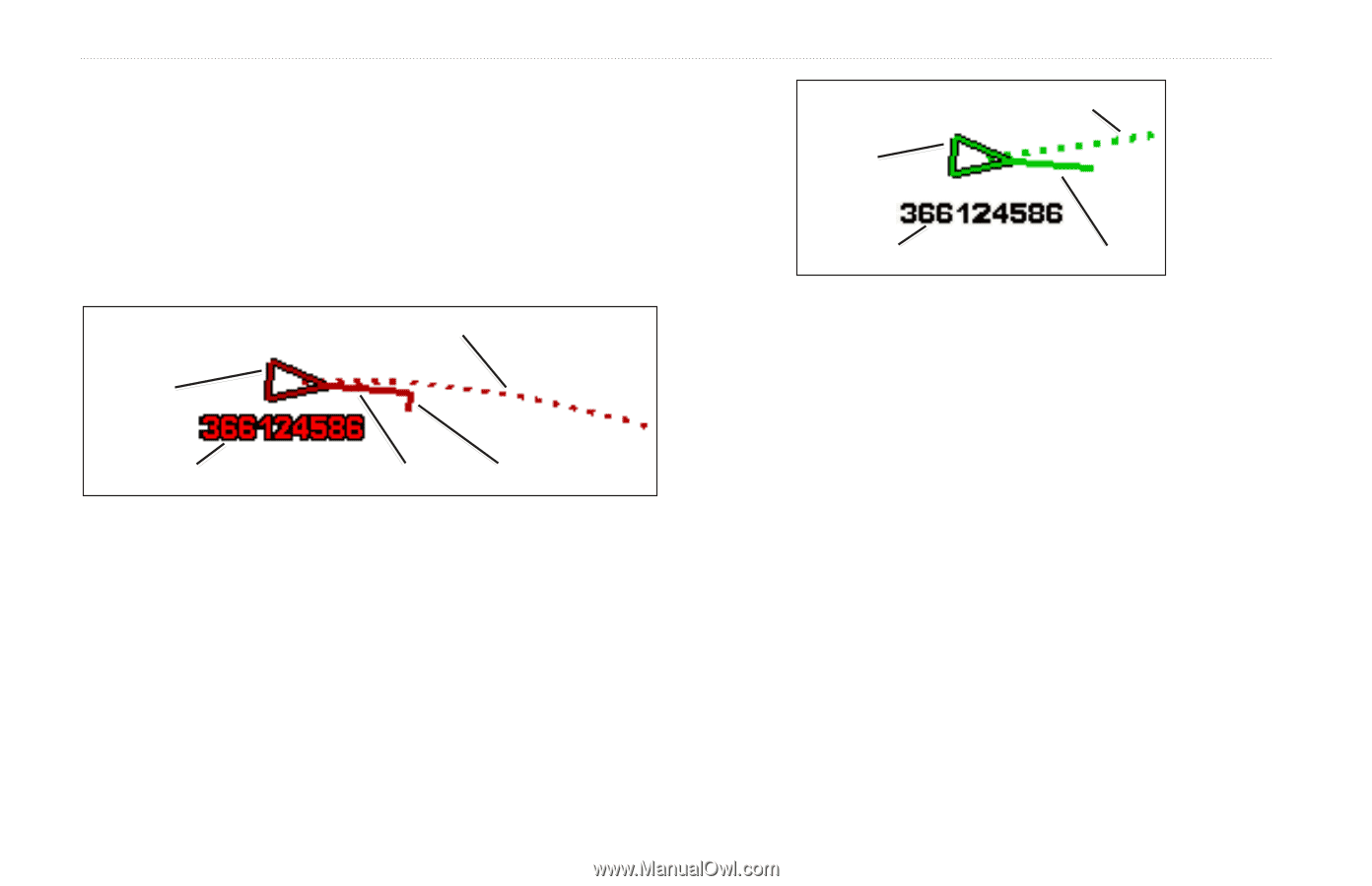
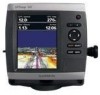
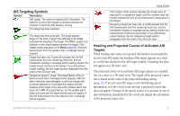
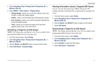
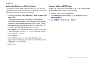
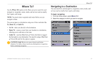
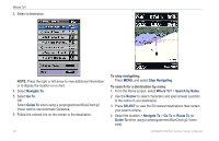
Using Charts When course over ground, heading, and rate of turn information are provided by an activated AIS target, the projected course of the target is calculated based on the course over ground and the rate of turn information. The direction in which the target is turning, which is also based on the rate of turn information, is indicated by the direction of the barb at the end of the heading line. The length of the barb does not change. Projected course Activated dangerous target MMSI Heading Direction of turn Target with Course over Ground, Heading, and Rate of Turn When course over ground and heading information are provided by an activated AIS target, but rate of turn information is not provided, the projected course of the target is calculated based on the course over ground information. Activated target Projected course MMSI Heading Target with Course over Ground and Heading Showing AIS Vessels on a Chart or on a 3D Chart View AIS requires the use of an external AIS device and active transponder signals from other vessels. You can configure how other vessels appear on a chart or on a 3D chart view. The display range configured for one chart or one 3D chart view are applied only to that chart or to that 3D chart view. The details, projected heading, and trails settings configured for one chart or one 3D chart view are applied to all charts and to all 3D chart views. Note: The Fishing chart and Mariner's Eye 3D are available with a preprogrammed BlueChart g2 Vision data card. 1. From the Home screen, select Charts. 24 GPSMAP 400/500 Series Owner's Manual
-
 1
1 -
2
-
3
-
4
-
5
-
6
-
7
-
8
-
9
-
10
-
11
-
12
-
13
-
14
-
15
-
16
-
17
-
18
-
19
-
20
-
21
-
22
-
23
-
24
-
 25
25 -
 26
26 -
 27
27 -
 28
28 -
 29
29 -
 30
30 -
 31
31 -
 32
32 -
 33
33 -
 34
34 -
 35
35 -
36
-
37
-
38
-
39
-
40
-
41
-
42
-
43
-
44
-
45
-
46
-
47
-
48
-
49
-
50
-
51
-
52
-
53
-
54
-
55
-
56
-
57
-
58
-
59
-
60
-
61
-
62
-
63
-
64
-
65
-
66
-
67
-
68
-
69
-
70
-
71
-
72
-
73
-
74
-
75
-
76
-
77
-
78
-
79
-
80
-
81
-
82
-
83
-
84
-
85
-
86
-
87
-
88
 |
 |