Garmin RINO 520 Owner's Manual - Page 60
Averaging a Waypoint, Projecting a Waypoint
 |
UPC - 753759049072
View all Garmin RINO 520 manuals
Add to My Manuals
Save this manual to your list of manuals |
Page 60 highlights
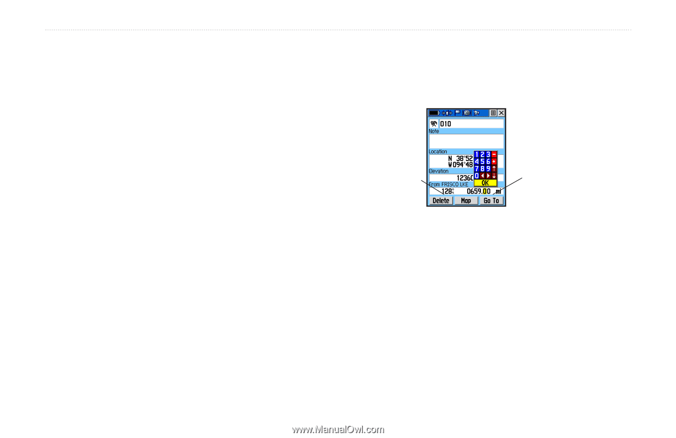
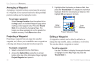
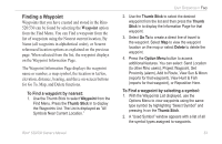
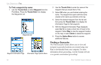
Unit Operation > Waypoints Averaging a Waypoint Averaging a waypoint location can increase the accuracy of a waypoint at your current location by taking multiple position readings and averaging the results. To average a waypoint: Select Average Location from the options list or the Avg button on the Mark Waypoint page when marking a new waypoint only. Press the Thumb Stick In to activate the Averaging Page. The longer you allow averaging to run the greater the location accuracy. Press Save when done. Projecting a Waypoint Projecting a waypoint from any map item (another waypoint, etc.) allows you to establish a new waypoint on a bearing and distance projected from that map item. To project a waypoint: 1. Select a map item from the Find Menu. 2. Access the Option Menu using the on-screen button at the top of the Information Page. Highlight Project Waypoint and press In. 50 3. Highlight either the bearing or distance field, then press the Thumb Stick In to display the numerical keyboard. Enter the new bearing or distance, then highlight OK and press In to finish. Enter Direction Enter Distance Project Waypoint Page Editing a Waypoint A waypoint or contact can be edited to add notes or change the map symbol, name, coordinates, or elevation. You can also delete a waypoint or contact. To edit a waypoint: Use the Find Menu to display the waypoint/contact or highlight it on the Map Page and press the Thumb Stick In. Rino® 520/530 Owner's Manual
-
 1
1 -
2
-
3
-
4
-
5
-
6
-
7
-
8
-
9
-
10
-
11
-
12
-
13
-
14
-
15
-
16
-
17
-
18
-
19
-
20
-
21
-
22
-
23
-
24
-
25
-
26
-
27
-
28
-
29
-
30
-
31
-
32
-
33
-
34
-
35
-
36
-
37
-
38
-
39
-
40
-
41
-
42
-
43
-
44
-
45
-
46
-
47
-
48
-
49
-
50
-
51
-
52
-
53
-
54
-
 55
55 -
 56
56 -
 57
57 -
 58
58 -
 59
59 -
 60
60 -
 61
61 -
 62
62 -
 63
63 -
 64
64 -
 65
65 -
66
-
67
-
68
-
69
-
70
-
71
-
72
-
73
-
74
-
75
-
76
-
77
-
78
-
79
-
80
-
81
-
82
-
83
-
84
-
85
-
86
-
87
-
88
-
89
-
90
-
91
-
92
-
93
-
94
-
95
-
96
-
97
-
98
-
99
-
100
-
101
-
102
-
103
-
104
-
105
-
106
-
107
-
108
-
109
-
110
-
111
-
112
-
113
-
114
-
115
-
116
-
117
-
118
-
119
-
120
-
121
-
122
-
123
-
124
-
125
-
126
-
127
-
128
-
129
-
130
-
131
-
132
 |
 |