Garmin D2 Charlie Owners Manual - Page 34
Map Settings, GroupTrack Settings, Navigation Settings, System Settings
 |
View all Garmin D2 Charlie manuals
Add to My Manuals
Save this manual to your list of manuals |
Page 34 highlights
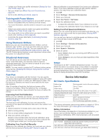
Elevation Settings Hold UP, and select Settings > Sensors & Accessories > Elevation. Calibrate: Allows you to calibrate the altimeter sensor manually. Auto Cal.: Allows the altimeter to self-calibrate each time you turn on GPS tracking. Elevation: Sets the units of measure for elevation. Map Settings You can customize how the map appears in the map app and data screens. Hold UP, and select Settings > Map. Orientation: Sets the orientation of the map. The North Up option shows north at the top of the screen. The Track Up option shows your current direction of travel at the top of the screen. User Locations: Shows or hides saved locations on the map. Auto Zoom: Automatically selects the zoom level for optimal use of your map. When disabled, you must zoom in or out manually. Lock on Road: Locks the position icon, which represents your position on the map, onto the nearest road. Track Log: Shows or hides the track log, or the path you have traveled, as a colored line on the map. Track Color: Changes the track log color. Detail: Sets the amount of detail shown on the map. Showing more detail may cause the map to redraw more slowly. Marine: Sets the map to display data in marine mode (Marine Map Settings, page 28). Marine Map Settings You can customize how the map appears in marine mode. Hold UP, and select Settings > Map > Marine. Marine Chart Mode: Enables the nautical chart when displaying marine data. This option displays various map features in different colors so the marine POIs are more readable, and so the map reflects the drawing scheme of paper charts. Spot Soundings: Enables depth measurements on the chart. Light Sectors: Shows and configures the appearance of light sectors on the chart. Symbol Set: Sets the chart symbols in marine mode. The NOAA option displays the National Oceanic and Atmospheric Administration chart symbols. The International option displays the International Association of Lighthouse Authorities chart symbols. Showing and Hiding Map Data If you have multiple maps installed on your device, you can choose the map data to show on the map. 1 Select > Map. 2 Hold UP. 3 Select the map settings. 4 Select Map > Configure Maps. 5 Select a map to activate the toggle switch, which shows or hides the map data. GroupTrack Settings Hold UP, and select Settings > GroupTrack. Show on Map: Enables you to view connections on the map screen during a GroupTrack session. Activity Types: Allows you to select which activity types appear on the map screen during a GroupTrack session. Navigation Settings You can customize the map features and appearance when navigating to a destination. Customizing Map Features 1 Hold UP. 2 Select Settings > Navigation > Data Screens. 3 Select an option: • Select Map to turn on or off the map. • Select Guide to turn on or off the guide screen that displays the compass bearing or course to follow while navigating. • Select Elevation Plot to turn on or off the elevation plot. • Select a screen to add, remove, or customize. Setting Up a Heading Bug You can set up a heading indicator to display on your data pages while navigating. The indicator points to your target heading. 1 Hold UP. 2 Select Settings > Navigation > Heading Bug. Setting Navigation Alerts You can set alerts to help you navigate to your destination. 1 Hold UP. 2 Select Settings > Navigation > Alerts. 3 Select an option: • To set an alert for a specified distance from your final destination, select Final Distance. • To set an alert for the estimated time remaining until you reach your final destination, select Final ETE. 4 Select Status to turn on the alert. 5 Enter a distance or time value, and select . System Settings Hold UP, and select Settings > System. Language: Sets the language displayed on the device. Time: Adjusts the time settings (Time Settings, page 29). Backlight: Adjusts the backlight settings (Changing the Backlight Settings, page 29). Sounds: Sets the device sounds, such as key tones, alerts, and vibrations. Do Not Disturb: Turns on or off do not disturb mode. Use the Sleep Time option to turn on do not disturb mode automatically during your normal sleep hours. You can set your normal sleep hours on your Garmin Connect account. Controls Menu: Allows you to add, reorder, and remove the shortcut menu options in the controls menu (Customizing the Controls Menu, page 29). Hot Keys: Allows you to assign shortcuts to device keys (Customizing the Hot Keys, page 29). Auto Lock: Allows you to lock the keys automatically to prevent accidental key presses. Use the During Activity option to lock the keys during a timed activity. Use the Not During Activity option to lock the keys when you are not recording a timed activity. Units: Sets the units of measure used on the device (Changing the Units of Measure, page 29). Aviation Units: Sets the units of measure used for aviation data. Format: Sets general format preferences, such as the pace and speed shown during activities, the start of the week, and geographical position format and datum options. 28 Customizing Your Device
-
 1
1 -
2
-
3
-
4
-
5
-
6
-
7
-
8
-
9
-
10
-
11
-
12
-
13
-
14
-
15
-
16
-
17
-
18
-
19
-
20
-
21
-
22
-
23
-
24
-
25
-
26
-
27
-
28
-
 29
29 -
 30
30 -
 31
31 -
 32
32 -
 33
33 -
 34
34 -
 35
35 -
 36
36 -
 37
37 -
 38
38 -
 39
39 -
40
-
41
-
42
-
43
-
44
-
45
-
46
 |
 |
