Garmin Rino 520HCx Owner's Manual - Page 29
Map Options, Using the Pan Map Option, Pan Map, Stop Navigation, Recalculate, Guidance Text
 |
UPC - 753759066833
View all Garmin Rino 520HCx manuals
Add to My Manuals
Save this manual to your list of manuals |
Page 29 highlights
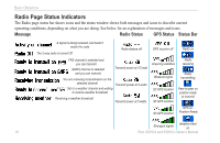
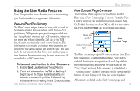
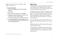
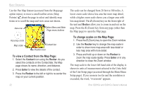
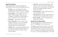
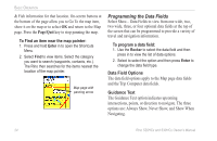
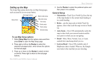
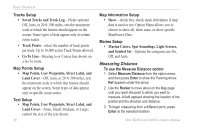
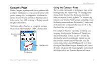
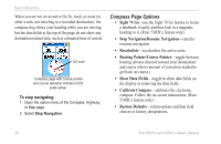
Map Page Options Map page options allow a variety of operating and custom features for your Rino. The Map page options are: • Pan Map-moves the Panning Arrow (Map Pointer) about on the map. Refer to the "Using the Pan Map Option" section for complete instructions. • Stop Navigation-stops navigation of a Go To, Route or Track in progress. When you are not navigating to a destination, the Stop Navigation option is "grayed out" and is non-functional. • Recalculate-recalculates the current route. • Show... Data Fields-shows two, three, or four navigation data fields or one or two wide fields, Map Only, and Contacts. Data fields can be programmed to show various data options. • Guidance Text-shows guidance information such as direction to turn at the next intersection. It can be set for Always Show, Never Show, or Show When Navigating. Basic Operation • Setup Map-opens the Setup Map pages, which allow you to tailor the map to your needs such as changing text size, map orientation, and map detail. Refer to the "Setting up the Map" section for complete instructions. • Measure Distance-shows the distance from one point on the map to another. • Turn Declutter On-turns the Declutter feature on to reduce the amount of map details when zoomed out. • Restore Defaults-returns the Map page to the original factory settings. Using the Pan Map Option The map panning function is activated from the option menu. Use the Rocker to move the map pointer. Press Enter to mark the arrow location or view the map item information page. The option menu allows you to: send the location of that item, project a waypoint from it, save it as a waypoint, set a proximity circle around it, add it to a route, or view the Sun & Moon phase or view Hunt Rino 520HCx and 530HCx Owner's Manual 23
-
 1
1 -
2
-
3
-
4
-
5
-
6
-
7
-
8
-
9
-
10
-
11
-
12
-
13
-
14
-
15
-
16
-
17
-
18
-
19
-
20
-
21
-
22
-
23
-
 24
24 -
 25
25 -
 26
26 -
 27
27 -
 28
28 -
 29
29 -
 30
30 -
 31
31 -
 32
32 -
 33
33 -
 34
34 -
35
-
36
-
37
-
38
-
39
-
40
-
41
-
42
-
43
-
44
-
45
-
46
-
47
-
48
-
49
-
50
-
51
-
52
-
53
-
54
-
55
-
56
-
57
-
58
-
59
-
60
-
61
-
62
-
63
-
64
-
65
-
66
-
67
-
68
-
69
-
70
-
71
-
72
-
73
-
74
 |
 |
