Garmin Rino 520HCx Owner's Manual - Page 32
Measuring Distance, Tracks Setup, Map Points Setup, Text Setup, Map Information Setup, Marine Setup
 |
UPC - 753759066833
View all Garmin Rino 520HCx manuals
Add to My Manuals
Save this manual to your list of manuals |
Page 32 highlights
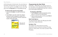
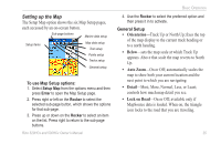
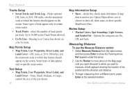
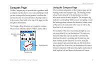
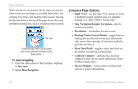
Basic Operation Tracks Setup • Saved Tracks and Track Log-(Scale options) Off, Auto, or 20 ft-500 miles, sets the maximum scale at which the feature should appear on the screen. Some types of data appear only at certain zoom scales. • Track Points-select the number of track points per track. Up to 10,000 active Track Points allowed. • Go To Line-Bearing to or Course line shown on a Go To route. Map Points Setup • Map Points, User Waypoints, Street Label, and Land Cover-Off, Auto, or 20 ft-500 miles; sets the maximum scale at which that feature should appear on the screen. Some types of data appear only at specific zoom scales. Text Setup • Map Points, User Waypoints, Street Label, and Land Cover-None, Small, Medium, or Large; control the size of the text shown. 26 Map Information Setup • Show-check box; check mark determines if map data is used or not. Option Menu allows you to choose to show all, show none, or show specific MapSource Data. Marine Setup • Marine Colors, Spot Soundings, Light Sectors, and Symbol Set-Options for categories are On, Off, and Auto. Measuring Distance To use the Measure Distance option: 1. Select Measure Distance from the option menu and then press Enter to show the Panning Arrow. Ref appears under the arrow. 2. Use the Rocker to move about on the Map page until you reach the point to which you want to measure. A field appears showing the location of the pointer and the direction and distance. 3. To begin measuring from a different point, press Enter at the selected location. Rino 520HCx and 530HCx Owner's Manual
-
 1
1 -
2
-
3
-
4
-
5
-
6
-
7
-
8
-
9
-
10
-
11
-
12
-
13
-
14
-
15
-
16
-
17
-
18
-
19
-
20
-
21
-
22
-
23
-
24
-
25
-
26
-
 27
27 -
 28
28 -
 29
29 -
 30
30 -
 31
31 -
 32
32 -
 33
33 -
 34
34 -
 35
35 -
 36
36 -
 37
37 -
38
-
39
-
40
-
41
-
42
-
43
-
44
-
45
-
46
-
47
-
48
-
49
-
50
-
51
-
52
-
53
-
54
-
55
-
56
-
57
-
58
-
59
-
60
-
61
-
62
-
63
-
64
-
65
-
66
-
67
-
68
-
69
-
70
-
71
-
72
-
73
-
74
 |
 |