Garmin Astro 320 Astro and DC 30 Owner's Manual - Page 23
Map Map Options, Rocker, Resume, Navigation, Recalculate, Data Fields, Change Data Fields - used
 |
View all Garmin Astro 320 manuals
Add to My Manuals
Save this manual to your list of manuals |
Page 23 highlights
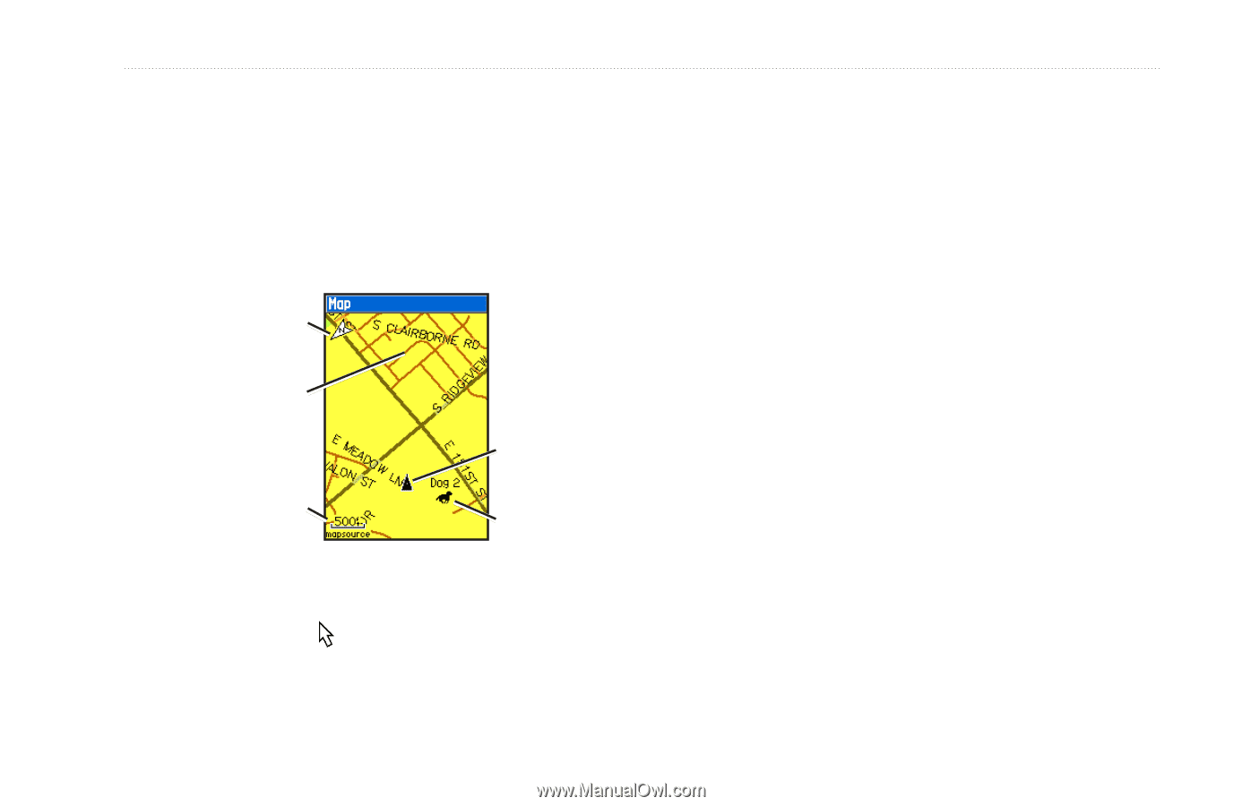
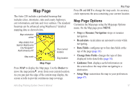
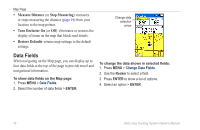
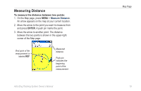
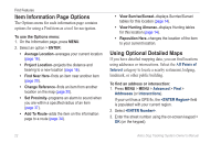
Map Page The Astro 220 includes a preloaded basemap that includes cities, interstates, state and county highways, exit information, and lake and river outlines. The standard basemap can be enhanced using MapSource® detailed mapping data as shown below. Map orientation arrow Map details from Garmin MapSource City Navigator® North America NT Your current location Map scale Dog location Map Page Press MAP to display the Map page. Use the Rocker to move the map pointer away from your current location. As you pan past the edge of the current map display, the screen scrolls to provide continuous map coverage. Map Page Press IN and OUT to change the map scale. An accuracy circle represents the area containing your current location. Map Page Options Customize the Map page using the Map page Options menu. On the Map page press MENU. • Stop (or Resume) Navigation-stops or resumes navigation. • Recalculate-recalculates an automotive route while navigating. • Data Fields-configures up to four data fields at the top of the page (page 18). • Change Data Fields-changes the type of data displayed in the data fields (page 18). • Guidance Text-displays useful information on the screen above the map when navigating to a destination. • Setup Map-customizes the map to your preferences (page 47). Astro Dog Tracking System Owner's Manual 17
-
 1
1 -
2
-
3
-
4
-
5
-
6
-
7
-
8
-
9
-
10
-
11
-
12
-
13
-
14
-
15
-
16
-
17
-
 18
18 -
 19
19 -
 20
20 -
 21
21 -
 22
22 -
 23
23 -
 24
24 -
 25
25 -
 26
26 -
 27
27 -
 28
28 -
29
-
30
-
31
-
32
-
33
-
34
-
35
-
36
-
37
-
38
-
39
-
40
-
41
-
42
-
43
-
44
-
45
-
46
-
47
-
48
-
49
-
50
-
51
-
52
-
53
-
54
-
55
-
56
-
57
-
58
-
59
-
60
-
61
-
62
-
63
-
64
-
65
-
66
-
67
-
68
-
69
-
70
-
71
-
72
-
73
-
74
-
75
-
76
 |
 |