Garmin Astro 320 Astro and DC 30 Owner's Manual - Page 55
Routing Setup, Map Setup - Marine
 |
View all Garmin Astro 320 manuals
Add to My Manuals
Save this manual to your list of manuals |
Page 55 highlights
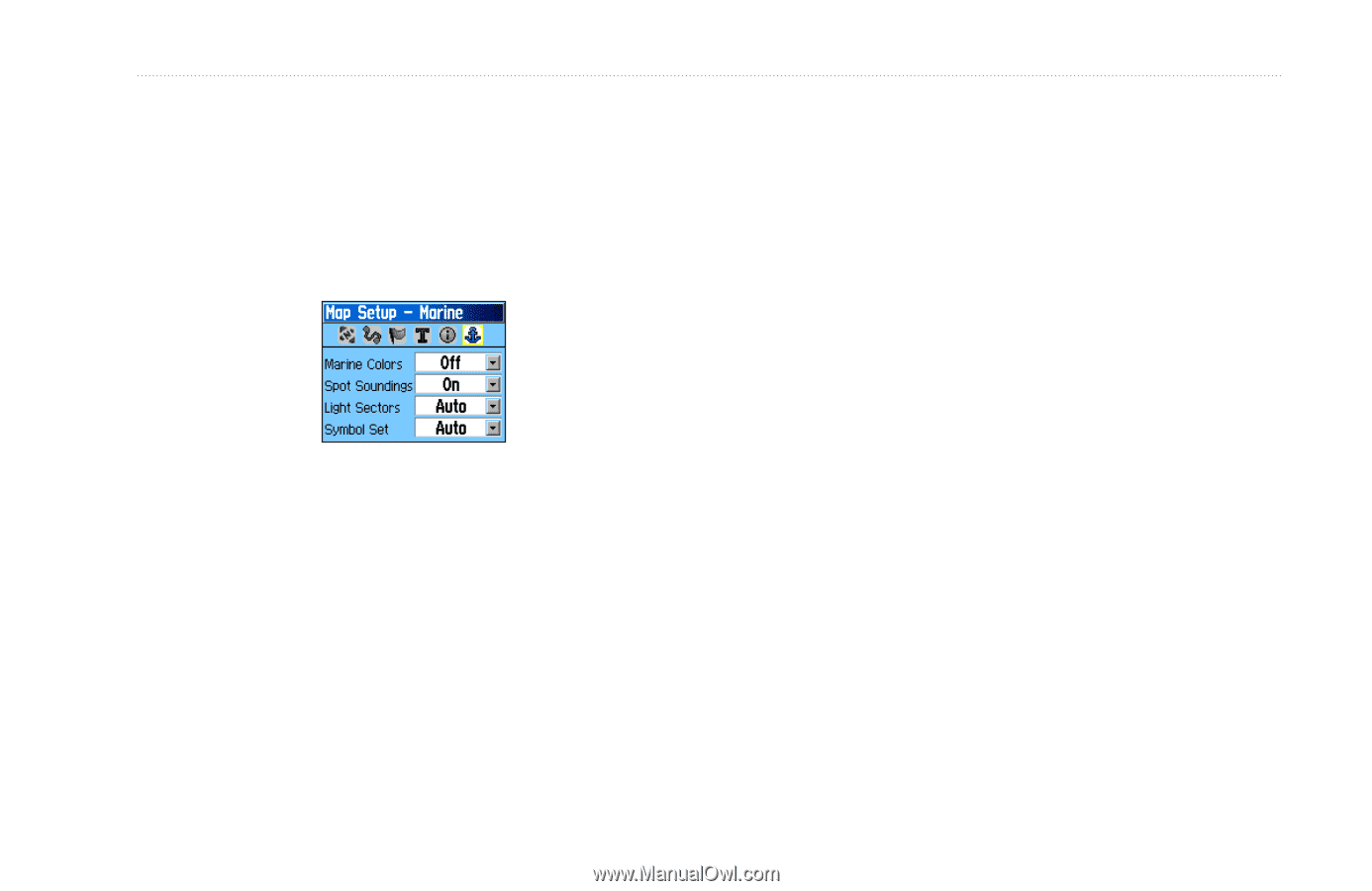
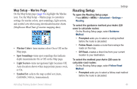
Map Setup - Marine Page On the Map Setup page (page 46), highlight the Marine icon. Use the Map Setup - Marine page to customize settings for marine colors, spot soundings, light sectors, and symbol sets when using downloaded marine charts (MapSource BlueChart g2 marine mapping data). • Marine Colors-turns marine colors On or Off on the Map page. • Spot Soundings-turns spot soundings that indicate depth measurements On or Off on the Map page. • Light Sectors-turns navigational light locations Off, Auto (location shown when map pointer passes over), or On. • Symbol Set-selects the map symbol set (Auto, GARMIN, NOAA, International). Settings Routing Setup To open the Routing Setup page: Press MENU > MENU > Advanced > Settings > Routing. To select the guidance method your Astro 220 uses to calculate routes: On the Routing Setup page, select Guidance Method. • Prompted-asks you to select a routing method before the route is calculated. • Follow Road-creates a route that overlays the roads on the map. • Off Road-creates a direct line from your current location to your destination. To select the method your Astro 220 uses to calculate road routes: On the Routing Setup page, select Follow Road Method. • Prompted-asks you to select a follow-road method before the route is calculated. Astro Dog Tracking System Owner's Manual 49
-
 1
1 -
2
-
3
-
4
-
5
-
6
-
7
-
8
-
9
-
10
-
11
-
12
-
13
-
14
-
15
-
16
-
17
-
18
-
19
-
20
-
21
-
22
-
23
-
24
-
25
-
26
-
27
-
28
-
29
-
30
-
31
-
32
-
33
-
34
-
35
-
36
-
37
-
38
-
39
-
40
-
41
-
42
-
43
-
44
-
45
-
46
-
47
-
48
-
49
-
 50
50 -
 51
51 -
 52
52 -
 53
53 -
 54
54 -
 55
55 -
 56
56 -
 57
57 -
 58
58 -
 59
59 -
 60
60 -
61
-
62
-
63
-
64
-
65
-
66
-
67
-
68
-
69
-
70
-
71
-
72
-
73
-
74
-
75
-
76
 |
 |