Garmin Astro 320 Astro and DC 30 Owner's Manual - Page 34
Using the Altimeter Set Course, Re-Sight, Project Location, Advanced, Applications, Altimeter
 |
View all Garmin Astro 320 manuals
Add to My Manuals
Save this manual to your list of manuals |
Page 34 highlights
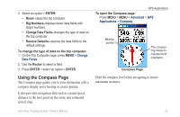
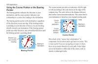
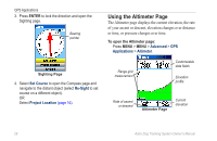
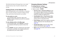
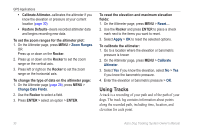
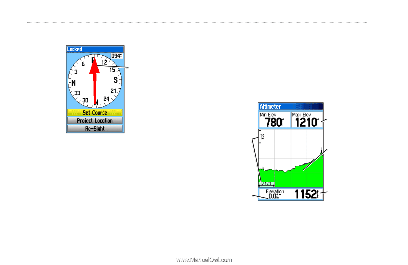
GPS Applications 3. Press ENTER to lock the direction and open the Sighting page. Bearing pointer Sighting Page 4. Select Set Course to open the Compass page and navigate to the distant object (select Re-Sight to set course on a different object). OR Select Project Location (page 16). Using the Altimeter Page The Altimeter page displays the current elevation, the rate of your ascent or descent, elevation changes over distance or time, or pressure changes over time. To open the Altimeter page: Press MENU > MENU > Advanced > GPS Applications > Altimeter. Range grid measurement Customizable data fields Elevation profile Rate of ascent or descent Altimeter Page Current elevation 28 Astro Dog Tracking System Owner's Manual
-
 1
1 -
2
-
3
-
4
-
5
-
6
-
7
-
8
-
9
-
10
-
11
-
12
-
13
-
14
-
15
-
16
-
17
-
18
-
19
-
20
-
21
-
22
-
23
-
24
-
25
-
26
-
27
-
28
-
 29
29 -
 30
30 -
 31
31 -
 32
32 -
 33
33 -
 34
34 -
 35
35 -
 36
36 -
 37
37 -
 38
38 -
 39
39 -
40
-
41
-
42
-
43
-
44
-
45
-
46
-
47
-
48
-
49
-
50
-
51
-
52
-
53
-
54
-
55
-
56
-
57
-
58
-
59
-
60
-
61
-
62
-
63
-
64
-
65
-
66
-
67
-
68
-
69
-
70
-
71
-
72
-
73
-
74
-
75
-
76
 |
 |
²·
Astro Dog Tracking System Owner’s Manual
GPS Applications
3. Press
ENTER
to lock the direction and open the
Sighting page.
Sighting Page
Bearing
pointer
4. Select
Set Course
to open the Compass page and
navigate to the distant object (select
Re-Sight
to set
course on a different object).
OR
Select
Project Location
(
page 16)
.
Using the Altimeter Page
The Altimeter page displays the current elevation, the rate
of your ascent or descent, elevation changes over distance
or time, or pressure changes over time.
To open the Altimeter page:
Press
MENU
>
MENU
>
Advanced
>
GPS
Applications
>
Altimeter
.
Altimeter Page
Current
elevation
Customizable
data fields
Rate of ascent
or descent
Range grid
measurement
Elevation
profile