Uniden SDS200 English Owner Manual - Page 29
Setting Location/range
 |
View all Uniden SDS200 manuals
Add to My Manuals
Save this manual to your list of manuals |
Page 29 highlights
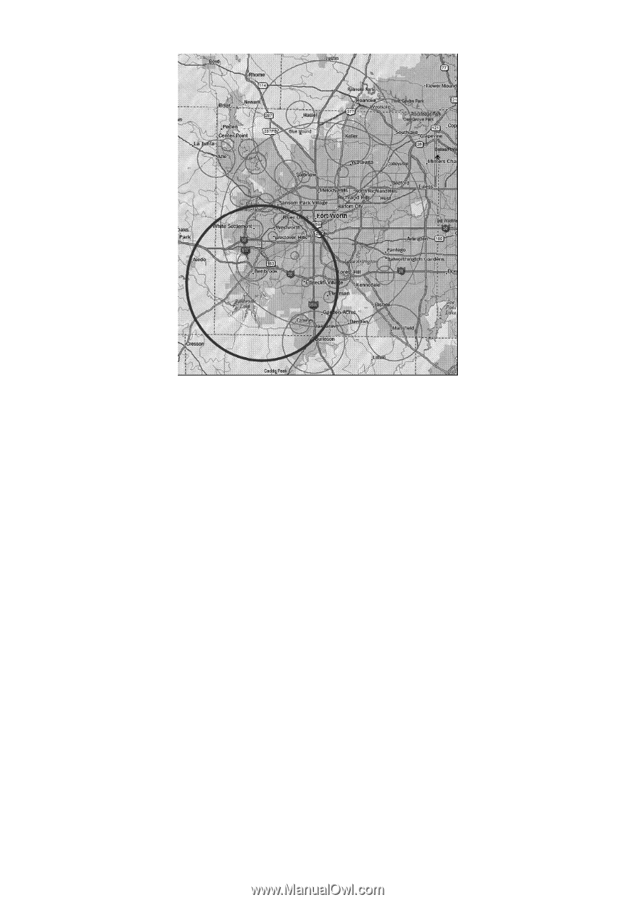
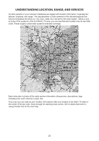
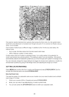
The scanner selects channels from systems that overlap the thick circle. So, the system down south that covers Burleson is included even though only part of it is covered, but Haslet, way up north, is not included. Each location method uses a different range. In addition to the 10-mile zip code radius, the scanner uses: • Auto Locate: 30-miles radius from the discovered radio tower. • GPS or Manual Location: 0-miles radius. 0 miles means that your location is precisely known. For a radio system to be selected, its circle must enclose your precise position. This setting is great if you are traveling...the scanner automatically selects and deselects systems as you drive through each system's coverage zone. You can manually change the range setting to be bigger (to include more systems) or smaller (to include fewer systems) by going to the Range menu and adjusting the range up or down. SETTING LOCATION/RANGE Press MENU then scroll to Set Your Location and Range and press E/YES/Q.SRCH. Scroll to through the following option and press E/YES/Q.SRCH. Enter Zip/Postal Code This sets the center of a zip/postal code as your location (not your exact location) and a default scan range of 10 miles. 1. Select your country (USA or Canada) and press E/YES/Q.SRCH. 2. Enter your zip code or see Data Naming, to enter a postal code. 3. You can also press the ZIP SERVICES button to enter your zip/postal code. 23
-
 1
1 -
2
-
3
-
4
-
5
-
6
-
7
-
8
-
9
-
10
-
11
-
12
-
13
-
14
-
15
-
16
-
17
-
18
-
19
-
20
-
21
-
22
-
23
-
 24
24 -
 25
25 -
 26
26 -
 27
27 -
 28
28 -
 29
29 -
 30
30 -
 31
31 -
 32
32 -
 33
33 -
 34
34 -
35
-
36
-
37
-
38
-
39
-
40
-
41
-
42
-
43
-
44
-
45
-
46
-
47
-
48
-
49
-
50
-
51
-
52
-
53
-
54
-
55
-
56
-
57
-
58
-
59
-
60
-
61
-
62
-
63
-
64
-
65
-
66
-
67
-
68
 |
 |