Garmin GPSMAP 5215 Owner's Manual - Page 15
Changing the Navigation Chart Settings, Changing the Chart Appearance
 |
View all Garmin GPSMAP 5215 manuals
Add to My Manuals
Save this manual to your list of manuals |
Page 15 highlights
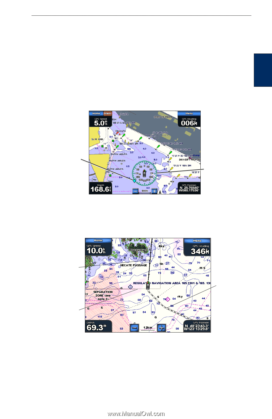
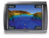
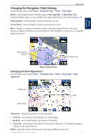
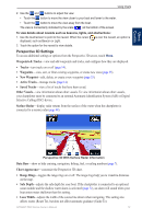
Using Charts Changing the Navigation Chart Settings From the Home screen, touch Charts > Navigation Chart > Menu > Chart Setup. Photos-sets the high-resolution satellite images to Off, Land Only, or Photo Map. Highresolution satellite imagery is only available while using a BlueChart g2 Vision SD card (page 18). Tides/Currents-turns the display of tides and currents on or off. Service Points-turns the display of marine service points on or off. Roses-displays a compass rose around your boat, indicating compass direction. True wind direction or apparent wind direction can be displayed if the chartplotter is connected to a compatible marine wind sensor. Using Charts Wind direction indicator Compass rose Wind Compass Rose Changing the Chart Appearance From the Home screen, touch Charts > Navigation Chart > Menu > Chart Setup > Chart Appearance. Heading line Chart border Track Orientation-changes the perspective of the map display. • North Up-sets the top of the map display to a north heading. • Head Up-sets the map display to the current track heading. • Course Up-sets the map so the direction of navigation is always up. The heading line appears vertically on the screen if shown. Detail-adjusts the amount of detail shown on the map at different zoom levels. GPSMAP 5000 Series Owner's Manual 11
-
 1
1 -
2
-
3
-
4
-
5
-
6
-
7
-
8
-
9
-
 10
10 -
 11
11 -
 12
12 -
 13
13 -
 14
14 -
 15
15 -
 16
16 -
 17
17 -
 18
18 -
 19
19 -
 20
20 -
21
-
22
-
23
-
24
-
25
-
26
-
27
-
28
-
29
-
30
-
31
-
32
-
33
-
34
-
35
-
36
-
37
-
38
-
39
-
40
-
41
-
42
-
43
-
44
-
45
-
46
-
47
-
48
-
49
-
50
-
51
-
52
-
53
-
54
-
55
-
56
-
57
-
58
-
59
-
60
-
61
-
62
-
63
-
64
-
65
-
66
-
67
-
68
-
69
-
70
-
71
-
72
-
73
-
74
-
75
-
76
-
77
-
78
-
79
-
80
-
81
-
82
-
83
-
84
 |
 |